Bourg-Saint-Maurice
Jump to content


Bourg-Saint-Maurice Bôrg-Sant-Mori (Arpitan) | |
|---|---|
 A general view of Bourg-Saint-Maurice | |
.svg) Coat of arms | |
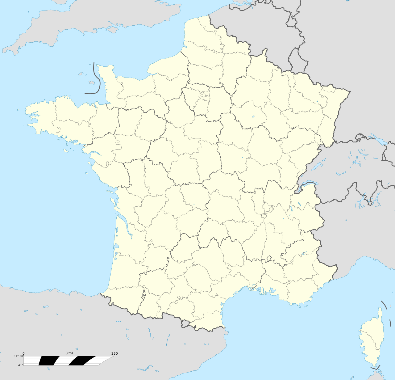
 Location of Bourg-Saint-Maurice | |
  Bourg-Saint-Maurice  Bourg-Saint-Maurice | |
| Coordinates: 45°37′03″N 6°46′10″E / 45.6175°N 6.7694°E | |
| Country | France |
| Region | Auvergne-Rhône-Alpes |
| Department | Savoie |
| Arrondissement | Albertville |
| Canton | Bourg-Saint-Maurice |
| Government | |
| • Mayor (2020–2026) | Guillaume Desrues[1] |
Area 1 | 179.07 km2 (69.14 sq mi) |
| Population (2022)[2] | 7,228 |
| • Density | 40.36/km2 (104.5/sq mi) |
| Time zone | UTC+01:00 (CET) |
| • Summer (DST) | UTC+02:00 (CEST) |
| INSEE/Postal code | 73054 /73700 |
| Elevation | 744–3,823 m (2,441–12,543 ft) (avg. 815 m or 2,674 ft) |
| 1 French Land Register data, which excludes lakes, ponds, glaciers > 1 km2 (0.386 sq mi or 247 acres) and river estuaries. | |
Bourg-Saint-Maurice (French pronunciation: [buʁ sɛ̃ mɔʁis, - moʁ-] ⓘ; Arpitan: Bôrg-Sant-Mori or simply Le Bôrg), popularly known as Bourg, is a commune in the Savoie department in the Auvergne-Rhône-Alpes region in south-eastern France.[3][4] Located on the Italian border south of Chamonix-Mont-Blanc, it had a population of 7,228 as of 2022. It serves as a transport hub for the Paradiski ski area, with direct rail travel from London (Connecting in Lille), and Amsterdam during the winter.
History
[edit]Bergintrum was a place on the Gallic side of the pass of the Alpes Graiae, lying on the road marked in the Antonine Itinerary between Mediolanum (modern Milan) and Vienna (modern Vienne, Isère). Jean-Baptiste Bourguignon d'Anville (Notice, etc.) placed it between Axima (modern Aime) and Alpis Graia. The distance from Bergintrum to Axima, marked viiii M. P. The Alpis Graia, is usually identified with a settlement at the watershed on the Pass of the Little Saint Bernard, which divides the waters that flow to the Isère on the French side from those that flow to the Dora Baltea on the Italian side. This is the place D'Anville calls L'Hôpital, on the authority of a manuscript map of the country. D'Anville first proposed the identification of Bergintrum with Bourg-Saint-Maurice; although he acknowledged that xii, the distance in the Table between Bergintrum and Alpis Graia, does not fit the distance between Bourg-Saint-Maurice and L'Hôpital, which is less. Modern scholarship confirms the identification.[5] In the course of the French Revolution, Bourg-Saint-Maurice was briefly renamed Nargue-Sarde between 1794 and 1815.
Geography
[edit]
Located in the arrondissement of Albertville in the Savoie department in the Auvergne-Rhône-Alpes region, Bourg-Saint-Maurice is the last town along the Tarentaise Valley in the heart of the French Alps.
Transport
[edit].JPG/1280px-TGV_%C3%A0_Bourg-Saint-Maurice_(Savoie).JPG)
Bourg-Saint-Maurice station is linked to the TGV network, and has services direct from London (Eurostar) and Amsterdam (Thalys) in the winter. The Arc en Ciel funicular railway links the town to the Arc 1600 ski area.
Climate
[edit]Located in the far east of France, Bourg-Saint-Maurice is right on the boundary between the warm-summer humid continental climate (Dfb) and the oceanic climate (Cfb) under the Köppen system. Winters are long, cold, with at least five months of below-freezing temperatures, especially at night. Summers are usually warm and stormy.
| Climate data for Bourg-Saint-Maurice (1991−2020 normals, extremes 1946−present) | |||||||||||||
|---|---|---|---|---|---|---|---|---|---|---|---|---|---|
| Month | Jan | Feb | Mar | Apr | May | Jun | Jul | Aug | Sep | Oct | Nov | Dec | Year |
| Record high °C (°F) | 16.0 (60.8) | 21.5 (70.7) | 25.6 (78.1) | 28.6 (83.5) | 33.8 (92.8) | 37.6 (99.7) | 38.4 (101.1) | 37.5 (99.5) | 33.1 (91.6) | 28.7 (83.7) | 23.5 (74.3) | 17.6 (63.7) | 38.4 (101.1) |
| Mean daily maximum °C (°F) | 5.7 (42.3) | 7.8 (46.0) | 12.8 (55.0) | 16.2 (61.2) | 20.4 (68.7) | 24.5 (76.1) | 26.7 (80.1) | 26.4 (79.5) | 21.9 (71.4) | 16.9 (62.4) | 10.2 (50.4) | 5.7 (42.3) | 16.3 (61.3) |
| Daily mean °C (°F) | 1.2 (34.2) | 2.5 (36.5) | 6.7 (44.1) | 10.1 (50.2) | 14.2 (57.6) | 17.8 (64.0) | 19.8 (67.6) | 19.5 (67.1) | 15.6 (60.1) | 11.3 (52.3) | 5.6 (42.1) | 1.7 (35.1) | 10.5 (50.9) |
| Mean daily minimum °C (°F) | −3.2 (26.2) | −2.8 (27.0) | 0.7 (33.3) | 4.1 (39.4) | 7.9 (46.2) | 11.2 (52.2) | 12.9 (55.2) | 12.6 (54.7) | 9.3 (48.7) | 5.7 (42.3) | 1.1 (34.0) | −2.2 (28.0) | 4.8 (40.6) |
| Record low °C (°F) | −21.3 (−6.3) | −19.6 (−3.3) | −15.1 (4.8) | −7.5 (18.5) | −2.3 (27.9) | 0.4 (32.7) | 2.9 (37.2) | 2.9 (37.2) | −1.2 (29.8) | −6.0 (21.2) | −13.2 (8.2) | −18.1 (−0.6) | −21.3 (−6.3) |
| Average precipitation mm (inches) | 100.8 (3.97) | 75.9 (2.99) | 73.8 (2.91) | 57.3 (2.26) | 83.2 (3.28) | 82.0 (3.23) | 81.2 (3.20) | 78.4 (3.09) | 67.7 (2.67) | 77.7 (3.06) | 83.9 (3.30) | 113.7 (4.48) | 975.6 (38.41) |
| Average precipitation days (≥ 1.0 mm) | 8.9 | 8.3 | 8.3 | 7.6 | 10.9 | 10.8 | 9.5 | 9.2 | 8.3 | 9.3 | 9.2 | 9.6 | 110.0 |
| Mean monthly sunshine hours | 109.6 | 122.0 | 169.5 | 176.3 | 200.0 | 226.0 | 249.4 | 231.6 | 188.9 | 142.5 | 99.2 | 93.9 | 2,008.8 |
| Source: Météo-France[6] | |||||||||||||
Population
[edit]| Year | Pop. | ±% p.a. |
|---|---|---|
| 1968 | 3,931 | — |
| 1975 | 4,748 | +2.73% |
| 1982 | 5,839 | +3.00% |
| 1990 | 6,056 | +0.46% |
| 1999 | 6,747 | +1.21% |
| 2007 | 7,681 | +1.63% |
| 2012 | 7,741 | +0.16% |
| 2017 | 7,302 | −1.16% |
| Source: INSEE[7] | ||
Landmarks
[edit]Ouvrage Chatelard is a lesser work (petit ouvrage) of the Maginot Line's Alpine extension, the Alpine Line, also known as the Little Maginot Line. Begun in 1938, the ouvrage consists of one infantry block about one kilometre north-east of the town, in the village of Le Chatelard. A short gallery with cross galleries extends into the rock, with an emergency exit and ventilation shaft halfway back. The ouvrage was incomplete in 1940, under the command of Sub-Lieutenant Bochaton.[8]
Religious sites
[edit]The Catholic church of St Maurice is on Grande Rue in the centre of town, the Protestant church is on Avenue Maréchal Leclerc to the south.
Economy
[edit]Bourg-Saint-Maurice provides accommodation and a transport hub for the Paradiski ski area.[9]
Notable people
[edit]The French ski mountaineer Bertrand Blanc was born in Bourg-Saint-Maurice on 29 October 1973. It is also the birthplace of French politician Hervé Gaymard (31 May 1960).
See also
[edit]
References
[edit]- ^ "Répertoire national des élus: les maires" (in French). data.gouv.fr, Plateforme ouverte des données publiques françaises. 13 September 2022.
- ^ "Populations de référence 2022" (in French). National Institute of Statistics and Economic Studies. 19 December 2024.
- ^ Commune de Bourg-Saint-Maurice (73054), INSEE
- ^ "Décret n° 2014-272 du 27 février 2014 portant délimitation des cantons dans le département de la Savoie | Legifrance". Retrieved 15 December 2023.
- ^ Richard Talbert, Barrington Atlas of the Greek and Roman World, (ISBN 0-691-03169-X), Map 17.
- ^ "Fiche Climatologique Statistiques 1991-2020 et records" (PDF) (in French). Météo-France. Retrieved 4 September 2022.
- ^ Population en historique depuis 1968, INSEE
- ^ Puelinckx, Jean; Aublet, Jean-Louis; Mainguin, Sylvie (2010). "Chatelard (po de)". Index de la Ligne Maginot (in French). fortiff.be. Retrieved 10 February 2010.
- ^ "Bourg St Maurice skiing holidays | ski apartments". Peak Retreats.
External links
[edit]
- Official site municipality of Bourg-Saint-Maurice (in French)
- Webcams from Bourg-Saint-Maurice Les Arcs updated daily

| International | |
|---|---|
| National | |
| Geographic | |


Bourg-Saint-Maurice Bôrg-Sant-Mori (Arpitan) | |
|---|---|
A general view of Bourg-Saint-Maurice | |
Location of Bourg-Saint-Maurice | |
| Coordinates: 45°37′03″N 6°46′10″E / 45.6175°N 6.7694°E / 45.6175; 6.7694 | |
| Country | France |
| Region | Auvergne-Rhône-Alpes |
| Department | Savoie |
| Arrondissement | Albertville |
| Canton | Bourg-Saint-Maurice |
| Government | |
| • Mayor (2020–2026) | Guillaume Desrues[1] |
Area 1 | 179.07 km2 (69.14 sq mi) |
| Population (2022)[2] | 7,228 |
| • Density | 40.36/km2 (104.5/sq mi) |
| Time zone | UTC+01:00 (CET) |
| • Summer (DST) | UTC+02:00 (CEST) |
| INSEE/Postal code | 73054 /73700 |
| Elevation | 744–3,823 m (2,441–12,543 ft) (avg. 815 m or 2,674 ft) |
| 1 French Land Register data, which excludes lakes, ponds, glaciers > 1 km2 (0.386 sq mi or 247 acres) and river estuaries. | |
.svg/1280px-Blason_ville_Fr_Bourg-Saint-Maurice_(Savoie).svg.png)


Bourg-Saint-Maurice (French pronunciation: [buʁ sɛ̃ mɔʁis, - moʁ-] ⓘ; Arpitan: Bôrg-Sant-Mori or simply Le Bôrg), popularly known as Bourg, is a commune in the Savoie department in the Auvergne-Rhône-Alpes region in south-eastern France.[3][4] Located on the Italian border south of Chamonix-Mont-Blanc, it had a population of 7,228 as of 2022. It serves as a transport hub for the Paradiski ski area, with direct rail travel from London (Connecting in Lille), and Amsterdam during the winter.
History
Bergintrum was a place on the Gallic side of the pass of the Alpes Graiae, lying on the road marked in the Antonine Itinerary between Mediolanum (modern Milan) and Vienna (modern Vienne, Isère). Jean-Baptiste Bourguignon d'Anville (Notice, etc.) placed it between Axima (modern Aime) and Alpis Graia. The distance from Bergintrum to Axima, marked viiii M. P. The Alpis Graia, is usually identified with a settlement at the watershed on the Pass of the Little Saint Bernard, which divides the waters that flow to the Isère on the French side from those that flow to the Dora Baltea on the Italian side. This is the place D'Anville calls L'Hôpital, on the authority of a manuscript map of the country. D'Anville first proposed the identification of Bergintrum with Bourg-Saint-Maurice; although he acknowledged that xii, the distance in the Table between Bergintrum and Alpis Graia, does not fit the distance between Bourg-Saint-Maurice and L'Hôpital, which is less. Modern scholarship confirms the identification.[5] In the course of the French Revolution, Bourg-Saint-Maurice was briefly renamed Nargue-Sarde between 1794 and 1815.
Geography
Located in the arrondissement of Albertville in the Savoie department in the Auvergne-Rhône-Alpes region, Bourg-Saint-Maurice is the last town along the Tarentaise Valley in the heart of the French Alps.
Transport
Bourg-Saint-Maurice station is linked to the TGV network, and has services direct from London (Eurostar) and Amsterdam (Thalys) in the winter. The Arc en Ciel funicular railway links the town to the Arc 1600 ski area.
Climate
Located in the far east of France, Bourg-Saint-Maurice is right on the boundary between the warm-summer humid continental climate (Dfb) and the oceanic climate (Cfb) under the Köppen system. Winters are long, cold, with at least five months of below-freezing temperatures, especially at night. Summers are usually warm and stormy.
| Climate data for Bourg-Saint-Maurice (1991−2020 normals, extremes 1946−present) | |||||||||||||
|---|---|---|---|---|---|---|---|---|---|---|---|---|---|
| Month | Jan | Feb | Mar | Apr | May | Jun | Jul | Aug | Sep | Oct | Nov | Dec | Year |
| Record high °C (°F) | 16.0 (60.8) | 21.5 (70.7) | 25.6 (78.1) | 28.6 (83.5) | 33.8 (92.8) | 37.6 (99.7) | 38.4 (101.1) | 37.5 (99.5) | 33.1 (91.6) | 28.7 (83.7) | 23.5 (74.3) | 17.6 (63.7) | 38.4 (101.1) |
| Mean daily maximum °C (°F) | 5.7 (42.3) | 7.8 (46.0) | 12.8 (55.0) | 16.2 (61.2) | 20.4 (68.7) | 24.5 (76.1) | 26.7 (80.1) | 26.4 (79.5) | 21.9 (71.4) | 16.9 (62.4) | 10.2 (50.4) | 5.7 (42.3) | 16.3 (61.3) |
| Daily mean °C (°F) | 1.2 (34.2) | 2.5 (36.5) | 6.7 (44.1) | 10.1 (50.2) | 14.2 (57.6) | 17.8 (64.0) | 19.8 (67.6) | 19.5 (67.1) | 15.6 (60.1) | 11.3 (52.3) | 5.6 (42.1) | 1.7 (35.1) | 10.5 (50.9) |
| Mean daily minimum °C (°F) | −3.2 (26.2) | −2.8 (27.0) | 0.7 (33.3) | 4.1 (39.4) | 7.9 (46.2) | 11.2 (52.2) | 12.9 (55.2) | 12.6 (54.7) | 9.3 (48.7) | 5.7 (42.3) | 1.1 (34.0) | −2.2 (28.0) | 4.8 (40.6) |
| Record low °C (°F) | −21.3 (−6.3) | −19.6 (−3.3) | −15.1 (4.8) | −7.5 (18.5) | −2.3 (27.9) | 0.4 (32.7) | 2.9 (37.2) | 2.9 (37.2) | −1.2 (29.8) | −6.0 (21.2) | −13.2 (8.2) | −18.1 (−0.6) | −21.3 (−6.3) |
| Average precipitation mm (inches) | 100.8 (3.97) | 75.9 (2.99) | 73.8 (2.91) | 57.3 (2.26) | 83.2 (3.28) | 82.0 (3.23) | 81.2 (3.20) | 78.4 (3.09) | 67.7 (2.67) | 77.7 (3.06) | 83.9 (3.30) | 113.7 (4.48) | 975.6 (38.41) |
| Average precipitation days (≥ 1.0 mm) | 8.9 | 8.3 | 8.3 | 7.6 | 10.9 | 10.8 | 9.5 | 9.2 | 8.3 | 9.3 | 9.2 | 9.6 | 110.0 |
| Mean monthly sunshine hours | 109.6 | 122.0 | 169.5 | 176.3 | 200.0 | 226.0 | 249.4 | 231.6 | 188.9 | 142.5 | 99.2 | 93.9 | 2,008.8 |
| Source: Météo-France[6] | |||||||||||||
Population
| Year | Pop. | ±% p.a. |
|---|---|---|
| 1968 | 3,931 | — |
| 1975 | 4,748 | +2.73% |
| 1982 | 5,839 | +3.00% |
| 1990 | 6,056 | +0.46% |
| 1999 | 6,747 | +1.21% |
| 2007 | 7,681 | +1.63% |
| 2012 | 7,741 | +0.16% |
| 2017 | 7,302 | −1.16% |
| Source: INSEE[7] | ||
Landmarks
Ouvrage Chatelard is a lesser work (petit ouvrage) of the Maginot Line's Alpine extension, the Alpine Line, also known as the Little Maginot Line. Begun in 1938, the ouvrage consists of one infantry block about one kilometre north-east of the town, in the village of Le Chatelard. A short gallery with cross galleries extends into the rock, with an emergency exit and ventilation shaft halfway back. The ouvrage was incomplete in 1940, under the command of Sub-Lieutenant Bochaton.[8]
Religious sites
The Catholic church of St Maurice is on Grande Rue in the centre of town, the Protestant church is on Avenue Maréchal Leclerc to the south.
Economy
Bourg-Saint-Maurice provides accommodation and a transport hub for the Paradiski ski area.[9]
Notable people
The French ski mountaineer Bertrand Blanc was born in Bourg-Saint-Maurice on 29 October 1973. It is also the birthplace of French politician Hervé Gaymard (31 May 1960).
See also

References
- ^ "Répertoire national des élus: les maires" (in French). data.gouv.fr, Plateforme ouverte des données publiques françaises. 13 September 2022.
- ^ "Populations de référence 2022" (in French). National Institute of Statistics and Economic Studies. 19 December 2024.
- ^ Commune de Bourg-Saint-Maurice (73054), INSEE
- ^ "Décret n° 2014-272 du 27 février 2014 portant délimitation des cantons dans le département de la Savoie | Legifrance". Retrieved 15 December 2023.
- ^ Richard Talbert, Barrington Atlas of the Greek and Roman World, (ISBN 0-691-03169-X), Map 17.
- ^ "Fiche Climatologique Statistiques 1991-2020 et records" (PDF) (in French). Météo-France. Retrieved 4 September 2022.
- ^ Population en historique depuis 1968, INSEE
- ^ Puelinckx, Jean; Aublet, Jean-Louis; Mainguin, Sylvie (2010). "Chatelard (po de)". Index de la Ligne Maginot (in French). fortiff.be. Retrieved 10 February 2010.
- ^ "Bourg St Maurice skiing holidays | ski apartments". Peak Retreats.
External links

- Official site municipality of Bourg-Saint-Maurice (in French)
- Webcams from Bourg-Saint-Maurice Les Arcs updated daily


.JPG)