Map of Indian Territory (Oklahoma) 1889, showing Oklahoma as a train stop on a railroad line. Britannica 9th ed.
← ホームへ戻る

オクラホマシティの全貌歴史、経済、そして現代の都市文化

アメリカ合衆国オクラホマ州の州都であるオクラホマシティ(Oklahoma City)は、「OKC」や「The Big Friendly」などの愛称で親しまれる、活気に満ちた大都市です。広大な面積と多様な文化、そして急速な経済成長を背景に、中西部の中心的な拠点としての地位を確立しています。

主要な事実(Key Facts)

  • 州都としての役割: オクラホマ州の政治・行政の中心地である。
  • 人口規模: 市内人口は約68万人(2020年)、都市圏人口は150万人を超える。
  • 経済的基盤: 州政府、軍事(ティンカー空軍基地)、医療、エネルギー産業が主要な雇用源。
  • スポーツの熱狂: NBAのオクラホマシティ・サンダーを擁し、スポーツ文化が非常に盛ん。
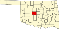
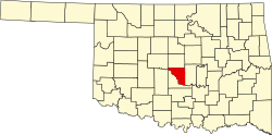
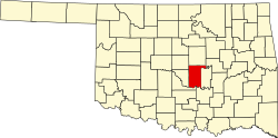
  • 地理的特徴: オクラホマ郡を中心に、カナディアン、クリーブランド、ポタワトミーの各郡にまたがる。

都市の成り立ちと歴史的変遷

オクラホマシティの歴史は、1889年4月22日の「ランドラッシュ(土地争奪戦)」から始まりました。鉄道の停車駅として誕生したこの街は、わずか1年後の1890年7月15日に法人化され、急速に発展を遂げました。
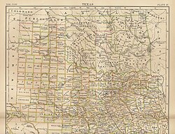
Map of Indian Territory (Oklahoma) 1889, showing Oklahoma as a train stop on a railroad line. Britannica 9th ed.

初期の街並みはリトグラフなどの記録に残されており、当時の開拓精神と都市化への意欲が伺えます。20世紀に入ると、商業の中心地としてブロードウェイ通りなどが整備され、近代的な都市へと変貌していきました。
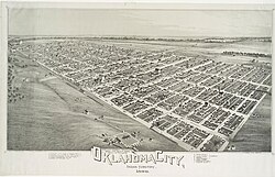
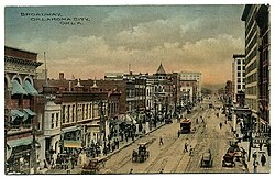
Lithograph of Oklahoma City from 1890.
Looking north on Broadway from present-day Sheridan Ave, 1910.

現代の都市景観とインフラ

現在のオクラホマシティは、近代的な高層ビルが立ち並ぶセントラル・ビジネス・ディストリクト(CBD)を中心に構成されています。特に2012年に完成したデボン・エナジー・センターは、高さ257メートル(844フィート)を誇る市内で最も高いビルです。
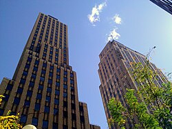
Looking up in the heart of Oklahoma City's Central Business District

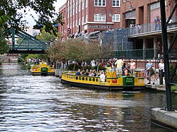
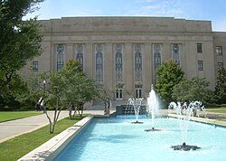
都市のシンボルであるオクラホマ州議会議事堂や、アールデコ様式の市庁舎など、歴史的建築物と現代建築が共存しています。また、ダウンタウンのブリックタウン地区ではウォータータクシーが運行し、観光客や市民に親しまれています。
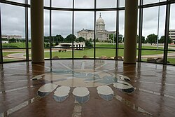
Oklahoma State Capitol, seen from the OK History Center
The Art Deco city hall building, a block from the Civic Center
Water taxis in Oklahoma City's downtown Bricktown neighborhood

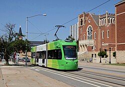
交通インフラにおいては、州道74号線(レイク・ヘフナー・パークウェイ)や、州を縦断する州間高速道路(I-35, I-40, I-44など)が網の目のように張り巡らされており、物流と移動の効率性を支えています。また、近年では路面電車(ストリートカー)の導入により、市街地の回遊性が向上しています。
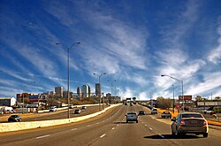
Old Interstate 40 Crosstown, Oklahoma City
Streetcar of the OKC Streetcar system passing the historic First United Methodist Church, in downtown

経済構造と主要産業

市の経済は非常に多角化しており、2023年の都市圏GDPは1,000億ドルを超えています。最大の雇用主は州政府ですが、ティンカー空軍基地などの軍事施設や、アマゾン、ホビーロビー、ペイコムといった企業の本社機能も集積しています。
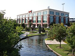
The Sonic Drive-In restaurant chain is headquartered in Oklahoma City.

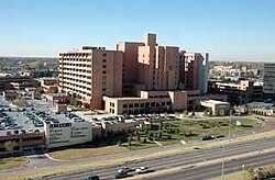
医療分野の発展も著しく、OUヘルスサイエンスセンターやインテグリス・バプティスト医療センターなどの高度な医療機関が、地域住民のみならず広域から患者を受け入れています。
OU Health Sciences Center in Oklahoma City
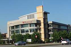
OU Physicians Center
INTEGRIS Baptist Medical Center

文化、スポーツ、そしてレクリエーション

スポーツは市民生活の重要な一部です。特にNBAのオクラホマシティ・サンダーの本拠地であるペイコム・センターは、街の熱狂の象徴となっています。また、マイナーリーグの野球やサッカーなど、多様なプロスポーツチームが活動しています。
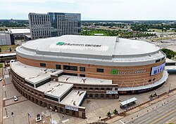
Paycom Center, home of the Oklahoma City Thunder

自然との調和も重視されており、ミリアド植物園や170以上の公園、100マイルに及ぶトレイルが整備されています。都市の緑化は、市民のQOL(生活の質)向上に大きく寄与しています。
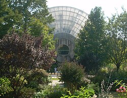
Myriad Botanical Gardens, the centerpiece of downtown OKC's central business district

記憶と再生:オクラホマシティ国立記念館

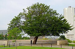
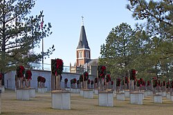
この街にとって忘れられない出来事が、連邦政府ビルへの爆破テロ事件です。被害を受けたマラー連邦ビル跡地には、犠牲者を追悼し、平和を願うオクラホマシティ国立記念館が設立されました。特に、攻撃を生き抜いた「サバイバー・ツリー(生存の樹)」は、不屈の精神の象徴として大切に保護されています。
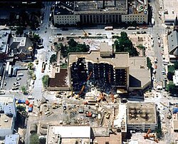
The Murrah Federal Building after the attack
Oklahoma City National Memorial at Christmas.
The Survivor Tree on the grounds of the Oklahoma City National Memorial

地理・気候と人口統計

地理的には北緯35度、西経97度に位置し、標高は約365メートルです。気候は極端な変動があることで知られ、夏季の猛暑や冬季の寒冷な気候に加え、竜巻などの激しい気象現象が発生しやすい地域です。
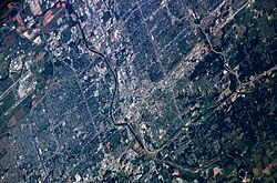
Mid-May 2006 photograph of Oklahoma City taken from the International Space Station (ISS).

人口構成は多様化が進んでおり、2020年の国勢調査では、白人に続きヒスパニック・ラティーノ、アフリカ系アメリカ人、アジア系、先住民族などが共生しています。この多様性は、街の文化的な豊かさにつながっています。
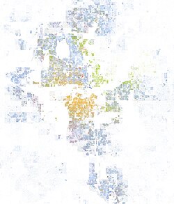
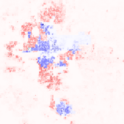
Map of racial distribution of the Oklahoma City area, 2020 U.S. census. Each dot is one person: ⬤ White ⬤ Black ⬤ Asian ⬤ Hispanic ⬤ Multiracial ⬤ Native American/Other
Oklahoma City region population dot map and 2016 presidential election results by precinct (click to enlarge).

都市概要まとめ

オクラホマシティ 基本データ
項目 詳細
設立日 1889年4月22日
人口(2020年) 681,054人
都市圏人口 1,512,242人
主要産業 政府、軍事、医療、エネルギー
最高峰ビル デボン・エナジー・センター (257m)
主要スポーツチーム オクラホマシティ・サンダー (NBA)

公共サービスとインフラ詳細

市民の安全を守るオクラホマシティ消防局(OKCFD)は、地上だけでなくレイク・ヘフナーなどの水域での救助活動も行うダイブチームを擁しており、高度な救急体制を構築しています。
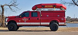
OKCFD dive team at Lake Hefner
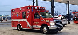
OKCFD ambulance

また、ウィル・ロジャース世界空港は、ユナイテッド航空などの主要航空会社が就航しており、世界的なビジネス・観光の玄関口として機能しています。
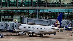
United Airlines Embraer 170 aircraft at the East Concourse of Will Rogers World Airport

教育面では、ビショップ・マグイネス・カトリック高校などの名門校や、キャリアテック(職業技術教育)などの多様な学習機会が提供されています。
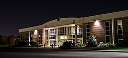
Bishop McGuinness Catholic High School

行政区画としては、以下の4つの郡にまたがって都市圏が形成されています。
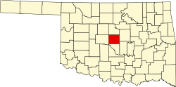
Canadian County map
Cleveland County map
Oklahoma County map
Pottawatomie County map

また、オートモービル・アレイのような商業地区の再開発が進み、歩きやすく魅力的な街づくりが推進されています。
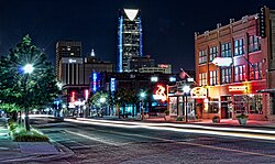
Automobile Alley in Oklahoma City

Frequently Asked Questions

オクラホマシティの主な産業は何ですか?

州都であるため州政府による雇用が最大ですが、ティンカー空軍基地などの軍事産業、医療サービス、そしてエネルギー産業が経済の柱となっています。

気候的な特徴や注意点はありますか?

夏季は非常に高温になり、冬季は氷点下まで下がるなど寒暖差が激しいのが特徴です。また、竜巻などの激しい気象現象が発生しやすい地域であるため、適切な防災対策が重要です。

どのようなスポーツチームが有名ですか?

NBAのオクラホマシティ・サンダーが最も有名で、ペイコム・センターを本拠地に活動しています。他にもマイナーリーグの野球チームやサッカーチームなどが人気を集めています。

観光で訪れるべきおすすめの場所はどこですか?

歴史と平和を学ぶオクラホマシティ国立記念館、自然豊かなミリアド植物園、そしてエンターテインメントが集まるブリックタウン地区などが代表的です。

人口構成にどのような特徴がありますか?

近年、ヒスパニック・ラティーノやアジア系、ミックス(混血)の人口が増加しており、多文化共生が進んでいるダイナミックな都市となっています。

References

  1. Mean monthly maxima and minima (i.e. the expected highest and lowest temperature readings at any point during the year or given month) calculated based on data at said location from 1991 to 2020.
  2. Official records for Oklahoma City were kept at the Weather Bureau Office from November 1890 to December 1953, and at Will Rogers World Airport since January 1954. For more information, see Threadex

📸 フォトギャラリー

Map of Indian Territory (Oklahoma) 1889, showing Oklahoma as a train stop on a railroad line. Britannica 9th ed.
Lithograph of Oklahoma City from 1890.
Looking north on Broadway from present-day Sheridan Ave, 1910.
Oklahoma City National Memorial at Christmas.
Mid-May 2006 photograph of Oklahoma City taken from the International Space Station (ISS).
Automobile Alley in Oklahoma City
Looking up in the heart of Oklahoma City's Central Business District
Map of racial distribution of the Oklahoma City area, 2020 U.S. census. Each dot is one person: ⬤ White ⬤ Black ⬤ Asian ⬤ Hispanic ⬤ Multiracial ⬤ Native American/Other
Old Interstate 40 Crosstown, Oklahoma City
The Murrah Federal Building after the attack
The Sonic Drive-In restaurant chain is headquartered in Oklahoma City.
Water taxis in Oklahoma City's downtown Bricktown neighborhood
The Survivor Tree on the grounds of the Oklahoma City National Memorial
Paycom Center, home of the Oklahoma City Thunder
Myriad Botanical Gardens, the centerpiece of downtown OKC's central business district
Oklahoma State Capitol, seen from the OK History Center
The Art Deco city hall building, a block from the Civic Center
Oklahoma City region population dot map and 2016 presidential election results by precinct (click to enlarge).
OU Health Sciences Center in Oklahoma City
Bishop McGuinness Catholic High School
OKCFD dive team at Lake Hefner
OKCFD ambulance
United Airlines Embraer 170 aircraft at the East Concourse of Will Rogers World Airport
Streetcar of the OKC Streetcar system passing the historic First United Methodist Church, in downtown
OU Physicians Center
INTEGRIS Baptist Medical Center
Canadian County map
Cleveland County map
Oklahoma County map
Pottawatomie County map