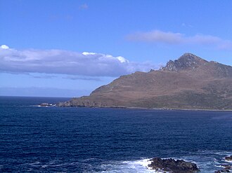
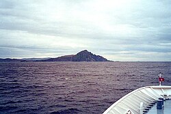
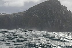
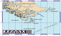
南米大陸の最南端、チリのティエラ・デル・フエゴ諸島に位置するケープホーン(ホーン岬)は、大西洋と太平洋が激しくぶつかり合う地点であり、航海者にとって古くから最大の難所として知られてきました。ドレーク海峡の北端を形成するこの地は、単なる地理的な境界線ではなく、自然の猛威と人間の挑戦が交差する象徴的な場所です。
Key Facts
- 地理的役割:大西洋と太平洋の接点であり、ドレーク海峡の北限に位置する。
- 気候特性:年間を通じて強風と多雨に見舞われ、冬場は視界不良の暴風雨が頻発する。
- 生態系:マゼランペンギンの南限であり、世界最南端の樹木(マゼランブナ)が確認されている。
- 航海上の定義:単に通過する「Rounding」と、南緯50度を基準とした過酷な往復航行「Doubling」がある。
- 最南端の灯台:ホーン島に世界最南端の伝統的な灯台が存在する。
地理と生態系の特異性
ケープホーンはチリの領海内にあり、ホーン島という小さな島の一部を構成しています。この地域は極めて厳しい環境にありながら、独自の生態系を維持しています。例えば、2019年の調査では、島の南東端で強風に耐えながら地面に這うように成長したマゼランブナ(世界最南端の樹木)が発見されました。また、動物学的にはマゼランペンギンの分布の南限としても知られています。
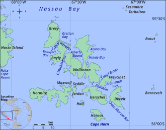
現在、ホーン島にはチリ海軍の基地が設置されており、居住施設や礼拝堂、灯台などが管理されています。また、この地で命を落とした船乗りたちを追悼するため、彫刻家ホセ・バルセリャスによるアホウドリの彫像を含む記念碑が建立されました(1992年)。しかし、この彫像さえも2014年に猛烈な風によってなぎ倒されるという、この地の自然の厳しさを物語る出来事がありました。
極限の気候条件
高緯度に位置するため、年間を通じて気温が低く、天候は極めて不安定です。近隣のディエゴ・ラミレス諸島のデータによれば、年間の平均気温は約5.2℃と低く、降水量は非常に豊富です。特に3月は月間平均降水量が最大となり、10月であっても相当量の雨が降ります。
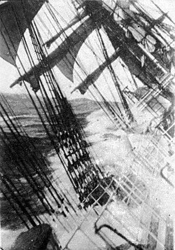
特筆すべきは風の強さです。平均風速は時速30km程度ですが、季節を問わず時速100kmを超える激しい突風(スコール)が発生します。夏季は視界が良い日が多いものの、冬季になると約30%の時間帯で暴風状態となり、視界も極端に悪化します。
| 項目 | 1月 | 4月 | 7月 | 10月 | 年平均 |
|---|---|---|---|---|---|
| 平均最高気温 (℃) | 14.7 | 9.8 | 3.7 | 10.6 | 9.7 |
| 平均最低気温 (℃) | 6.5 | 3.2 | -1.1 | 2.6 | 2.7 |
| 平均降水量 (mm) | 126.0 | 134.4 | 107.6 | 93.7 | 1,367.5 |
航海術と「ホーンを回る」ことの意味
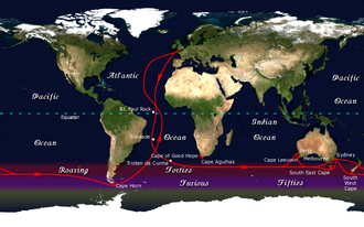
現代ではヘリコプターやクルーズ船で訪れることができますが、帆船時代においてここを通過することは至難の業でした。航海用語には、単に岬を通過することを指す「Rounding the Horn」と、より困難な「Doubling the Horn」という区別があります。
Doubling the Hornとは、太平洋側の南緯50度から岬を回り、大西洋側の南緯50度まで到達した後、再び逆風に抗って太平洋側の南緯50度まで戻るという過酷な航程を指します。この往復距離は片道最低でも約1,500kmに及び、熟練の船乗りであっても精神的・肉体的な限界を試される挑戦となります。
灯台の役割と位置
一般的に「ケープホーン灯台」として知られ、観光客が訪れるのはチリ海軍基地にある灯台ですが、厳密には岬の本体から北東に約1.6km離れた場所にあります。本当の意味での最南端の灯台は、岬の先端に設置された高さ4メートルのファイバーグラス製タワーであり、これが世界最南端の伝統的な灯台とされています。
歴史的な挑戦と記録
ヨーロッパ人がこの地を訪れた当初、ここはティエラ・デル・フエゴの最南端だと思われていましたが、1624年になってようやく島であることが判明しました。あまりに気象条件が過酷であったため、わずか650km先に南極大陸がありながら、その発見は1820年まで待たねばなりませんでした。
また、歴史的な航海の中には、あまりの困難に断念した例もあります。1788年のHMSバウンティ号は、31日間でわずか85マイルしか前進できず、ルートをアフリカ経由に変更しました。この絶望的な状況が、後の有名な「バウンティ号の反乱」の一因となったという説もあります。
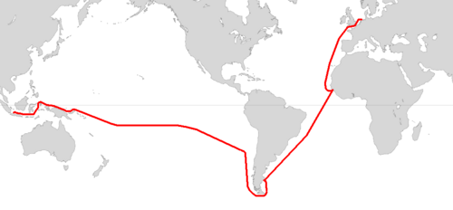
一方で、個人の挑戦も続いてきました。1895年にジョシュア・スロカムが初の単独ヨットによる通過を成し遂げ(ただし沿岸ルートを利用)、1942年にはアルゼンチンのヴィト・ドゥマスが単独での世界一周を成功させました。近年では2010年に当時16歳のアビー・サンダーランドが単独で通過するなど、時代を超えて多くの航海者がこの「世界の果て」に挑み続けています。
Frequently Asked Questions
「Rounding」と「Doubling」の違いは何ですか?
「Rounding」は単に岬を通過することを指しますが、「Doubling」は南緯50度の境界線を基準に、太平洋から大西洋へ、そして再び太平洋へと逆風の中を戻るという、より厳格で困難な航海ルートを完遂することを意味します。
世界最南端の灯台はどこにありますか?
チリ海軍基地にある有名な灯台ではなく、岬の先端(Cape Horn proper)に設置されている高さ4メートルのファイバーグラス製タワーが、世界最南端の伝統的な灯台です。
この地域に樹木は生えていますか?
はい。2019年の調査により、島の南東端にマゼランブナが生育していることが確認されました。強風のため地面に押し付けられたような形状をしていますが、世界最南端の樹木とされています。
なぜ南極大陸の発見が遅れたのですか?
ケープホーン周辺のドレーク海峡が、予測不能な暴風雨や激しい海況という極めて危険な環境であったため、航海者がさらに南へ探索を進めることが困難だったためです。
気候は一年中寒いのでしょうか?
はい。高緯度のため年間を通じて冷涼です。夏季の平均最高気温でも14℃前後であり、冬季には氷点下まで下がります。また、年間を通じて非常に雨が多く、特に冬は暴風雨による視界不良が頻発します。
References
- Venanzangeli, Paolo. "Cape Horn the Terrible". Nautical Web. Archived from the original on March 18, 2011. Retrieved February 5, 2006.
- Rolfo, Mariolina; Ardrizzi, Giorgio (2004). "7. Cabo de Hornos". Patagonia and Tierra del Fuego Nautical Guide: Chilean and Argentine coasts from Valdivia to Mar del Plata including Isla de los Estados and Cabo de Hornos. Editrice Incontri Nautici. .
- Bywater, Thomas (2020). "Isolation Station: the lighthouse keeper at the end of the world". Travel. New Zealand Herald. Retrieved August 3, 2024.
- Pile, Tim (August 6, 2020). "10 lighthouses with claims to fame, the legacies of which shine on". South China Post Magazine. Retrieved August 3, 2024.
Navy officer Captain Ariel Barrientos is currently stationed at the windswept outpost with his family.
- "Isla Hornos Lighthouse". Lighthouse Depot. Archived from the original on January 11, 2006. Retrieved February 5, 2006.
- Benavente, Roberto (May 20, 2001). "Cape Horn Memorial". Fundacion Caphorniers Chile. Archived from the original on September 26, 2005. Retrieved February 5, 2006.
On December 5th 1992 the Cape Horn Memorial was inaugurated.
- Welch, Craig (July 2020). "The tree at the bottom of the world—and the wind-blasted trek to find it". . Archived from the original on July 7, 2020. Retrieved July 13, 2020.
- Hogan, C. Michael (November 27, 2008). Stromberg, Nicklas (ed.). "Magellanic Penguin". GlobalTwitcher. Archived from the original on June 7, 2012.
They [Magellanic penguins] breed as far south as Cape Horn, the location where the first European, Ferdinand Magellan, sighted the species in 1519.
- Cokendolpher, James C.; Lanfranco, Dolly L. (1985). "Opiliones from the Cape Horn Archipelago" (PDF). Texas Tech University. Archived from the original (PDF) on September 30, 2007. Retrieved February 5, 2006.
- "Rescate en el Cabo de Hornos" [Rescue at Cape Horn]. Archived from the original on November 14, 2014. Retrieved November 18, 2012.
📸 フォトギャラリー