アメリカ合衆国ワシントン州に位置するセント・ヘレンズ山は、その劇的な噴火履歴と自然の回復力で世界的に知られる活火山です。カスケード山脈の一部であり、地質学的に非常に若く活動的なこの山は、単なる地形的なランドマークではなく、地球のダイナミズムを象徴する生きた研究室とも言えます。
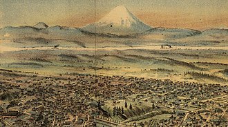
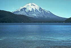
かつてはその完璧な円錐形のシルエットから「アメリカの富士山」と称賛されていましたが、1980年の大噴火によってその姿は一変しました。しかし、壊滅的な破壊の後には驚くべき生態系の再生が始まり、現在は多くのハイカーや科学者を惹きつける場所となっています。
主要な事実(Key Facts)
- 山種: 成層火山(カスケード火山弧に属する)
- 最高地点: 標高 2,549メートル
- 形成時期: 約4万年前から活動開始
- 最大イベント: 1980年5月18日の大規模噴火(VEI 5)
- 最新の活動: 2004年から2008年にかけての噴火活動
- 保護区: セント・ヘレンズ山国立火山記念碑として指定
地理的背景と地質学的構造
セント・ヘレンズ山は、カスケード山脈の西側に位置し、近隣にはアダムス山やレーニア山といった他の主要な火山が点在しています。これらの火山は、プレートの沈み込み帯に伴う火山活動によって形成されました。
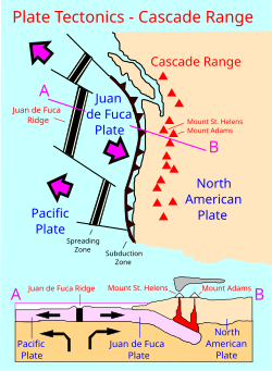
地質学的な特徴として、地下には2つのマグマ溜まりが存在することが分かっています。一つは地表から約5〜12km、もう一つは12〜40kmの深さにあり、深い方の溜まりはアダムス山などの近隣火山と共有している可能性があります。この複雑な構造が、不定期かつ強力な噴火の原動力となっています。
歴史を変えた1980年の大噴火
1980年3月、マグニチュード4.2の地震を皮切りに、山頂付近で蒸気の放出が始まりました。4月末には山の北側が大きく膨らみ始め、ついに5月18日午前8時32分、マグニチュード5.1の地震が引き金となって北壁が崩落しました。
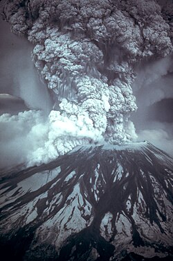
この崩落は記録史上最大規模のデブリアバランシェ(岩屑なだれ)となり、直後に猛烈な火砕流が発生しました。火砕流は周囲約600平方キロメートルの植生や建物をなぎ倒し、大気中には150万トン以上の二酸化硫黄が放出されました。この噴火は火山爆発指数(VEI)で「5」と定義されるプリニー式噴火に分類されます。
噴火直前まで観測を続けていたデイヴィッド・A・ジョンストン氏を含む多くの犠牲者が出たこの惨事は、現代の火山学における重要な教訓となりました。
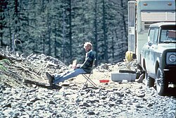
噴火後の活動と現在の状況
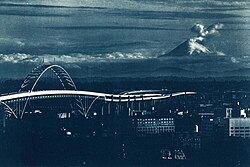
1980年の大噴火後も、火山活動は止まりませんでした。1980年代から1990年代にかけて、火口内では新しい溶岩ドームの形成と小規模な爆発が繰り返されました。その後、2004年から2008年にかけて再び活動期に入り、2005年にはシアトルからも視認できるほどの巨大な蒸気と灰の柱が立ち上がりました。
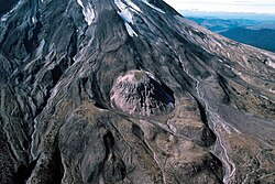
地質学者たちは、今後の噴火はより破壊的になる可能性があると予測しています。これは、現在の溶岩ドームの形状が、噴出のために以前よりも高い圧力を必要とするためです。
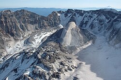
生態系の破壊と驚異的な再生
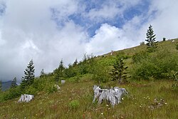
噴火当時、山頂付近の森林は完全に消滅し、生息していた山羊などの野生動物も一掃されました。しかし、時が経つにつれ、自然の回復力が現れ始めました。
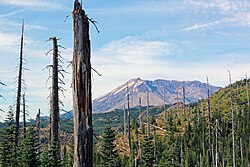
死滅した樹木が立ち並ぶ荒野から、徐々に植物が戻り、現在のジョンストン・リッジ天文台付近などでは豊かな緑が回復している様子が見られます。このプロセスは、大規模な環境破壊からの生態系遷移を研究する上で極めて貴重な事例となっています。
人間との関わりと文化
この山は、古くから先住民族にとって重要な意味を持っていました。カウルリッツ族は「Lawetlat'la」、クリキタット族は「Loowit」や「Louwala-Clough」と呼び、その美しさと力強さに基づく伝説が受け継がれています。
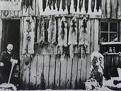
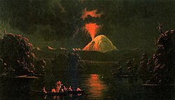
ヨーロッパ人による記録は1792年、ジョージ・ヴァンクーバー船長によるものです。彼はイギリスの外交官アリーン・フィッツハーバート(第1代セント・ヘレンズ男爵)にちなんでこの山に名前を付けました。19世紀には毛皮猟師たちがこの地を訪れ、時折起こる小規模な噴火を記録に残しています。
レクリエーションと登山
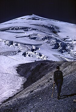
現在は、1982年に設立された「セント・ヘレンズ山国立火山記念碑」として保護されており、年間を通じて多くの登山者が訪れます。特に冬の標準ルートとされる「ワーム・フローズ・ルート」は、技術的な登攀を必要とせず、山頂まで直接的にアクセスできるため人気です。
| 項目 | 詳細 |
|---|---|
| 標高 | 2,549 m |
| 山種 | 成層火山 |
| 主要な噴火年 | 1980年、2004-2008年 |
| 1980年噴火の規模 | VEI 5 (プリニー式噴火) |
| 管理区分 | 国立火山記念碑 |
Frequently Asked Questions
1980年の噴火で山はどう変わりましたか?
北側の山肌が大規模に崩落し、完璧な円錐形だった山頂が消失して巨大な馬蹄形の火口が形成されました。また、広大な範囲の森林が火砕流によって破壊されました。
現在も噴火する可能性はありますか?
はい、セント・ヘレンズ山は依然として活火山です。地質学的な予測では、将来的に再び噴火する可能性があり、特に現在の溶岩ドームの構造上、次回の噴火はより高い圧力を伴う破壊的なものになると考えられています。
登山は安全に行えますか?
はい、一年中登山が可能で、多くのハイカーが訪れています。ただし、国立火山記念碑の規制や、ルートごとの難易度を確認し、適切な装備で登ることが推奨されています。
噴火後の自然はどうなりましたか?
一度は完全に破壊されましたが、その後、植物や野生動物が徐々に戻ってきました。この「自然の再生プロセス」は科学的に非常に重要視されており、現在も観察が続いています。
この山の名前の由来は何ですか?
1792年にジョージ・ヴァンクーバー船長が、イギリスの外交官である第1代セント・ヘレンズ男爵アリーン・フィッツハーバートに敬意を表して命名しました。
References
- "Mount Saint Helens". . , .
- "Distance between Portland and Mount Saint Helens". distancefromto.net. Retrieved March 27, 2021.
- "Distance between Seattle and Mount Saint Helens". distancefromto.net. Retrieved March 27, 2021.
- "Mount St. Helens National Volcanic Monument". . Archived from the original on November 23, 2006.
- Tilling, Robert I.; Topinka, Lyn; Swanson, Donald A. (1990). "Impact and Aftermath". Eruptions of Mount St. Helens: Past, Present, and Future. 1.01. USGS.
- "Mount St. Helens – From the 1980 eruption to 2000". United States Geological Survey. 2000. Fact Sheet 036-00. Retrieved November 12, 2006.
- "May 18, 1980 eruption of Mount St. Helens". USDA Forest Service. Archived from the original on May 29, 2009.
- "1980 Cataclysmic Eruption". Mount St. Helens. USGS. Retrieved March 27, 2021.
- "Mount St. Helens: A Living Laboratory for Ecological Research | Pacific Northwest Research Station | PNW – US Forest Service". www.fs.usda.gov. Retrieved June 1, 2021.
- Haas, Maya (May 18, 2020). "Mount St. Helens isn't where it should be. Scientists may finally know why". National Geographic. Archived from the original on June 3, 2021. Retrieved June 20, 2021.
📸 フォトギャラリー