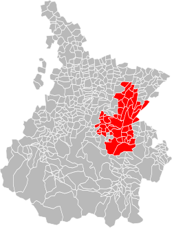
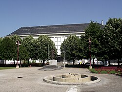
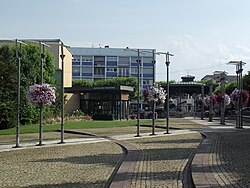
フランス南西部、オート=ピレネー県に位置するラネメザン(Lannemezan)は、広大な高原地帯に広がる魅力的なコミューンです。豊かな自然環境と、鉄道の開通による都市発展の歴史を持ち、現在は穏やかな地方都市としての顔と、農業の拠点としての顔を併せ持っています。
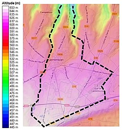
標高442メートルから647メートルにわたる起伏のある地形に位置し、周囲を豊かな水系に囲まれたこの街は、ピレネー山脈の麓ならではの独特な気候と景観を形作っています。
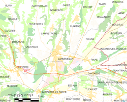
主要な事実(Key Facts)
- 地理的特性:オート=ピレネー県に属し、平均標高は約610メートルの高原地帯に位置する。
- 人口規模:2023年時点で5,811人が居住。
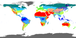
- 気候区分:ケッペンの気候区分では「Cfb(西岸海洋性気候)」に分類され、年間を通じて降水がある。
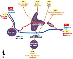
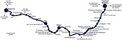
- 交通の要衝:バイヨンヌ〜トゥールーズ線などの鉄道や、主要国道(D817など)が交差する。
- スポーツの聖地:ツール・ド・フランスのスタート地点として何度も選出された実績を持つ。
自然環境と地理的特徴
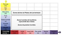
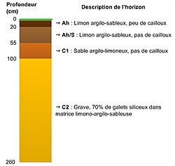
ラネメザンは、その名の通り「ラネメザン高原」という地質学的に特徴的なエリアにあります。この地域の土壌は層によって粒子の大きさが異なり、農業に適した環境を提供しています。
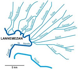
水系においては、バイズ川(La Baïse)やネスト川(La Neste)などの河川がこの高原から始まり、最終的にガロンヌ川へと合流します。これらの豊かな水資源が、地域の植生や農業を支える基盤となっています。
気候の特性
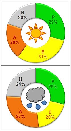
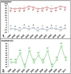
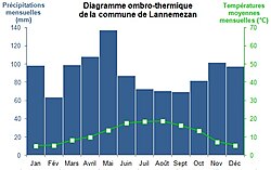
この地域の気候は、温帯で四季がはっきりしており、極端な乾燥期間がないのが特徴です。年間の平均降水量は約1,220mmに達し、冬から春にかけて特に多くの雨が降ります。最高気温は39度、最低気温はマイナス17度を記録することもあり、季節による温度差が明確です。
都市の構造とインフラ
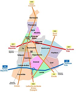
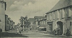
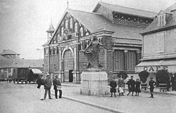
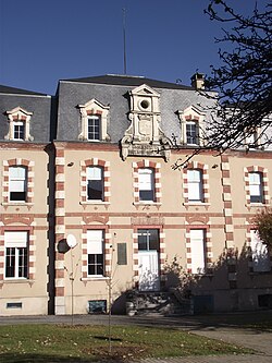
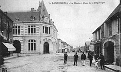
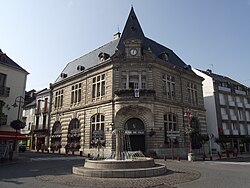
街の構成は南北方向に伸びており、中心部には共和国広場(Place de la République)などの公共スペースが配置されています。また、1911年に落成した市役所などの歴史的建造物が街のシンボルとなっています。
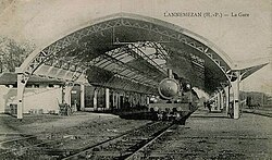
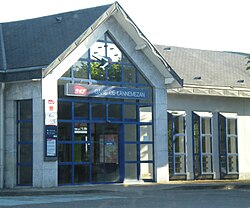
交通インフラが非常に充実しており、鉄道駅(SNCF)を通じてトゥールーズやバイヨンヌといった主要都市へアクセス可能です。また、近隣にはタルブ・ルルド・ピレネー空港などの国際空港が3つあり、広域的な移動の利便性が確保されています。
住宅と生活環境
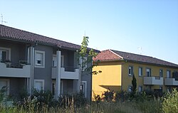
住宅事情を見ると、一戸建ての割合が非常に高く、フランスの全国平均を上回っています。これは、高原地帯という広々とした土地利用を反映した結果と言えるでしょう。
歴史と社会の変遷
ラネメザンの人口推移を辿ると、20世紀半ばに急激な成長を遂げたことがわかります。1900年から1970年にかけて人口は大幅に増加しましたが、1970年以降は緩やかな減少傾向に転じました。
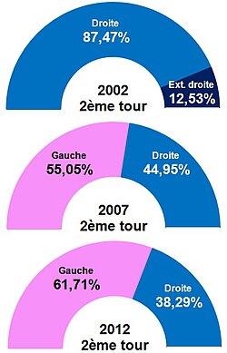
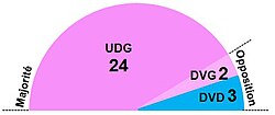
政治的には、2000年代以降、社会党(PS)系の候補者が強い支持を得る傾向にあり、地方自治の安定した体制が築かれています。
文化・スポーツと地域活動
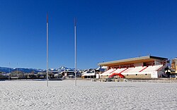
ラネメザンはスポーツが非常に盛んな街です。サッカー、ハンドボール、バスケットボールなどの球技から、柔道、空手、合気道といった武道まで、多様なクラブ活動が展開されています。
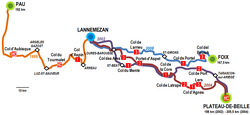
特にサイクリングへの情熱は高く、世界的に有名な自転車レース「ツール・ド・フランス」のステージ出発地として、1999年、2002年、2004年、2008年、2015年と何度も選ばれています。
地域経済と農業
都市部以外では広大な農村地帯が広がっており、混合農業が営まれています。これに関連した地域の祭事や市場が年間を通じて開催されており、地元の食文化を支えています。
ラネメザン基本データまとめ
| 項目 | 詳細内容 |
|---|---|
| 面積 | 19.03 km² |
| 人口 (2023年) | 5,811人 |
| 平均標高 | 約610 m |
| 気候区分 | Cfb (温帯・湿潤) |
| 主要河川 | バイズ川、ネスト川 |
| 姉妹都市 | トンデラ (ポルトガル) |
Frequently Asked Questions
ラネメザンの気候はどのような特徴がありますか?
ケッペンの気候区分で「Cfb」に分類される温帯気候です。年間を通じて降水があり、特に深刻な干ばつ期間がないのが特徴で、四季がはっきりと分かれています。
交通アクセスはどうなっていますか?
SNCFの鉄道駅があり、バイヨンヌ〜トゥールーズ線を利用できます。また、A64高速道路(ラ・ピレネーヌ)や主要国道が通っており、車でのアクセスも非常に便利です。
スポーツに関してどのような特徴がありますか?
非常に多様なスポーツクラブが存在します。特にサイクリングが盛んで、ツール・ド・フランスのスタート地点に何度も選ばれた歴史があります。
街の人口推移はどう変化してきましたか?
19世紀から20世紀前半にかけて緩やかに増加し、1900年から1970年にかけて急成長を遂げました。その後、1970年代以降は緩やかな減少傾向にあります。
どのような産業が盛んですか?
都市部での商業活動に加え、周辺の農村地帯では混合農業が盛んに行われており、地域の経済と文化を支えています。
References
- "Répertoire national des élus: les maires" (in French). data.gouv.fr, Plateforme ouverte des données publiques françaises. 13 September 2022.
- "Populations de référence 2023" (in French). National Institute of Statistics and Economic Studies. 18 December 2025.
- INSEE commune file
- Information extracted from the article fr:Plateau de Lannemezan
- Carte géographique des alentours de Lannemezan, sur le site de "ViaMichelin".
- Site of Viamichelin "ViaMichelin". Archived from the original on 6 October 2007.
- "Climat" [Climate] (in French). Archived from the original on 2 October 2013.
- "Fiche Climatologique Statistiques 1991-2020 et records" (PDF) (in French). . Retrieved 12 September 2022.
- "Viamichelin". Retrieved 12 May 2015.
{{}}: CS1 maint: deprecated archival service () - "linternaute.com".
📸 フォトギャラリー