私たちの目の前に広がる山々や深い谷、海岸線などの風景は、決して静止したものではありません。地形学(Geomorphology)とは、地球の表面や海底に現れる地形の成り立ちと、それがどのように変化していくのかを研究する学問です。物理的、化学的、あるいは生物学的なプロセスが複雑に絡み合い、現在の地表の姿を作り上げています。
地形学者は、フィールドワークによる観察、物理的な実験、そして数値シミュレーションを組み合わせることで、「なぜこの場所はこのような形をしているのか」という問いに答えを出し、将来的な地形の変化を予測しようとしています。この分野は、地質学や物理地理学だけでなく、土木工学、考古学、気候学など、多岐にわたる学問領域と密接に関わっています。
地球の表面は、内部からの力(地殻変動)と外部からの力(地表プロセス)の相互作用によって絶えず更新されています。例えば、プレートの動きによる山脈の隆起や火山活動といった地質学的プロセスがある一方で、水、風、氷、さらには生物や人間による浸食や堆積といった地表プロセスがそれを削り、形作ります。これらのプロセスは気候の影響を強く受けており、地球の岩石圏(リソスフェア)が、水圏、気圏、生物圏と交差する地点で地形が決定されると言えます。
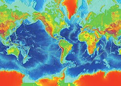
Key Facts
- 定義: 地表および海底の地形の起源と進化を研究する科学。
- 形成要因: 地殻変動(隆起・沈降)と地表プロセス(水・風・氷・生物)の相互作用。
- 影響因子: 気候が地表プロセスの速度や形態を大きく左右する。
- 手法: 現地観察、物理実験、数値モデリングによる定量的分析。
- 学際性: 地質学、地理学、工学、気候学などの境界領域に位置する。
地形学の歴史的変遷
古代から近代までの洞察
地形の変化に対する関心は古く、古代ギリシャのヘロドトスは土壌の観察からナイルデルタの成長を指摘し、アリストテレスは陸地と海が周期的に入れ替わるという大胆な仮説を立てました。また、11世紀のペルシャの学者アル・ビールーニーは、河口の岩石からインド亜大陸がかつて海に覆われていたことを推測しています。
東洋においても、中国・宋代の沈括は、山岳地帯で海生生物の化石を発見したことから、かつての海岸線が数百マイル移動したこと、そして浸食と堆積が地形を再形成することを理論化しました。彼はまた、化石化した竹の発見から、数世紀にわたる緩やかな気候変動の存在を説いています。
![Badlands incised into shale at the foot of the North Caineville Plateau, Utah, within the pass carved by the Fremont River and known as the Blue Gate. G. K. Gilbert studied the landscapes of this area in great detail, forming the observational foundation for many of his studies on geomorphology.[1]](/images/ef/0e/ef0ebf5f57befe1043e3d90fc9ccf0487d753f774b5ed15d96d4371a9737d2e4.jpg)
近代的なモデルの登場と対立
19世紀後半になると、「地形学」という用語が定着し、体系的なモデルが構築されました。ウィリアム・モリス・デイビスが提唱した「浸食サイクル」は、地殻の隆起後に浸食が進み、最終的に平坦な地形になるという定性的なモデルで、長らく主流となりました。
これに対し、ヴァルター・ペンクは、隆起と浸食が同時に進行するという動的なモデルを提示しました。彼は、地形の進化は単なる「衰退」ではなく、後退的な浸食(バックウェアリング)によるものであると強調し、地表プロセスの重要性を説きました。
![Part of the Great Escarpment in the Drakensberg, southern Africa. This landscape, with its high altitude plateau being incised into by the steep slopes of the escarpment, was cited by Davis as a classic example of his cycle of erosion.[33]](/images/31/16/3116892f3faa30faade41b9ec7cf9d3c054399c3bd85c1901567c269decda535.jpg)
気候と定量化へのアプローチ
20世紀に入ると、世界各地の調査結果に基づき、気候が地形分布の主因であるとする「気候地形学」が発展しました。しかし、1960年代後半には、物理法則は地球上のどこでも共通であるという視点から、単純な気候区分による分類への批判が高まりました。
その後、地形学は定量的な分析へとシフトします。河川や斜面の形状を直接測定し、そのスケール則を研究することで、過去の挙動の解明や将来の予測が可能になりました。現代では、数値的なアプローチが主流となり、地域的な記述よりもプロセスベースの理解が重視されています。
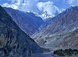
地形を形成する主要なプロセス
地形は、以下のような多様な要因によって彫刻されます。
- 河川プロセス(Fluvial): 流れる水が岩石を削り、谷や峡谷を形成します。
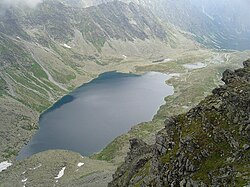
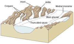
- 氷河プロセス(Glacial): 巨大な氷の塊が地表を削り取り、U字谷や湖を形成します。
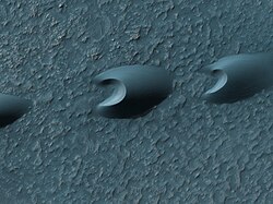
- 風成プロセス(Aeolian): 風による砂の運搬と堆積が砂丘などを作ります。
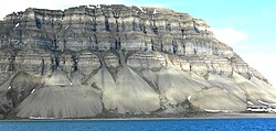
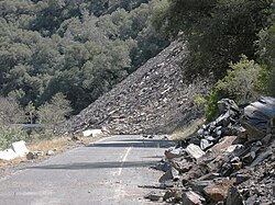
- 斜面プロセス(Hillslope): 重力による土砂の移動や地滑りが起こります。
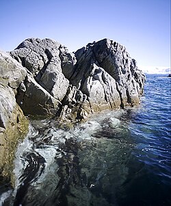
- 海洋プロセス(Marine): 波や海流が海岸線を浸食・堆積させます。
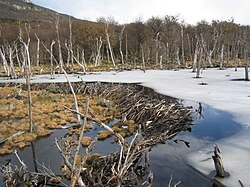
- 生物プロセス(Biological): 生物の活動(例:ビーバーのダム建設)が地形を変えます。
- 火成・構造プロセス(Igneous/Tectonic): 火山活動やプレートの衝突による隆起。
!["Cono de Arita" at the dry lake Salar de Arizaro on the Atacama Plateau, in northwestern Argentina. The cone itself is a volcanic edifice, representing complex interaction of intrusive igneous rocks with the surrounding salt.[10]](/images/01/9b/019b65fe1a46dc21b3e6eacc5812f37aad965ca0a38d24814e702de681eb9269.jpg)

地形学の概要まとめ
| プロセス名 | 主な駆動要因 | 代表的な地形例 | 主な作用 |
|---|---|---|---|
| 河川 | 流水 | V字谷、河口デルタ | 浸食・運搬・堆積 |
| 氷河 | 氷の移動 | U字谷、モレーン | 強力な削剥・堆積 |
| 風成 | 風 | 砂丘、ヤルダン | 運搬・堆積 |
| 構造 | 地殻変動 | 山脈、断層崖 | 隆起・沈降 |
| 生物 | 生物活動 | ビーバーダム、サンゴ礁 | 構造的改変 |
Frequently Asked Questions
地形学と地質学はどう違うのですか?
地質学が主に地球の内部構造、岩石の組成、地層の歴史などを扱うのに対し、地形学は特に「地表の形状」とその変化のプロセスに焦点を当てます。地質学的な基盤が地形を決定しますが、地形学はその上の「形」をどう作るかに注目する学問です。
気候はどのように地形に影響を与えますか?
気候は水の量や状態(液体か氷か)、風の強さなどを決定するため、浸食の速度や種類を大きく変えます。例えば、寒冷地では氷河による浸食が支配的になりますが、乾燥地では風による浸食や堆積が主役となります。
「浸食サイクル」とは何ですか?
かつてデイビスが提唱した理論で、地殻が隆起して山ができ、その後長い時間をかけて浸食され、最終的に平坦な土地(準平原)になるという一連の流れを指します。現在はより複雑な動的モデルに取って代わられていますが、地形学の歴史において重要な概念です。
人間活動も地形学の対象になりますか?
はい。現代の地形学では、都市開発や採掘、ダム建設など、人間による地表の改変も重要な要因として考慮されます。これは生物地形学の一環として、あるいは人為的な地表プロセスとして研究されています。
References
- Gilbert, Grove Karl, and Charles Butler Hunt, eds. Geology of the Henry Mountains, Utah, as recorded in the notebooks of GK Gilbert, 1875–76. Vol. 167. Geological Society of America, 1988.
- Huggett, Richard John (2011). "What Is Geomorphology?". Fundamentals Of Geomorphology. Routledge Fundamentals of Physical Geography Series (3rd ed.). . p. 3. .
- Willett, Sean D.; Brandon, Mark T. (January 2002). "On steady states in mountain belts". Geology. 30 (2): 175–178. :2002Geo....30..175W. :10.1130/0091-7613(2002)030<0175:OSSIMB>2.0.CO;2. 8571776.
- Roe, Gerard H.; Whipple, Kelin X.; Fletcher, Jennifer K. (September 2008). "Feedbacks among climate, erosion, and tectonics in a critical wedge orogen" (PDF). American Journal of Science. 308 (7): 815–842. :2008AmJS..308..815R. 10.1.1.598.4768. :10.2475/07.2008.01. 13802645.
{{}}: Cite uses deprecated parameter|citeseerx=() - Summerfield, M.A. (1991). Global Geomorphology. . p. 537. .
- Dunai, T.J. (2010). Cosmogenic Nucleides. . p. 187. .
- Messina, Paul (2 May 1997). "What is Digital Terrain Analysis?". Department of Geography, New York.
- Hargitai, Henrik; Kereszturi, Ákos, eds. (2015). Encyclopedia of Planetary Landforms. New York, NY: Springer New York. :10.1007/978-1-4614-3134-3. . 132406061.
- "International Conference of Geomorphology". Europa Organization. Archived from the original on 2013-03-17.
- Patowary, Kaushik (16 July 2014). "Cono de Arita in Argentina". amusingplanet.com.
📸 フォトギャラリー