タグ

カリブプレート

2 件の記事

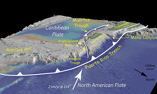
Bathymetry of the northeast corner of the Caribbean plate showing the major faults and plate boundaries; view looking south-west. The main bathymetric features of this area include: the Lesser Antilles Volcanic Arc; the old inactive volcanic arc of the Greater Antilles (Virgin Islands, Puerto Rico, and Hispaniola); the Muertos Trough; and the Puerto Rico Trench formed at the plate boundary zone between the Caribbean and obliquely subducting North American plates. Vertical exaggeration is 5:1.

カリブプレートの境界構造と地質学的特性

カリブプレートプレートテクトニクス沈み込み帯トランスフォーム断層
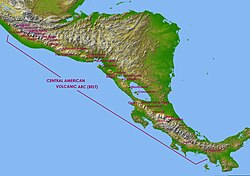
Map of the Central American volcanic arc, with captions showing the location of several volcanoes – in the Mexico/Guatemala border: Tacaná; in Guatemala: Tajumulco, Santa Maria, Chicabal, Tolimán, Atitlán, Volcán de Fuego, Volcán de Agua, Pacaya, Chingo; in El Salvador: Apaneca Range, Chinchontepec or San Vicente, Chaparrastique or San Miguel, Chinameca and Conchagua; in Nicaragua: Cosiguina, Telica, Cerro Negro, Momotombo, Apoyeque-Chiltepe, Mombacho and Concepción; in Costa Rica: Orosí, Rincón de la Vieja, Miravalles, Arenal, Barva, Turrialba and Irazú; in Panama: Barú and La Yeguada.

中央アメリカ火山弧(CAVA)の地質学的構造と火山活動の歴史

中央アメリカ火山弧CAVAプレートテクトニクスココスプレート