タグ

マウナケア

6 件の記事

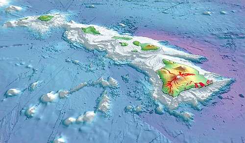
Hawaiian Islands from space.[11]

ハワイ諸島の地理と歴史火山が創り出した太平洋の楽園

ハワイ諸島ホットスポット火山太平洋プレート
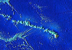
The Hawaiian-Emperor seamount chain, zoomed in on the modern-day islands

ハワイ・エンペラー海山列の謎ホットスポットが描く地球の記憶

ハワイ・エンペラー海山列ホットスポットプレートテクトニクスマウナケア
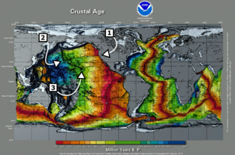
Global map labeled Crustal Age with callouts for specific areas of interest. There is an overall pattern of younger crust in the East Pacific and younger in the West.

ハワイホットスポット太平洋に刻まれた巨大火山列の謎

ハワイホットスポットマントルプルーム太平洋プレートハワイ・エンペラー海山列
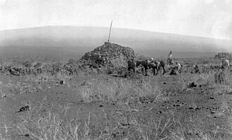
The Ahu-a-ʻUmi Heiau, built for ʻUmi-a-Līloa in the Kona District

ハワイ島(ビッグアイランド)の自然と文化火山が創り出すダイナミックな大地

ハワイ島ビッグアイランドキラウエア火山マウナケア
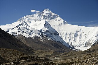
Mount Everest, Earth's highest mountain

山岳の定義と地質学的特性地球を形作る巨大な地形の科学

地質学エベレスト標高
To illustrate Mauna Kea's dry prominence, imagine raising the sea level of the Pacific Ocean to submerge the top of Mauna Kea. Then slowly lower it again. The first thing to appear is the peak of Mauna Kea. Then Mauna Loa and peaks of the surrounding Hawaiian Islands will emerge from the ocean. If the ocean drains further, the island around Mauna Kea will grow and merge with the adjacent islands. Continue draining until a land bridge forms between the Hawaiian Islands and a continent so that it is possible to walk all the way there without getting wet. Stop draining at this point, and this bridge is the key col of a dry Mauna Kea, connecting it to Mount Everest. Mauna Kea's peak stands 30,610 ft (9,330 m) above this key col.

マウナケア山の全貌ハワイの最高峰が持つ地質学的価値と天文学的重要性

マウナケアハワイ楯状火山天文台