タグ

水氷

20 件の記事

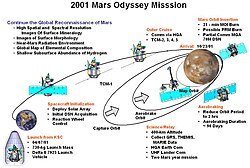
Summary of Mars Odyssey mission start

Mars Odyssey火星の地下水と地質を解き明かす不屈の探査機

Mars Odyssey火星探査機NASAエアロブレーキング
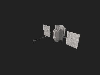
Interactive 3D model of MESSENGER

MESSENGERによる水星探査太陽系最内惑星の謎に迫った11年の旅

MESSENGER水星探査機NASA水星
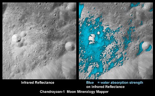
These false-color images show areas where water presence is indicated in a young lunar crater on the far side, as imaged by the Moon Mineralogy Mapper aboard Chandrayaan-1.

月面の水氷の分布から化学的結合まで最新の知見

水氷レゴリス
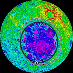
Topographic map of the South Pole–Aitken basin based on Kaguya data. Red represents high elevation, purple represents low elevation. The purple and grey elliptical rings trace the inner and outer walls of the basin. (The black ring is an old artifact of the image.)

南極・エイトケン盆地月最大の衝撃クレーターが明かす月の起源

南極・エイトケン盆地衝撃クレーター嫦娥6号
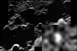
The flash from the LCROSS Centaur impact.

LCROSSミッション月面への意図的な衝突が明かした水の存在

LCROSSNASA月探査水氷
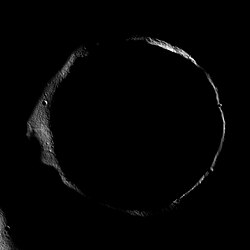
The Moon's Erlanger crater is an example of a permanently shadowed crater.

永久影領域(PSR)の謎月や惑星に眠る氷と資源の宝庫

永久影領域PSR月面探査水氷
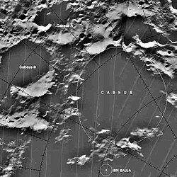
Cabeus Crater.

カベウス・クレーター月南極に眠る水と氷の秘密

カベウス・クレーター月南極LCROSS水氷
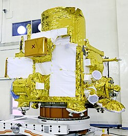
Chandrayaan-2 orbiter at integration facility

チャンドラヤーン2号インドが挑んだ月面探査の軌跡と科学的挑戦

チャンドラヤーン2号ISRO月探査ヴィクラム着陸機
First photo by ShadowCam, Shackleton crater[29]

KPLO搭載の科学観測機器とShadowCamによる月面探査

KPLOShadowCam月探査永久影
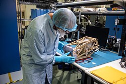
Engineers prepare the Mass Spectrometer Observing Lunar Operations (MSolo) instrument

Nova-C月面着陸機とIM-2ミッション月南極の氷探索と次世代インフラの展開

Nova-CIntuitive Machines月南極シャックルトンクレーター
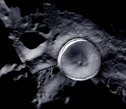
The lunar south pole at the center of this image, situated on the rim of Shackleton Crater. Mosaic image created by LROC (Lunar Reconnaissance Orbiter) and ShadowCam

月南極の科学的価値と探査の最前線

月南極水氷永久影シャクルトンクレーター
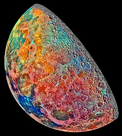
An artificially colored mosaic constructed from a series of 53 images taken through three spectral filters by Galileo's imaging system as the spacecraft flew over the northern regions of the Moon on 7 December 1992. The colors indicate different materials.

月資源の可能性と現地利用(ISRU)の最前線

月資源ISRU現地資源利用ヘリウム3