タグ

WGS84

2 件の記事

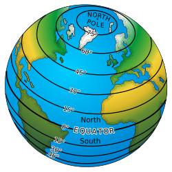
Earth model with circles of latitude in black and indications of the North Pole, Equator, and the northern and southern hemispheres.

緯度と経度の仕組み地球の形状と測地学的な座標系

緯度経度測地学WGS84
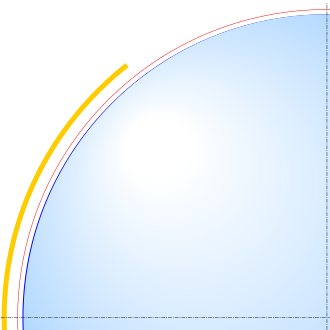
A scale diagram of the oblateness of the 2003 IERS reference ellipsoid, with north at the top. The light blue region is a circle. The outer edge of the dark blue line is an ellipse with the same minor axis as the circle and the same eccentricity as the Earth. The red line represents the Karman line 100 km (62 mi) above sea level, while the yellow area denotes the altitude range of the ISS in low Earth orbit.

地球の半径形状の科学と測地学的定義

地球の半径赤道半径極半径WGS84