Calhoun County, West Virginia
Jump to content


Calhoun County, West Virginia | |
|---|---|
 The Calhoun County Courthouse in Grantsville | |
 Flag | |
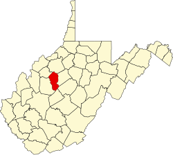
 Location within the U.S. state of West Virginia | |
| Coordinates: 38°50′N 81°07′W / 38.84°N 81.12°W | |
| Country |  United States United States |
| State |  West Virginia West Virginia |
| Founded | March 5, 1856 |
| Named after | John C. Calhoun |
| Seat | Grantsville |
| Largest town | Grantsville |
| Area | |
• Total | 281 sq mi (730 km2) |
| • Land | 279 sq mi (720 km2) |
| • Water | 1.4 sq mi (3.6 km2) 0.5% |
| Population (2020) | |
• Total | 6,229 |
• Estimate (2021) | 6,176  |
| • Density | 22.3/sq mi (8.62/km2) |
| Time zone | UTC−5 (Eastern) |
| • Summer (DST) | UTC−4 (EDT) |
| Congressional district | 1st |
| Website | www |
Calhoun County is a county in the U.S. state of West Virginia. As of the 2020 census, the population was 6,229,[1] making it the third-least populous county in West Virginia. Its county seat is Grantsville.[2] The county was founded in 1856 and named for South Carolina politician John C. Calhoun.[3][4]
Geography
[edit]According to the United States Census Bureau, the county has a total area of 281 square miles (730 km2), of which 279 square miles (720 km2) is land and 1.4 square miles (3.6 km2) (0.5%) is water.[5]
In 1863, West Virginia's counties were divided into civil townships, with the intention of encouraging local government. This proved impractical in the heavily rural state, and in 1872 the townships were converted into magisterial districts.[6] Calhoun County was divided into five districts: Centre, Lee, Sheridan, Sherman, and Washington. Between 1980 and 1990, the county was reorganized into five new magisterial districts: District 1, District 2, District 3, District 4, and District 5.[7]
Major highways
[edit]


Adjacent counties
[edit]- Ritchie County (north)
- Gilmer County (east)
- Braxton County (southeast)
- Clay County (south)
- Roane County (west)
- Wirt County (northwest)
Demographics
[edit]| Census | Pop. | Note | %± |
|---|---|---|---|
| 1860 | 2,502 | — | |
| 1870 | 2,939 | 17.5% | |
| 1880 | 6,072 | 106.6% | |
| 1890 | 8,155 | 34.3% | |
| 1900 | 10,266 | 25.9% | |
| 1910 | 11,258 | 9.7% | |
| 1920 | 10,268 | −8.8% | |
| 1930 | 10,866 | 5.8% | |
| 1940 | 12,455 | 14.6% | |
| 1950 | 10,259 | −17.6% | |
| 1960 | 7,948 | −22.5% | |
| 1970 | 7,046 | −11.3% | |
| 1980 | 8,250 | 17.1% | |
| 1990 | 7,885 | −4.4% | |
| 2000 | 7,582 | −3.8% | |
| 2010 | 7,627 | 0.6% | |
| 2020 | 6,229 | −18.3% | |
| U.S. Decennial Census[8] 1790–1960[9] 1900–1990[10] 1990–2000[11] 2010–2020[1] | |||
2020 census
[edit]As of the 2020 census, the county had a population of 6,229. Of the residents, 19.6% were under the age of 18 and 24.3% were 65 years of age or older; the median age was 48.4 years. For every 100 females there were 100.4 males, and for every 100 females age 18 and over there were 100.4 males.[12][13]
The racial makeup of the county was 96.4% White, 0.2% Black or African American, 0.2% American Indian and Alaska Native, 0.2% Asian, none from some other race, and 3.0% from two or more races. Hispanic or Latino residents of any race comprised 0.8% of the population.[13]
There were 2,699 households in the county, of which 25.7% had children under the age of 18 living with them and 22.7% had a female householder with no spouse or partner present. About 29.8% of all households were made up of individuals and 15.8% had someone living alone who was 65 years of age or older.[12]
There were 3,181 housing units, of which 15.2% were vacant. Among occupied housing units, 79.2% were owner-occupied and 20.8% were renter-occupied. The homeowner vacancy rate was 2.1% and the rental vacancy rate was 12.5%.[12]
2010 census
[edit]As of the 2010 United States census, there were 7,627 people, 3,268 households, and 2,178 families living in the county.[14] The population density was 27.3 inhabitants per square mile (10.5/km2). There were 3,963 housing units at an average density of 14.2 per square mile (5.5/km2).[15] The racial makeup of the county was 98.4% white, 0.3% American Indian, 0.2% black or African American, 0.2% Asian, 0.2% from other races, and 0.7% from two or more races. Those of Hispanic or Latino origin made up 0.7% of the population.[14] In terms of ancestry, 22.4% were German, 21.3% were Irish, 7.7% were American, 7.3% were English, and 5.7% were Dutch.[16]
Of the 3,268 households, 26.5% had children under the age of 18 living with them, 51.7% were married couples living together, 9.7% had a female householder with no husband present, 33.4% were non-families, and 28.5% of all households were made up of individuals. The average household size was 2.33 and the average family size was 2.80. The median age was 45.1 years.[14]
The median income for a household in the county was $26,922 and the median income for a family was $34,897. Males had a median income of $32,229 versus $20,707 for females. The per capita income for the county was $17,121. About 13.2% of families and 20.5% of the population were below the poverty line, including 35.0% of those under age 18 and 6.6% of those age 65 or over.[17]
2000 census
[edit]As of the census of 2000, there were 7,582 people, 3,071 households, and 2,201 families living in the county. The population density was 27 people per square mile (10 people/km2). There were 3,848 housing units at an average density of 14 per square mile (5.4/km2). The racial makeup of the county was 98.91% White, 0.11% Black or African American, 0.30% Native American, 0.11% Asian, 0.01% Pacific Islander, 0.13% from other races, and 0.44% from two or more races. 0.55% of the population were Hispanic or Latino of any race.
There were 3,071 households, out of which 28.90% had children under the age of 18 living with them, 57.00% were married couples living together, 10.30% had a female householder with no husband present, and 28.30% were non-families. 24.90% of all households were made up of individuals, and 12.30% had someone living alone who was 65 years of age or older. The average household size was 2.46 and the average family size was 2.91.
In the county, the population was spread out, with 22.40% under the age of 18, 8.00% from 18 to 24, 25.90% from 25 to 44, 27.10% from 45 to 64, and 16.70% who were 65 years of age or older. The median age was 41 years. For every 100 females there were 99.70 males. For every 100 females age 18 and over, there were 98.30 males.
The median income for a household in the county was $21,578, and the median income for a family was $26,701. Males had a median income of $25,609 versus $14,304 for females. The per capita income for the county was $11,491. About 19.10% of families and 25.10% of the population were below the poverty line, including 29.40% of those under age 18 and 24.90% of those age 65 or over.
Politics
[edit]Calhoun County is a historically secessionist and Democratic county, which never voted Republican between the first Reconstruction election and Dwight D. Eisenhower’s landslide win in 1956.[18] Since then it has consistently followed the statewide results of West Virginia, from Democratic-leaning to Republican bastion in the twenty-first century.
| Year | Republican | Democratic | Third party(ies) | |||
|---|---|---|---|---|---|---|
| № | % | № | % | № | % | |
| 1912 | 575 | 23.84% | 1,349 | 55.93% | 488 | 20.23% |
| 1916 | 936 | 41.31% | 1,317 | 58.12% | 13 | 0.57% |
| 1920 | 1,671 | 48.48% | 1,773 | 51.44% | 3 | 0.09% |
| 1924 | 1,399 | 38.51% | 2,231 | 61.41% | 3 | 0.08% |
| 1928 | 1,745 | 44.27% | 2,179 | 55.28% | 18 | 0.46% |
| 1932 | 1,564 | 33.11% | 3,139 | 66.45% | 21 | 0.44% |
| 1936 | 1,733 | 33.88% | 3,369 | 65.87% | 13 | 0.25% |
| 1940 | 1,891 | 39.70% | 2,872 | 60.30% | 0 | 0.00% |
| 1944 | 1,687 | 42.81% | 2,254 | 57.19% | 0 | 0.00% |
| 1948 | 1,549 | 42.08% | 2,126 | 57.76% | 6 | 0.16% |
| 1952 | 2,101 | 49.56% | 2,138 | 50.44% | 0 | 0.00% |
| 1956 | 2,094 | 52.06% | 1,928 | 47.94% | 0 | 0.00% |
| 1960 | 1,946 | 49.63% | 1,975 | 50.37% | 0 | 0.00% |
| 1964 | 1,275 | 32.68% | 2,626 | 67.32% | 0 | 0.00% |
| 1968 | 1,612 | 44.63% | 1,682 | 46.57% | 318 | 8.80% |
| 1972 | 1,992 | 56.59% | 1,528 | 43.41% | 0 | 0.00% |
| 1976 | 1,283 | 37.12% | 2,173 | 62.88% | 0 | 0.00% |
| 1980 | 1,606 | 46.67% | 1,717 | 49.90% | 118 | 3.43% |
| 1984 | 1,765 | 53.88% | 1,473 | 44.96% | 38 | 1.16% |
| 1988 | 1,395 | 45.63% | 1,644 | 53.78% | 18 | 0.59% |
| 1992 | 1,095 | 33.51% | 1,627 | 49.79% | 546 | 16.71% |
| 1996 | 1,000 | 36.70% | 1,402 | 51.45% | 323 | 11.85% |
| 2000 | 1,425 | 54.49% | 1,112 | 42.52% | 78 | 2.98% |
| 2004 | 1,588 | 54.97% | 1,266 | 43.82% | 35 | 1.21% |
| 2008 | 1,366 | 56.24% | 993 | 40.88% | 70 | 2.88% |
| 2012 | 1,319 | 59.68% | 818 | 37.01% | 73 | 3.30% |
| 2016 | 2,035 | 77.14% | 456 | 17.29% | 147 | 5.57% |
| 2020 | 2,364 | 79.57% | 568 | 19.12% | 39 | 1.31% |
| 2024 | 2,391 | 81.44% | 488 | 16.62% | 57 | 1.94% |
Attractions
[edit]Calhoun County is home to four public parks: The Upper West Fork Park in Chloe on West Virginia Route 16, the West Fork Park in Arnoldsburg on U.S. Route 33, Mt. Zion Park on West Virginia Route 16, and Calhoun County Park on West Virginia Route 16.
Calhoun is home to the annual West Virginia Wood Festival, the West Virginia Molasses Festival in September.
Calhoun County was home to one of the last 500 drive-in theaters in the nation, now closed. Calhoun also has one of the largest genealogy collections in the state, housed at Calhoun County Library. The library is also home to the "West Virginia Room" which includes books on West Virginia and by West Virginians.
Communities
[edit]Town
[edit]- Grantsville (county seat)
Magisterial districts
[edit]- District 1
- District 2
- District 3
- District 4
- District 5
Unincorporated communities
[edit]- Adam
- Altizer
- Annamoriah
- Arnoldsburg
- Ayers
- Beech
- Big Springs
- Bigbend
- Cabot Station
- Chloe
- Cremo
- Dodrill
- Douglas
- Euclid
- Five Forks
- Freed
- Hathaway
- Hattie
- Henrietta
- Hur
- Joker
- Leatherbark
- Liberty Hill
- Millstone
- Milo
- Minnora
- Mount Zion
- Mudfork
- Nicut
- Nobe
- Oka
- Orma
- Pink
- Pleasant Hill
- Purdy
- Rhoda
- Richardson
- Russet
- Sand Ridge
- Stinson
- Sycamore
- White Pine
See also
[edit]- The Calhoun Chronicle and The Grantsville News
- National Register of Historic Places listings in Calhoun County, West Virginia
- Stumptown Wildlife Management Area
- USS Calhoun County (LST-519)
References
[edit]- ^ a b "State & County QuickFacts". United States Census Bureau. Retrieved October 18, 2022.
- ^ "Find a County". National Association of Counties. Archived from the original on May 31, 2011. Retrieved June 7, 2011.
- ^ "Calhoun County history sources". Archived from the original on January 17, 2013. Retrieved January 17, 2013.
- ^ "West Virginia County Histories". Archived from the original on March 20, 2008. Retrieved March 19, 2008.
- ^ "2010 Census Gazetteer Files". United States Census Bureau. August 22, 2012. Retrieved July 23, 2015.
- ^ Otis K. Rice & Stephen W. Brown, West Virginia: A History, 2nd ed., University Press of Kentucky, Lexington (1993), p. 240.
- ^ United States Census Bureau, U.S. Decennial Census, Tables of Minor Civil Divisions in West Virginia, 1870–2010.
- ^ "U.S. Decennial Census". United States Census Bureau. Retrieved January 9, 2014.
- ^ "Historical Census Browser". University of Virginia Library. Retrieved January 9, 2014.
- ^ "Population of Counties by Decennial Census: 1900 to 1990". United States Census Bureau. Retrieved January 9, 2014.
- ^ "Census 2000 PHC-T-4. Ranking Tables for Counties: 1990 and 2000" (PDF). United States Census Bureau. Archived (PDF) from the original on October 9, 2022. Retrieved January 9, 2014.
- ^ a b c "2020 Decennial Census Demographic Profile (DP1)". United States Census Bureau. 2021. Retrieved 2025-12-01.
- ^ a b "2020 Decennial Census Redistricting Data (Public Law 94-171)". United States Census Bureau. 2021. Retrieved 2025-12-01.
- ^ a b c "DP-1 Profile of General Population and Housing Characteristics: 2010 Demographic Profile Data". United States Census Bureau. Archived from the original on February 13, 2020. Retrieved April 3, 2016.
- ^ "Population, Housing Units, Area, and Density: 2010 - County". United States Census Bureau. Archived from the original on February 13, 2020. Retrieved April 3, 2016.
- ^ "DP02 SELECTED SOCIAL CHARACTERISTICS IN THE UNITED STATES – 2006-2010 American Community Survey 5-Year Estimates". United States Census Bureau. Archived from the original on February 13, 2020. Retrieved April 3, 2016.
- ^ "DP03 SELECTED ECONOMIC CHARACTERISTICS – 2006-2010 American Community Survey 5-Year Estimates". United States Census Bureau. Archived from the original on February 13, 2020. Retrieved April 3, 2016.
- ^ Menendez, Albert J.; The Geography of Presidential Elections in the United States, 1868-2004, pp. 334-335 ISBN 0786422173
- ^ Leip, David. "Dave Leip's Atlas of U.S. Presidential Elections". uselectionatlas.org. Retrieved March 27, 2018.
External links
[edit]- Official website
- General Highway Map of northern Calhoun County, prepared by WV Dept. of Transportation Archived March 26, 2009, at the Wayback Machine
- General Highway Map of southern Calhoun County, prepared by WV Dept. of Transportation Archived March 26, 2009, at the Wayback Machine
Places adjacent to Calhoun County, West Virginia | ||||||||||||||||
|---|---|---|---|---|---|---|---|---|---|---|---|---|---|---|---|---|
| ||||||||||||||||


38°50′N 81°07′W / 38.84°N 81.12°W
| International | |
|---|---|
| National | |
| Geographic | |
| Other | |


Calhoun County, West Virginia | |
|---|---|
The Calhoun County Courthouse in Grantsville | |
 Location within the U.S. state of West Virginia | |
| Coordinates: 38°50′N 81°07′W / 38.84°N 81.12°W / 38.84; -81.12 | |
| Country |  United States United States |
| State |  West Virginia West Virginia |
| Founded | March 5, 1856 |
| Named after | John C. Calhoun |
| Seat | Grantsville |
| Largest town | Grantsville |
| Area | |
• Total | 281 sq mi (730 km2) |
| • Land | 279 sq mi (720 km2) |
| • Water | 1.4 sq mi (3.6 km2) 0.5% |
| Population (2020) | |
• Total | 6,229 |
• Estimate (2021) | 6,176  |
| • Density | 22.3/sq mi (8.62/km2) |
| Time zone | UTC−5 (Eastern) |
| • Summer (DST) | UTC−4 (EDT) |
| Congressional district | 1st |
| Website | www.calhouncountywv.com |

Calhoun County is a county in the U.S. state of West Virginia. As of the 2020 census, the population was 6,229,[1] making it the third-least populous county in West Virginia. Its county seat is Grantsville.[2] The county was founded in 1856 and named for South Carolina politician John C. Calhoun.[3][4]
Geography
According to the United States Census Bureau, the county has a total area of 281 square miles (730 km2), of which 279 square miles (720 km2) is land and 1.4 square miles (3.6 km2) (0.5%) is water.[5]
In 1863, West Virginia's counties were divided into civil townships, with the intention of encouraging local government. This proved impractical in the heavily rural state, and in 1872 the townships were converted into magisterial districts.[6] Calhoun County was divided into five districts: Centre, Lee, Sheridan, Sherman, and Washington. Between 1980 and 1990, the county was reorganized into five new magisterial districts: District 1, District 2, District 3, District 4, and District 5.[7]
Major highways


Adjacent counties
- Ritchie County (north)
- Gilmer County (east)
- Braxton County (southeast)
- Clay County (south)
- Roane County (west)
- Wirt County (northwest)
Demographics
| Census | Pop. | Note | %± |
|---|---|---|---|
| 1860 | 2,502 | — | |
| 1870 | 2,939 | 17.5% | |
| 1880 | 6,072 | 106.6% | |
| 1890 | 8,155 | 34.3% | |
| 1900 | 10,266 | 25.9% | |
| 1910 | 11,258 | 9.7% | |
| 1920 | 10,268 | −8.8% | |
| 1930 | 10,866 | 5.8% | |
| 1940 | 12,455 | 14.6% | |
| 1950 | 10,259 | −17.6% | |
| 1960 | 7,948 | −22.5% | |
| 1970 | 7,046 | −11.3% | |
| 1980 | 8,250 | 17.1% | |
| 1990 | 7,885 | −4.4% | |
| 2000 | 7,582 | −3.8% | |
| 2010 | 7,627 | 0.6% | |
| 2020 | 6,229 | −18.3% | |
| U.S. Decennial Census[8] 1790–1960[9] 1900–1990[10] 1990–2000[11] 2010–2020[1] | |||
2020 census
As of the 2020 census, the county had a population of 6,229. Of the residents, 19.6% were under the age of 18 and 24.3% were 65 years of age or older; the median age was 48.4 years. For every 100 females there were 100.4 males, and for every 100 females age 18 and over there were 100.4 males.[12][13]
The racial makeup of the county was 96.4% White, 0.2% Black or African American, 0.2% American Indian and Alaska Native, 0.2% Asian, none from some other race, and 3.0% from two or more races. Hispanic or Latino residents of any race comprised 0.8% of the population.[13]
There were 2,699 households in the county, of which 25.7% had children under the age of 18 living with them and 22.7% had a female householder with no spouse or partner present. About 29.8% of all households were made up of individuals and 15.8% had someone living alone who was 65 years of age or older.[12]
There were 3,181 housing units, of which 15.2% were vacant. Among occupied housing units, 79.2% were owner-occupied and 20.8% were renter-occupied. The homeowner vacancy rate was 2.1% and the rental vacancy rate was 12.5%.[12]
2010 census
As of the 2010 United States census, there were 7,627 people, 3,268 households, and 2,178 families living in the county.[14] The population density was 27.3 inhabitants per square mile (10.5/km2). There were 3,963 housing units at an average density of 14.2 per square mile (5.5/km2).[15] The racial makeup of the county was 98.4% white, 0.3% American Indian, 0.2% black or African American, 0.2% Asian, 0.2% from other races, and 0.7% from two or more races. Those of Hispanic or Latino origin made up 0.7% of the population.[14] In terms of ancestry, 22.4% were German, 21.3% were Irish, 7.7% were American, 7.3% were English, and 5.7% were Dutch.[16]
Of the 3,268 households, 26.5% had children under the age of 18 living with them, 51.7% were married couples living together, 9.7% had a female householder with no husband present, 33.4% were non-families, and 28.5% of all households were made up of individuals. The average household size was 2.33 and the average family size was 2.80. The median age was 45.1 years.[14]
The median income for a household in the county was $26,922 and the median income for a family was $34,897. Males had a median income of $32,229 versus $20,707 for females. The per capita income for the county was $17,121. About 13.2% of families and 20.5% of the population were below the poverty line, including 35.0% of those under age 18 and 6.6% of those age 65 or over.[17]
2000 census
As of the census of 2000, there were 7,582 people, 3,071 households, and 2,201 families living in the county. The population density was 27 people per square mile (10 people/km2). There were 3,848 housing units at an average density of 14 per square mile (5.4/km2). The racial makeup of the county was 98.91% White, 0.11% Black or African American, 0.30% Native American, 0.11% Asian, 0.01% Pacific Islander, 0.13% from other races, and 0.44% from two or more races. 0.55% of the population were Hispanic or Latino of any race.
There were 3,071 households, out of which 28.90% had children under the age of 18 living with them, 57.00% were married couples living together, 10.30% had a female householder with no husband present, and 28.30% were non-families. 24.90% of all households were made up of individuals, and 12.30% had someone living alone who was 65 years of age or older. The average household size was 2.46 and the average family size was 2.91.
In the county, the population was spread out, with 22.40% under the age of 18, 8.00% from 18 to 24, 25.90% from 25 to 44, 27.10% from 45 to 64, and 16.70% who were 65 years of age or older. The median age was 41 years. For every 100 females there were 99.70 males. For every 100 females age 18 and over, there were 98.30 males.
The median income for a household in the county was $21,578, and the median income for a family was $26,701. Males had a median income of $25,609 versus $14,304 for females. The per capita income for the county was $11,491. About 19.10% of families and 25.10% of the population were below the poverty line, including 29.40% of those under age 18 and 24.90% of those age 65 or over.
Politics
Calhoun County is a historically secessionist and Democratic county, which never voted Republican between the first Reconstruction election and Dwight D. Eisenhower’s landslide win in 1956.[18] Since then it has consistently followed the statewide results of West Virginia, from Democratic-leaning to Republican bastion in the twenty-first century.
| Year | Republican | Democratic | Third party(ies) | |||
|---|---|---|---|---|---|---|
| № | % | № | % | № | % | |
| 1912 | 575 | 23.84% | 1,349 | 55.93% | 488 | 20.23% |
| 1916 | 936 | 41.31% | 1,317 | 58.12% | 13 | 0.57% |
| 1920 | 1,671 | 48.48% | 1,773 | 51.44% | 3 | 0.09% |
| 1924 | 1,399 | 38.51% | 2,231 | 61.41% | 3 | 0.08% |
| 1928 | 1,745 | 44.27% | 2,179 | 55.28% | 18 | 0.46% |
| 1932 | 1,564 | 33.11% | 3,139 | 66.45% | 21 | 0.44% |
| 1936 | 1,733 | 33.88% | 3,369 | 65.87% | 13 | 0.25% |
| 1940 | 1,891 | 39.70% | 2,872 | 60.30% | 0 | 0.00% |
| 1944 | 1,687 | 42.81% | 2,254 | 57.19% | 0 | 0.00% |
| 1948 | 1,549 | 42.08% | 2,126 | 57.76% | 6 | 0.16% |
| 1952 | 2,101 | 49.56% | 2,138 | 50.44% | 0 | 0.00% |
| 1956 | 2,094 | 52.06% | 1,928 | 47.94% | 0 | 0.00% |
| 1960 | 1,946 | 49.63% | 1,975 | 50.37% | 0 | 0.00% |
| 1964 | 1,275 | 32.68% | 2,626 | 67.32% | 0 | 0.00% |
| 1968 | 1,612 | 44.63% | 1,682 | 46.57% | 318 | 8.80% |
| 1972 | 1,992 | 56.59% | 1,528 | 43.41% | 0 | 0.00% |
| 1976 | 1,283 | 37.12% | 2,173 | 62.88% | 0 | 0.00% |
| 1980 | 1,606 | 46.67% | 1,717 | 49.90% | 118 | 3.43% |
| 1984 | 1,765 | 53.88% | 1,473 | 44.96% | 38 | 1.16% |
| 1988 | 1,395 | 45.63% | 1,644 | 53.78% | 18 | 0.59% |
| 1992 | 1,095 | 33.51% | 1,627 | 49.79% | 546 | 16.71% |
| 1996 | 1,000 | 36.70% | 1,402 | 51.45% | 323 | 11.85% |
| 2000 | 1,425 | 54.49% | 1,112 | 42.52% | 78 | 2.98% |
| 2004 | 1,588 | 54.97% | 1,266 | 43.82% | 35 | 1.21% |
| 2008 | 1,366 | 56.24% | 993 | 40.88% | 70 | 2.88% |
| 2012 | 1,319 | 59.68% | 818 | 37.01% | 73 | 3.30% |
| 2016 | 2,035 | 77.14% | 456 | 17.29% | 147 | 5.57% |
| 2020 | 2,364 | 79.57% | 568 | 19.12% | 39 | 1.31% |
| 2024 | 2,391 | 81.44% | 488 | 16.62% | 57 | 1.94% |
Attractions
Calhoun County is home to four public parks: The Upper West Fork Park in Chloe on West Virginia Route 16, the West Fork Park in Arnoldsburg on U.S. Route 33, Mt. Zion Park on West Virginia Route 16, and Calhoun County Park on West Virginia Route 16.
Calhoun is home to the annual West Virginia Wood Festival, the West Virginia Molasses Festival in September.
Calhoun County was home to one of the last 500 drive-in theaters in the nation, now closed. Calhoun also has one of the largest genealogy collections in the state, housed at Calhoun County Library. The library is also home to the "West Virginia Room" which includes books on West Virginia and by West Virginians.
Communities
Town
- Grantsville (county seat)
Magisterial districts
- District 1
- District 2
- District 3
- District 4
- District 5
Unincorporated communities
- Adam
- Altizer
- Annamoriah
- Arnoldsburg
- Ayers
- Beech
- Big Springs
- Bigbend
- Cabot Station
- Chloe
- Cremo
- Dodrill
- Douglas
- Euclid
- Five Forks
- Freed
- Hathaway
- Hattie
- Henrietta
- Hur
- Joker
- Leatherbark
- Liberty Hill
- Millstone
- Milo
- Minnora
- Mount Zion
- Mudfork
- Nicut
- Nobe
- Oka
- Orma
- Pink
- Pleasant Hill
- Purdy
- Rhoda
- Richardson
- Russet
- Sand Ridge
- Stinson
- Sycamore
- White Pine
See also
- The Calhoun Chronicle and The Grantsville News
- National Register of Historic Places listings in Calhoun County, West Virginia
- Stumptown Wildlife Management Area
- USS Calhoun County (LST-519)
References
- ^ a b "State & County QuickFacts". United States Census Bureau. Retrieved October 18, 2022.
- ^ "Find a County". National Association of Counties. Archived from the original on May 31, 2011. Retrieved June 7, 2011.
- ^ "Calhoun County history sources". Archived from the original on January 17, 2013. Retrieved January 17, 2013.
- ^ "West Virginia County Histories". Archived from the original on March 20, 2008. Retrieved March 19, 2008.
- ^ "2010 Census Gazetteer Files". United States Census Bureau. August 22, 2012. Retrieved July 23, 2015.
- ^ Otis K. Rice & Stephen W. Brown, West Virginia: A History, 2nd ed., University Press of Kentucky, Lexington (1993), p. 240.
- ^ United States Census Bureau, U.S. Decennial Census, Tables of Minor Civil Divisions in West Virginia, 1870–2010.
- ^ "U.S. Decennial Census". United States Census Bureau. Retrieved January 9, 2014.
- ^ "Historical Census Browser". University of Virginia Library. Retrieved January 9, 2014.
- ^ "Population of Counties by Decennial Census: 1900 to 1990". United States Census Bureau. Retrieved January 9, 2014.
- ^ "Census 2000 PHC-T-4. Ranking Tables for Counties: 1990 and 2000" (PDF). United States Census Bureau. Archived (PDF) from the original on October 9, 2022. Retrieved January 9, 2014.
- ^ a b c "2020 Decennial Census Demographic Profile (DP1)". United States Census Bureau. 2021. Retrieved 2025-12-01.
- ^ a b "2020 Decennial Census Redistricting Data (Public Law 94-171)". United States Census Bureau. 2021. Retrieved 2025-12-01.
- ^ a b c "DP-1 Profile of General Population and Housing Characteristics: 2010 Demographic Profile Data". United States Census Bureau. Archived from the original on February 13, 2020. Retrieved April 3, 2016.
- ^ "Population, Housing Units, Area, and Density: 2010 - County". United States Census Bureau. Archived from the original on February 13, 2020. Retrieved April 3, 2016.
- ^ "DP02 SELECTED SOCIAL CHARACTERISTICS IN THE UNITED STATES – 2006-2010 American Community Survey 5-Year Estimates". United States Census Bureau. Archived from the original on February 13, 2020. Retrieved April 3, 2016.
- ^ "DP03 SELECTED ECONOMIC CHARACTERISTICS – 2006-2010 American Community Survey 5-Year Estimates". United States Census Bureau. Archived from the original on February 13, 2020. Retrieved April 3, 2016.
- ^ Menendez, Albert J.; The Geography of Presidential Elections in the United States, 1868-2004, pp. 334-335 ISBN 0786422173
- ^ Leip, David. "Dave Leip's Atlas of U.S. Presidential Elections". uselectionatlas.org. Retrieved March 27, 2018.
External links
- Official website
- General Highway Map of northern Calhoun County, prepared by WV Dept. of Transportation Archived March 26, 2009, at the Wayback Machine
- General Highway Map of southern Calhoun County, prepared by WV Dept. of Transportation Archived March 26, 2009, at the Wayback Machine
Places adjacent to Calhoun County, West Virginia | ||||||||||||||||
|---|---|---|---|---|---|---|---|---|---|---|---|---|---|---|---|---|
| ||||||||||||||||


Municipalities and communities of Calhoun County, West Virginia, United States | ||
|---|---|---|
| Town | | |
| Unincorporated communities |
| |
| Ghost town | ||
38°50′N 81°07′W / 38.84°N 81.12°W / 38.84; -81.12