タグ

地質学

596 件の記事

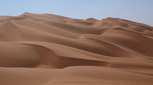
Sand dunes in the Rub' al Khali ("Empty quarter") of Arabia

砂漠の生態系と地質学地球上の乾燥地帯が持つ多様な姿

砂漠乾燥地帯極地砂漠蒸発散量
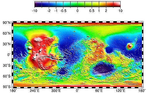
Global topography of Mars based on MOLA data. The Tharsis bulge is the large area at left (shown in shades of red and white). Amazonis and Chryse Planitiae are the blue areas left (west) and right (east) of Tharsis, respectively. In this image, the higher average elevation of the southern hemisphere (zonal spherical harmonic degree 1) has been removed to highlight the elevation contrast of Tharsis with the rest of the planet.

タルシス地域火星最大級の火山台地とその地質学的謎

火星タルシス火山オリンポス山
Mariner 9 image of Ascraeus Mons.[1] This is one of the first images to show that Mars has large volcanoes.

火星の火山活動太陽系最大の火山を擁する赤い惑星の地質学

火星火山活動オリンポス山タルシス
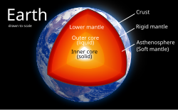
The internal structure of Earth

地球の内核太陽に匹敵する熱を秘めた惑星の深部

地球の内核地球内部構造地震波鉄・ニッケル合金
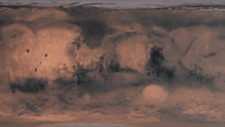
Mars surface map rendered using a color map and a heightmap from NASA

火星の表面特性地質学的組成と観測手法の解析

火星アルベド反射分光法熱慣性
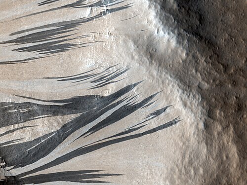
Slope streaks in Acheron Fossae in 2010

火星の暗い斜面筋赤い惑星で起きているダイナミックな地質現象

火星暗い斜面筋ダストアバランシェ地質学
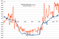
Elevation profiles along south to north transects across Mars's Hellas basin and the Moon's South Pole-Aitken basin, created with Lunar Quickmap and Mars Quickmap

ヘラス平原火星最大級の衝突クレーターが語る惑星の歴史

ヘラス平原火星衝突クレーター後期重爆撃期
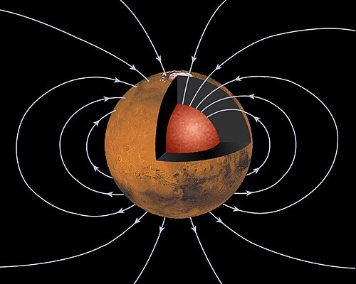
Martian Dynamo. The schematic illustration of the ancient dipolar magnetic field of Mars generated by a core dynamo process.

火星の磁場失われたダイナモと地殻に残る記憶

火星磁場ダイナモ理論地殻磁気
📖

アマゾニス平原火星の地質学的若さとアイスランドとの類似性

アマゾニス平原火星地質学溶岩流
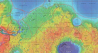
MOLA map showing boundaries for Arabia Terra and other nearby regions.

アラビア・テラ火星最古の地層に刻まれた火山と水の記憶

アラビア・テラ火星地質学スーパーボルケーノ
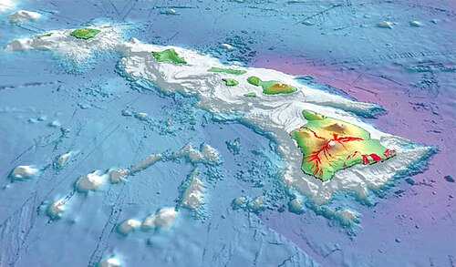
To illustrate Mauna Kea's dry prominence, imagine raising the sea level of the Pacific Ocean to submerge the top of Mauna Kea. Then slowly lower it again. The first thing to appear is the peak of Mauna Kea. Then Mauna Loa and peaks of the surrounding Hawaiian Islands will emerge from the ocean. If the ocean drains further, the island around Mauna Kea will grow and merge with the adjacent islands. Continue draining until a land bridge forms between the Hawaiian Islands and a continent so that it is possible to walk all the way there without getting wet. Stop draining at this point, and this bridge is the key col of a dry Mauna Kea, connecting it to Mount Everest. Mauna Kea's peak stands 30,610 ft (9,330 m) above this key col.

マウナケア山の全貌ハワイの最高峰が持つ地質学的価値と天文学的重要性

マウナケアハワイ楯状火山天文台
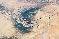
Image of the Grand Canyon and surrounding area taken from the International Space Station

グランドキャニオンの地質と歴史コロラド川が刻んだ地球の記憶

グランドキャニオンコロラド川アリゾナ州地質学