タグ

火星

113 件の記事

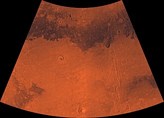
Image of the Cebrenia Quadrangle (MC-7). The northwest contains relatively smooth plains; the southeast contains Hecates Tholus (one of three Elysium shield volcanoes) and Phlegra Montes (a ridge system).

セブレニア四分の一図(MC-7)から見る火星の地形的特徴

火星セブレニア四分の一図MC-7USGS
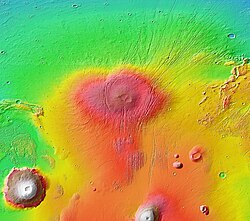
MOLA topographic map of Alba Mons and surroundings. The main edifice appears in colors of red to orange; the surrounding apron is in shades of yellow-orange to green. The relief is greatest to the north because the volcano straddles the dichotomy boundary. Elevated terrain of Ceraunius Fossae, which underlies part of the volcano, extends southward like a handle.

アルバ・モンズ火星最大の面積を誇る特異な火山

アルバ・モンズ火星タルシス火山
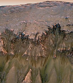
Oblique view of warm season flows in Newton Crater

ニュートンクレーターに見る火星の地質学的謎と水の痕跡

ニュートンクレーター火星ガリー液体水
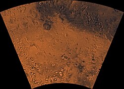
Image of the Phaethontis Quadrangle (MC-24). The region is dominated by heavily cratered highlands and low-lying areas forming relatively smooth plains.

ファエトン四分の一区(Phaethontis Quadrangle)の地質学的特徴と火星の歴史

火星ファエトン四分の一区地質学プレートテクトニクス
📖

コロンバス・クレーターの地層が明かす火星の水の歴史

コロンバス・クレーター火星地層硫酸塩
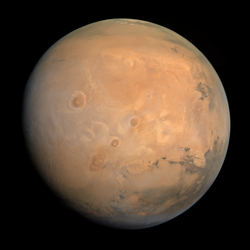
Mars in true color

火星における生命の可能性古代の居住可能性から最新の探査成果まで

火星アストロバイオロジー居住可能性バイオシグネチャー
📖

火星の地形に見る「逆転地形」と古代の水流の痕跡

火星逆転地形河川チャネル宮本クレーター
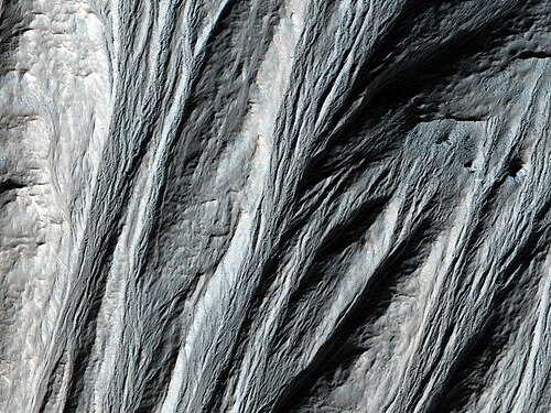
Gullies in the southern highlands of Mars, south of Argyre Planitia. 2014 image from the HiRISE camera on the Mars Reconnaissance Orbiter.

火星のガリー地形的特徴と形成メカニズムの謎

火星ガリー地形
Topographic map – volcanic peaks in white due to great height. Near the equator, three volcanoes point south to Phaethontis quadrangle and three large craters – an area containing many gullies.

火星のガリー液状水の痕跡と形成メカニズムの謎

火星ガリー液状水帯水層
📖

同心円状クレーター充填物の謎火星の氷とブレインテレイン

火星同心円状クレーター充填物ブレインテレインHiRISE
📖

火星のローブ状デブリエプロン(LDA)氷の貯蔵庫としての地質学的価値

火星ローブ状デブリエプロンLDA水氷
📖

線状谷底堆積物(LVF)が明かす火星の氷河地形と「脳状地形」の謎

火星線状谷底堆積物LVF氷河