タグ

地質学

596 件の記事

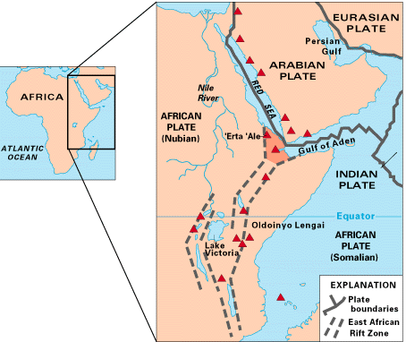
A map of East Africa showing some of the historically active volcanoes (as red triangles) and the Afar Triangle (shaded at the center), which is a so-called triple junction (or triple point) where three plates are pulling away from one another: the Arabian plate and two parts of the African plate—the Nubian and Somali—splitting along the East African Rift Zone

東アフリカ地溝帯大陸を分かつ巨大な地質学的ダイナミズム

東アフリカ地溝帯プレートテクトニクスアフリカプレートマントルプルーム
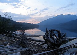
Clearwater Lake, a lava dammed lake in the Wells Gray-Clearwater volcanic field

ウェルズ・グレイ・クリアウォーター火山地帯の地質と自然

ウェルズ・グレイ・クリアウォーター火山地帯カナダ 火山ブリティッシュコロンビア州単成火山地帯
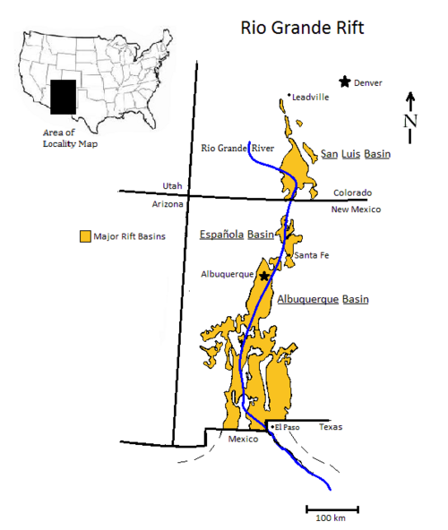
Locality map showing the Rio Grande rift extending from southern Colorado to Chihuahua, Mexico. The Rio Grande follows this rift for much of its course.

リオグランデ・リフトの地質学的構造と形成史

リオグランデ・リフト大陸リフトコロラド高原ハーフグラーベン
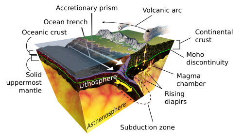
Diapirs in a subducting plate boundary

ダイアピル(貫入構造)のメカニズムと地質学的影響

ダイアピル岩塩ドーム地質学貫入構造
A superplume generated by cooling processes in the mantle (LVZ=low-velocity zone)[3]

プレート内火山活動のメカニズムマントルプルーム説とプレート説の対立

プレート内火山活動マントルプルームホットスポットプレートテクトニクス
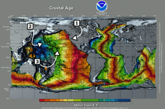
Global map labeled Crustal Age with callouts for specific areas of interest. There is an overall pattern of younger crust in the East Pacific and younger in the West.

ハワイホットスポット太平洋に刻まれた巨大火山列の謎

ハワイホットスポットマントルプルーム太平洋プレートハワイ・エンペラー海山列
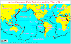
World map of active volcanoes and plate boundaries

活火山の定義と世界的な分布地球のダイナミズムを読み解く

活火山休火山死火山環太平洋火山帯
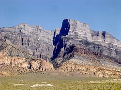
A Jurassic pluton of pink monzonite intruded below a section of gray sedimentary rocks which was subsequently uplifted and exposed, near Notch Peak, House Range, Utah.

火成岩貫入体の種類と形成メカニズム地下で凝固するマグマの科学

火成岩貫入体マグマバソリス
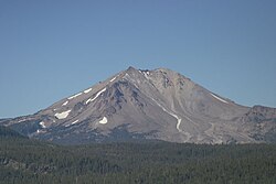
Lassen Peak and Devastated Area from Cinder Cone

カスケード山脈の火山群北米西海岸を形作る火の環のダイナミズム

カスケード山脈火山セントヘレンズ山カスケディア沈み込み帯
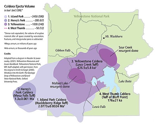
Yellowstone sits on top of four overlapping calderas.

イエローストーン・ホットスポット北米大陸を形作った巨大火山活動の軌跡

イエローストーンホットスポットカルデラ超巨大噴火
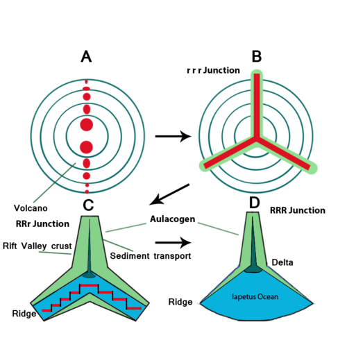
An illustration of the likely formation history of the Southern Oklahoma Aulacogen. In A, volcanoes form along a continental plate boundary. B shows the triple junction's basic appearance following its formation. C shows that one of the three "arms" has not split while the other two do, continuing into D, in which the Iapetus Ocean forms.

アウラコゲンとは何か?プレートテクトニクスが残した「失敗したリフト」の正体

アウラコゲンプレートテクトニクストリプルジャンクションリフト帯
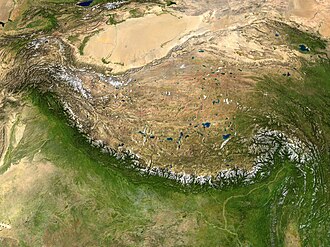
Satellite image of the Tibetan Plateau between the Himalayan mountains to the south and the Taklamakan Desert to the north

高原(プラトー)の形成メカニズムと世界的な分布

高原プラトー地質学地形