List of windmills in Kent
A list of all windmills and windmill sites which lie in the current Ceremonial county of Kent.


1

2
3
4
5
6
7
8
9
10
11
12
13
14
15
16
17
18
19
20
21
22
23
24
25
26
27
28
29
30
31
32
33
Extant (red) and former (blue) windmills in Kent.1 Barham, 2 Benenden, 3 Bidborough, 4 Biddenden 5 Canterbury, 6 Charing, 7 Chillenden, 8 Chislet, 9 Cranbrook, 10 Eastry, 11 Edenbridge, 12 Copton, 13 Guston, 14 Herne, 15 Kingston, 16 Margate, 17 Meopham, 18 Northbourne, 19 Oare, 20 Ringwould, 21 Rolvenden, 22 Sandhurst, 23 Sandwich, 24 Sarre, 25 Sheerness, 26 Stanford, 27 Stelling Minnis, 28 St Margaret's Bay, 29 West Kingsdown, 30 Whitstable, 31 Willesborough, 32 Wittersham, 33 Woodchurch.
Locations
A
| Location | Name of mill andgrid reference | Type | Maps | First mentionor built | Notes | Image |
|---|---|---|---|---|---|---|
| Acrise | Elham MillElham Down MillManor Mill | Post | 1596161017361769 | 1596 | Blown down in 1876.[1] | |
| Acrise | Elham Mill | Smock | 1878 | Working until June 1916. Demolished 6 July 1919.[1] | ||
| Acrise | Acrise Mill | Post | 1769 | 1769 | Stood 7 furlongs (1.4 km) south east of Acrise Church.[2] | |
| Adisham | Bekesbourne Mill | Smock | 1843 | Standing by 1843. Working until c. 1922. Burnt down 29 August 1933.[2] | ||
| Aldington | Aldington MillTR 056 363 | Smock | 1878 | Working until c. 1908. Demolished 1910.[3] Base survives, used as a store.[4] |  | |
| Appledore | Horne Place Mill | Post | 15961736 | 1596 | Stood 7 furlongs (1.4 km) north north east of Appledore Church.[5] | |
| Appledore | Court Lodge Mill | Post | 1596 | 1596 | Stood 3 furlongs (600 m) south west of Appledore Church. Demolished late C18th.[5] | |
| Appledore | Great Mill,Union MillTQ 953 304 | Smock | 1791 | Demolished in 1909.[6] Base survives, converted into a house.[7] | ||
| Appledore | TQ 953 303 | Post | Moved from Playden, East Sussex.[6][Note 1] Demolished 1900. Part of the roundhouse survives as part of a farm building.[8][9] | |||
| Ash (near Sandwich) | Mount Ephraim Mill | Post | 1818 | Moved from Woodnesborough.[10] Blown down 28 October 1955. | ||
| Ash (Sandwich) | (formed a pair with Mount Ephraim Mill) | Post | Demolished before 1879.[10] | |||
| Ash (Sandwich) | Ash Mill | Post | 1736 | 1736 | Stood north west of Knell Farm and 6 furlongs (1.2 km) north of Ash Church.[11] | |
| Ashford | Regent's Place Mill | Smock | 1870 | Moved to Badlesmere, 1872.[11] | ||
B
| Location | Name of mill andgrid reference | Type | Maps | First mentionor built | Notes | Image |
|---|---|---|---|---|---|---|
| Badlesmere | Boundgate MillTR 010 532 | Smock | 1872 | Working until 1921.[12] Demolished 1938. Base survives, used as a store.[13][14] | ||
| Badlesmere Lees | Post | 16951736 | 1695 | Stood 1 mile (1.6 km) south south west of Badlesmere Church.[12] | ||
| Bapchild | Bapchild Mill | Stood south of Watling Street, 4 furlongs (800 m) east of Bapchild Church. Standing by 1843. Demolished by 1865.[12] | ||||
| Barfreston | Barfeston Mill | 1769 | 1769 | Standing in 1819.[12] | ||
| Barfreston | Barfreston Mill | Smock | 1769 | 1769 | Thought to have been standing c.1852. Base survived into the 1860s, converted to a house.[12] | |
| Barham | Barham Downs Mill | Post | 159616951736 | 1596 | ||
| Barham | Black Mill,Barham Downs MillTR 214 510 | Smock | 1834 | Burnt down 3 March 1970. Derelict base survives.[15] |  | |
| Barham | Early C18th | Stood 4 furlongs (800 m) east south east of Barham Church.[16] | ||||
| Barham | Breach Downs Mill | Smock | 1875 | Working in 1878. Demolished c.1900.[16] | ||
| Barham | Derringstone Mill[17] | Smock | 1855[17] | Stood near the site later occupied by Barham railway station. Moved to Margate in 1869.[16] | ||
| Barming | Barming Heath Mill | c.1800 | Burnt down 1805.[18] | |||
| Barming | Barming Heath Mill | 1829 | 1805 | Stood 1 mile (1.6 km) north east of Barming Church. Standing in 1845, demolished c.1846, gone by 1853.[18] | ||
| Bearsted | Smock | Stood 3 furlongs (600 m) north west of Barming Church. Demolished by 1873.[19] | ||||
| Benenden | Beacon Mill (south) | Demolished by 1850.[20] | ||||
| Benenden | Beacon Mill (north)TQ 821 325 | Smock | 1821 | 1821 | Working until 1921. |   Media related to Beacon Mill, Benenden at Wikimedia Commons Media related to Beacon Mill, Benenden at Wikimedia Commons |
| Benenden | East End Mill | Post | Stood 2 miles 3 furlongs (3.8 km) east of Benenden Church. Demolished c.1870[20] | |||
| Bethersden | Old MillTQ 929 407 | Post | 1596161017361769 | 1555 | Moved to Biddenden (Paul Sharpe's Mill).[20] | |
| Bethersden | White MillTQ 929 407 | Smock | Working until 1923.[21] Blown down in 1937.[22] |  | ||
| Bethersden | Little Mill (1st site) | Smock | Six-sailed saw mill. Moved from Sandgate. Moved to 2nd site.[23] | |||
| Bethersden | Little Mill (2nd site) | Smock | Stood 2 furlongs (400 m) north north east of Bethersden Church, near the Black Mill. A six-sailed saw mill moved from a location within Bethersden village. Demolished c.1896.[23] | |||
| Bethersden | Black MillTQ 929 407 | Smock | c.1886 | Moved from Folkestone. A saw mill, latterly worked by a suction gas engine. Demolished by 1933,[24] leaving the brick base, which was later demolished.[25] | ||
| Betteshanger | 1596 | 1596 | Stood north west of Betteshanger Church.[26] | |||
| Bicknor | Post | 1769 | 1769 | Stood 4 furlongs (800 m) south south west of Bicknor Church. Demolished before 1865.[27] | ||
| Bidborough | Bidborough MillTQ 561 435 | 1769 | 1769 | |||
| Bidborough | Bidborough MillTQ 561 435 | Tower | 1858 | Working until c.1900. Converted to house in 2006. |  Media related to Bidborough Windmill at Wikimedia Commons Media related to Bidborough Windmill at Wikimedia Commons | |
| Biddenden | Beacon Hill Mill,Paul Sharpe's MillTQ 8495 3706 | Post | 17361769 | 1736 | Moved from Bethersden. Working until 1882. Demolished 1912.[28] | |
| Biddenden | Three Chimneys Mill,Cherry Clack MillApproximately TQ 815 378 | Smock | 1859[29] | Moved to Punnetts Town, Sussex in 1859.[29] | ||
| Biddenden | Town MillTQ 85046 38171 | Smock | Working until 1914. Was being lived in during the 1930s.[30] Collapsed in 1946.[31] |  Media related to Town Mill, Biddenden at Wikimedia Commons Media related to Town Mill, Biddenden at Wikimedia Commons | ||
| Birchington | Post | 1414159616951719 | 1414[32] | Stood east of the Birchington Church.[30] | ||
| Birchington | Dentdelion Mill | 16101695 | 1610 | Stood north east of Birchington Church.[30] | ||
| Birchington | Quex Park Mill, Birchington Mill | 17361769 | 1736 | Stood 7 furlongs (1.4 km) south east of Birchington Church. Possibly moved within Birchington (Hudson's Mill).[30] | ||
| Birchington | Grove End Mill | 1769 | 1769 | Stood 1 furlong (200 m) west north west of Birchington Church.[33] | ||
| Birchington | Seed Mill | Stood 3 furlongs (600 m) north of Birchington Church, near Birchington railway station.[33] | ||||
| Birchington | Hudson's Mill | Smock | May have been moved from within Birchington. Raised c.1850. Working until 1891. Demolished c.1900.[33] | |||
| Blean | Glover's Old MillTR 125 607 | Smock | Standing by 1843. Demolished early C20th.[34] The base survives.[25][35] | |||
| Blean | Glover's New Mill | Smock | 1868 | Workinguntil 1922. Demolished 1924.[36] | ||
| Blue Bell Hill | Blue Bell Hill MillTQ 747 621 | Smock | 1833 | 1833 | Blown down July 1890. Base survives.[37][38] | |
| Bobbing | Goord's Mill | Smock | 1857 | Stood 5 furlongs (1,000 m) south west of Bobbing Church. Demolished c.1902.[39] | ||
| Boughton Monchelsea | Haste Hill Mill | Smock | Stood 7 furlongs (1.4 km) north north west of Boughton Monchelsea Chruct. Burnt down in 1858.[40] | |||
| Boughton under Blean | Black Mill | Standing c.1850.[40] | ||||
| Boughton under Blean | Demolished before c.1850.[40] | |||||
| Boughton under Blean | Miles' MillTR 058 595 | Smock | c.1793 | Working until 1931, latterly by engine.[40] Demolished in 1942 due to bomb damage. The base survives.[38] | ||
| Boughton under Blean | Richardson's Mill | Smock | 1769 | 1769 | Stood 7 furlongs (1.4 km) north east of Boughton Church. Had ceased working by 1925.[41] Demolished during World War Two[42] | |
| Boxley | The Pilgrim's Way Mill | Stood 4 furlongs (800 m) west of Boxley Church and south of the Pilgrim's Way. Demolished between 1876 and 1880.[43] | ||||
| Boxley | Boxley Mill | 1837[44] | Stood 1 mile (1.6 km) south west of Boxley Church. Standing 1876, demolished by 1880.[45] | |||
| Brabourne | Brabourne Lees Mill | Smock | 1867 | Stood 1 mile (1.6 km) south west of Brabourne Church. Burnt down c.1871.[46] | ||
| Bredgar | Dean's Hill Mill | Smock | 1769 | 1769 | Stood 1 mile (1.6 km) west north west of Bredgar Church. Demolished c.1909.[47] | |
| Bredhurst | Naylor's MillTQ 792 619 | Smock | 1845 | Demolished c.1914.[48] | ||
| Brenchley | Pixett Hill Mill | Post | 1769 | 1769 | Stood 2 furlongs (400 m) north west of Brenchley Church.[49] Standing in 1860.[50] | |
| Brenchley | Keys Green Mill, Kippings CrossTQ 647 397 | Tower | 1843 | Working until c.1916 when tailwinded, cap and sails blown off.[51] Demolished c. 1957, leaving a two-storey stump.[52] – c. 1963.[53] |  | |
| Brenzett | Brenzett Corner Mill | Post | 15961610 | 1596 | Stood 5 furlongs (1,000 m) south west of Brenzett Church.[54] | |
| Brenzett | Brenzett Corner Mill | Post | 1776 | Stood 5 furlongs (1,000 m) south west of Brenzett Church. Working into 1920s. Demolished 5 February 1925.[54] | ||
| Bridge | ½ mile E of church | Post | 15961719 | 1596 | Stood 2 furlongs (400 m) east of Bridge Church.[54] | |
| Bridge | ½ mile E of church | Smock | 1829 | Stood 2 furlongs (400 m) south east of Bridge Church.[54] | ||
| Bridge | Bridge Mill | Smock | 1879 | Stood 3 furlongs (600 m) north west of Bridge Church. Working until 1907.[55] Demolished in 1955.[56] | ||
| Broadstairs | St Peter's Mill | 16951736 | 1695 | Stood 6 furlongs (1.2 km) north north east of St Peter's Church, Broadstars. A mill is also marked on the 1819-43 Ordnance Survey map.[57][Note 2] | ||
| Broadstairs | Clairmont Mill[58] | Post[58] | 15961610171917361769 | 1596 | Moved to Canterbury in 1858.[58] | |
| Broadstairs | Bradstowe MillPierremont Mill[58] | Smock | 1827[58] | Working until 1907.[57] Demolished in 1909.[58] |  | |
| Brook | Spelder's Hill Mill | Smock | 1820 | Demolished c.1912. Base was standing in 1933.[59] | ||
C
| Location | Name of mill andgrid reference | Type | Maps | First mentionor built | Notes | Image |
|---|---|---|---|---|---|---|
| Canterbury(environs) | Standing c.1200[60] | |||||
| Canterbury(environs) | Standing c.1200[60] | |||||
| Canterbury | St Martin's MillTR 161 578 | Tower | 1817 | Working until 1890, house converted in 1920. |  | |
| Canterbury | St Martin's Black MillTR 162 576 | Smock | 1816[61] | Demolished 1868,[62] |  | |
| Canterbury | St Lawrence Mill | Smock | 1843 | Stood 5 furlongs (1,000 m) south south west of St. Martin's Church, Canterbury. Burnt down 15 May 1873.[62] | ||
| Canterbury | Dane John Mill | Post | 1731 | 1839[50] | ||
| Canterbury | Franciscan Gardens Mill | Smock | 1846 | Stood 1⁄5 mile (320m) north west of Canterbury Castle.[63] | ||
| Canterbury | St Thomas Hill Mill | 1816 | Standing in 1856.[63] | |||
| Challock | Challock Lees MillTR 0081 5105 | 1769 | 1769 | Burnt down 1779[64] | ||
| Challock | Challock Lees Mill | 1779[64] | Stood 1 mile (1.6 km) north north west of Challock Church. Burnt down, date unknown.[65] | |||
| Challock | Challock Lees Mill2nd millTR 0088 5093 | Smock | Struck by lightning and burnt down, 10 February 1906.[66] | |||
| Charing | Charing Mill,Field MillTQ 957 503 | Smock | 1821 | 1821 | Working until 1891. House conversion. |  Media related to Charing Windmill at Wikimedia Commons Media related to Charing Windmill at Wikimedia Commons |
| Charing | Charing Heath Mill | Smock | Stood 1 mile 4 furlongs (2.4 km) west of Charing Church. Demolished by 1870.[67] | |||
| Chartham | Hatch Green Mill | Stood 1 mile (1.6 km) north northwest of Chartham Church.[68] | ||||
| Chatham | Upberry Mill,Gilbert's Mill,Lower Chatham Hill MillTQ 770 673 | Smock | 1596169517361769 | 1596 | Working in 1885. Demolished autumn 1897.[69] | |
| Chatham | Star MillUpper Chatham Hill MillAustin's MillTQ 778 666 | Smock | Demolished in 1925.[69] |  | ||
| Chatham | Cherry Tree Hall MillTQ 759 674 | Smock | 1860 | Blown down c.1875. Base survived as a store until c.1900.[70] | ||
| Chatham | Chalk Pit Hill MillTQ 760 670 | Smock | Burnt down 1836.[71] | |||
| Chatham | Chalk Pit Hill Mill,Field's MillTQ 760 670 | Smock | 1837 | Working until, and demolished in, 1887.[72] | ||
| Chatham | Chalk Pit Hill Mill (2nd mill) | Stood 2 furlongs (400 m) south of St. Paul's Church, Chatham. Marked on an Ordnance Survey map produced between 1819 and 1843.[71] | ||||
| Chatham | New Road Mill,Feather MillTQ 754 678 | Smock | Pre 1851[73] | Demolished c. 1890,[74] | ||
| Chatham | Ordnance Place Mill,Bacon's Mill,Belsey's MillTQ 753 673 | Smock | 1845 | Used for grinding corn and pumping water. Demolished c. 1900. Base was standing in 1933,[75] but had been demolished by 1973.[42] |  | |
| Chatham | Ordnance Place Mill,Willis's MillTQ 753 673 | Smock | 1839 | Demolished c. 1875.[76] | ||
| Chatham | Luton Mill,Mainwaring's MillTQ 772 658 | Smock | 1848 | Moved from Slough, Buckinghamshire. Burnt down autumn 1887.[77] | ||
| Chatham | Luton mill (2nd mill) | Stood 4 furlongs (800 m) south west of Luton Church. Formed a pair with Luton Mill.[78] | ||||
| Chevening | Chevening Mill | 1824[79] | Stood 4 furlongs (800 m) south of Chevening Church.[80] Standing in 1837, demolished c.1840.[79] | |||
| Chilham | Chilham Windmill | Mid C19th. | stood 1 mile 4 furlongs (2.4 km) north north east of Chilham Church.[80] | |||
| Chillenden | Chillenden MillTR 268 546 | Post | 169517361769 | 1695 | Blown down in 1868.[80] | |
| Chillenden | Chillenden MillTR 268 543 | Post | 1868 | Collapsed 26 November 2003.[81]Windmill World | ||
| Chillenden | Chillenden MillTR 268 543 | Post | 2005 | Rebuild of mill blown down in 2003. |  Media related to Chillenden Windmill at Wikimedia Commons Media related to Chillenden Windmill at Wikimedia Commons | |
| Chislet | c.1200[60] | |||||
| Chislet | Chislet MillTR 224 679 | Smock | 1744[82] | Burnt down 15 October 2005.[83]Windmill World | ||
| Chislet | Chislet Mock Mill TR 224 679 | Smock | 2012 | Residential mock mill. |  | |
| Cliffe | Dance's Mill | Smock | 1769 | 1769 | Burnt down c.1885.[84] | |
| Cliftonville | Gougher's Mill (east) | Smock | 1839 | Demolished November 1875 | ||
| Cliftonville | Gougher's Mill (middle) | Smock | 1839 | Burnt down after 1839 | ||
| Cliftonville | Gougher's Mill (west) | 1836 | Burnt down 27 February 1836.[85] | |||
| Cliftonville | Gougher's Mill (west) | Smock | 1839 | Demolished November 1875 | ||
| Cobham | Cobham Hall Mill | Post | 15961610 | 1596 | Stood 4 furlongs (800 m) north of Cobham Hall.[86] | |
| Cobham | Darnley's MillTQ 672 684 | Smock | 1852[50] | Struck by lightning and burnt down in 1903.[86] Base survives, house converted.[87] | ||
| Cowden | Polefields Mill | Stood about 4 furlongs (800 m) north of Cowden Church. Demolished by 1843.[86] | ||||
| Cranbrook | Windmill Hill Mill | Smock | 17361769 | 1736 | Stood 2 furlongs (400 m) west north west of Cranbrook Church. Moved to Sissinghurst (Crampton's Mill) c. 1814.[88] | |
| Cranbrook | Satin's Hill Mill | 1769 | 1769 | Stood 1 mile 5 furlongs (2.6 km) north east of Cranbrook Church. Gone by early C19th.[89] | ||
| Cranbrook | Cranbrook Common Mill | Smock | 1872 | Stood 1 mile 6 furlongs (2.8 km) north north east of Cranbrook church. Working until 1876. Demolished 9 August 1901.[90] |  | |
| Cranbrook | Union MillTQ 779 359 | Smock | 1814 | Working until 1957, restored 1958-60. Tallest smock mill in the United Kingdom. |  Media related to Union Mill, Cranbrook at Wikimedia Commons Media related to Union Mill, Cranbrook at Wikimedia Commons | |
| Crayford | May Place Mill | Post | 1769 | 1769 | Stood 1 mile 2 furlongs (2.0 km) north of Bexley Church. Working until 1858.[91] Demolished c.1870.[92] | |
| Cudham | Biggin Hill Mill,Pimlico Mill | Post | 1829 | 1809[93] | Stood 1 mile 4 furlongs (2.4 km) south west of Cudham Church.[94] Demolished in 1885.[50] | |
D
| Location | Name of mill andgrid reference | Type | Maps | First mentionor built | Last mention or demise | Image |
|---|---|---|---|---|---|---|
| Dartford | Brent Mill | Smock | 1799[95] | Stood 1 mile (1.6 km) east south east of Dartford Church. Working until 1886. Demolished c. 1901.[94] |  | |
| Dartford | Hall's Engineering Works, Hythe StreetTQ 542 745 | 1795[96] | Demolished c. 1801.[97] | |||
| Deal | Upper Deal Mill | Post | 15961769 | 1596 | Stood 4 furlongs (800 m) south of Upper Deal Church. Standing in 1840.[98] | |
| Deal | Upper Deal Mill | Smock | 1855 | Stood 4 furlongs (800 m) south of Upper Deal Church. Demolished March 1929.[98] |  | |
| Deal | Wellington Mill | Smock | Stood 3 furlongs (600 m) west of Deal Castle. Demolished c.1890.[98] | |||
| Deal | Lower Deal Mill | Smock | 17361769 | 1736 | Stood 4 furlongs (800 m) south west of Sandown Castle. Demolished c.1870.[99] | |
| Deal | North End Mill,Great Mill | Smock | 1767 | Stood 4 furlongs (800 m) south west of Sandown castle. Burnt down c.1896.[99] | ||
| Deal | Sandown Castle Mill | 1829 | 1829 | Stood 4 furlongs (800 m) south of Sandown Castle.[99] | ||
| Deal | Sandown Mill | Post | 1695 | 1695 | Stood 2 furlongs (400 m) south of Sandown Castle.[99] | |
| Deal | Sandown Mill | Smock | Stood 2 furlongs (400 m) south of Sandown Castle.[99] Demolished c.1892.[100] | |||
| Deal | Walmer Road Mill | Smock | 1844 | Stood 1 furlong (200 m) south of Deal Castle. Demolished early 1850s.[101] | ||
| Denton | Denton | 17361769 | 1736 | Stood 3 furlongs (600 m) north east of Denton Church.[101] | ||
| Detling | Detling Mill | Smock | 1864[50] | Stood 6 furlongs (1.2 km) north east of Detling Church. Standing in 1866, demolished by February 1868.[102] | ||
| Doddington | Elvey's Mill,Jarvis's MillTQ 93395 57405 | Smock | c. 1820 | Demolished 1937.[103] | ||
| Dover | Dover Castle, Mill Tower | Late C13th | Tower 22 had a windmill erected on it during the time of Stephen de Pencester (d.1303). The mill was demolished during the Anglo-American War under orders from the Ordnance Board.[104] | |||
| Dover | Buckland Brewery | Smock | 1798[105] | A pumping mill.[104] Demolished in the 1890s.[105] |  | |
| Dover | Infectious Diseases Hospital | Titt iron wind engine | 1893 | |||
| Dymchurch | Dymchurch Mill | Smock | 1829 | 1829 | Moved 200 yards (180 m) to a new site within Dymchurch at an unknown date.[104] | |
| Dymchurch | Dymchurch Mill | Stood 1 mile (1.6 km) south west of Dymchurch Church. Working until c.1882. Demolished c. 1905.[104] | ||||
E
| Location | Name of mill andgrid reference | Type | Maps | First mentionor built | Notes | Image |
|---|---|---|---|---|---|---|
| Eastchurch | Eastchurch Mill | Post | 15961610 | 1596 | Stood to the south west of Eastchurch Church.[106] | |
| East Farleigh | East Farleigh Mill | Smock | Stood 1 mile 2 furlongs (2.0 km) south east of East Farleigh Church. Burnt down in the 1830s or earlier.[107] | |||
| East Langdon | Martin MillTR 34205 46515 | Smock | 1769 | 1769 | Demolished c. 1954[108] | |
| Eastling | Eastling MillTQ 958 555 | Smock | 1823 | Demolished c. 1912,[109] | ||
| Eastry | Post | 159616951736 | 1596 | Standing in 1839.[50] | ||
| Eastry | Lower Mill | Smock | 1769 | 1743 | Demolished 1926.[109] | |
| Eastry | Upper MillTR 304 545 | Smock | 1769 | 1769 | Working by wind until 1913, then by suction gas engine until 1959. House conversion. |  Media related to Eastry Windmill at Wikimedia Commons Media related to Eastry Windmill at Wikimedia Commons |
| Eastry | (3rd mill) | Smock | Stood about 4 furlongs (800 m) south west of Eastry Church. Standing in 1833, burnt down, date unknown.[109] | |||
| Eastry | (4th mill) | Mid C19th | Stood about 4 furlongs (800 m) south west of Eastry Church.[109] | |||
| Eastry | Eastry Mill | 1736 | 1736 | Stood north of Eastry Church.[109] | ||
| Edenbridge | Edenbridge MillTQ 444 457 | Tower | 1815 | Working until 1886. House converted 1990s. |  Media related to Edenbridge Windmill at Wikimedia Commons Media related to Edenbridge Windmill at Wikimedia Commons | |
| Egerton | (near church) | Smock | 1818 | Moved to Stone Hill, c.1818.[109] | ||
| Egerton | Stone Hill MillTQ 908 471 | Smock | c.1818 | Blown down 2 December 1919.[110] Base survives, used as a store.[111][112] | ||
| Elham | Elham Mill | Post | 1769 | 1769 | Stood 2 furlongs (400 m) north of Elham Church. Blown down, date unknown.[110] | |
| Elham | Bladblean Mill | 1769 | 1769 | Stood 1 mile 5 furlongs (2.6 km) north of Elham Church.[113] | ||
| Elham | Cullen's Hill Mill | Smock | c. 1820 | Stood 1 furlong (200 m) north of Elham Church. Working until c.1918, demolished in 1925 .[113] | ||
| Elmley | 1695 | 1695 | Stood south east of Elmley Chapel.[113] | |||
| Elmsted | Itinge Mill | 17361769 | 1736 | Stood 1 mile (1.6 km) north of Elmsted Church. | ||
| Elmsted | Itinge Mill,Folly Town Mill | Post | c. 1865 | Stood 1 mile (1.6 km) north of Elmsted Church. Moved from Petham (Mark's Folly Mill) c.1865. Collapsed c.1875.[113] | ||
| Elmsted | Stone Street Mill,The George Seed Mill (west) | Smock | Stood 1 mile 2 furlongs (2.0 km) east of Elmsted Church. Demolished c.1868 .[114] | |||
| Elmsted | Stone Street Mill,The George Seed Mill (east) | Smock | 1769 | 1769 | Stood 1 mile 2 furlongs (2.0 km) east of Elmsted Church. Demolished c.1876.[114] | |
| Elmsted | Bodsham Green MillTR 106 456 | Smock | Stood 6 furlongs (1,200 m) north west of Elmsted Church. Working until 1890. Demolished c. 1895.[115] Base survives, used as a store.[116] | |||
| Eythorne | Upper Eythorne Mill | 1769 | 1769 | Stood 1 mile 2 furlongs (2.0 km) north east of Sibertswold Church.[117] | ||
F
| Location | Name of mill andgrid reference | Type | Maps | First mentionor built | Notes | Image |
|---|---|---|---|---|---|---|
| Farningham | Farningham Mill | Smock | 1820 | Moved to West Kingsdown in 1880. | ||
| Faversham | Forbes Road Mill,Gravel Pit Mill | Smock | 1843 | Stood 6 furlongs (1.2 km) south west of Faversham Church. Demolished c.1910.[118] | ||
| Faversham | Hangman's Lane Mill | Smock | 1843 | Stood 5 furlongs (1,000 m) south west of Faversham Church. Demolished c.1855.[118] | ||
| Faversham | Copton MillTR 014 596 | Tower | 1863[108] | A pumping mill, tower stands, used as a store. | ||
| Fawkham | Fawkham Mill | 1719 | 1719 | Stood 6 furlongs (1.2 km) east of Fawkham Church.[118] | ||
| Folkestone | Cheriton Mill,Ashley MillTR 205 373 | Smock | 1877 | Moved from Hythe. Working by wind until 1902, then by engine. Demolished in 1919, brick base built upon and used as a store.[119][120] | ||
| Folkestone | Cheriton Mill | 1843 | Stood 5 furlongs (1,000 m) east north east of Cheriton Church. Standing 1869, later burnt down.[121] | |||
| Folkestone | Cheriton Mill | Smock | Moved to Lympne.[122] | |||
| Folkestone | Folkestone MillFoord Road Mill | 1769 | 1769 | Stood 4 furlongs (800 m) north of Folkestone Church and 4 furlongs (800 m) east of Folkestone Central railway station.[122] Standing in 1833.[123] |  | |
| Folkestone | (on coast) | Post | 1769 | 1769 | Stood 4 furlongs (800 m) south east of Foord Road Mill.[122] | |
| Folkestone | Dawson's Mill | Smock | 1843 | Stood 2 furlongs (400 m) south east of Folkestone Central railway station. Moved to Bethersden (Black Mill) in 1885.[122] | ||
| Frindsbury | Quarry MillTQ 747 695 | Post | 1596161017361769 | 1596 | Burnt down c.1850 .[124] | |
| Frindsbury | Prospect Hill Mill,Little Mill,Manwaring's MillTQ 736 703 | Smock | 1769 | 1769 | Struck by lightning and consequently demolished c.1886.[124] | |
| Frindsbury | Prospect Hill Mill,Great Mill,Rose's MillTQ 736 703 | Smock | 1843 | Demolished c.1890. Base converted to a pair of cottages, which survive.[125][126] | ||
| Frindsbury | Kimmins' MillTQ 741 701 | Smock | 1843 | Demolished c.1865.[127] | ||
| Frindsbury | Frindsbury Mill,House MillTQ 741 701 | Smock | 1843 | Demolished 1931.[128] | ||
| Frinsted | Frinsted Mill | 1736 | 1736 | Stood north of Frinsted Church.[129] | ||
| Frittenden | Maplehurst Windmill | Stood 7 furlongs (1.4 km) north west of Frittenden Church. Demolished by 1836.[130] | ||||
| Frittenden | Sinkhurst Green MillTQ 8127 4252 | Post | 1829 | 1829 | Possibly moved here from an unknown location. Working until the First World War.[131] Demolished early 1950s.[42][108] | |
G
| Location | Name of mill andgrid reference | Type | Maps | First mentionor built | Notes | Image |
|---|---|---|---|---|---|---|
| Gillingham | Stedman's MillTQ 7712 6905 | Smock | 1874 | Demolished c.1888.[132] | ||
| Gillingham | Stedman's MillTQ 7715 6904 | Smock | 1839 | Moved from Snodland. Struck by lightning and burnt down 28 June 1892 | ||
| Gillingham | Charter Street millHuggins' Mill | Stood 3 furlongs (600 m) north of St Mark's Church, Gillingham. Burnt down, date unknown.[132] | ||||
| Gillingham | Mulberry Tree Place MillTQ 797 687 | Stood 2 furlongs (400 m) east of the Hastings Arms PH.[132] | ||||
| Gillingham | Friday's MillTQ 798 686 | Smock | 1839 | Demolished c.1896 .[133] | ||
| Goodnestone | Post | 1736 | 1736 | Stood south south west of Goodnestone Church.[134] | ||
| Goudhurst | Kilndown Mill[135] | Post[136] | 1770[135] | Moved to Nutley, Sussex c. 1817.[136] | ||
| Goudhurst | Town MillTQ 7249 3794 | Smock | c. 1803 | Working until late 1870s. Demolished c.1890.[137] | ||
| Gravesend | Windmill Hill Mill | Post | 1596 | 1596 | Stood 5 furlongs (1,000 m) south of Gravesend church. Burnt down 1763.[138] | |
| Gravesend | Windmill Hill Mill (south) | Post | 1769 | 1769 | Stood 5 furlongs (1,000 m) south of Gravesend Church. Caught fire and remains demolished 1787.[138] | |
| Gravesend | Windmill Hill Mill (south) | Post | c.1787 | Woking until 1856. Later converted to a camera obscura. Burnt down 17 May 1900 to celebrate the Relief of Mafeking.[138] | ||
| Gravesend | Windmill Hill Mill (north) | Post | 1769 | 1769 | Stood 5 furlongs (1,000 m) south of Gravesend church, and 120 yards (110 m) north east of the southerly mill.[138] | |
| Gravesend | Denton MillSulphur Mill | 1812 | Stood 1 mile (1,600 m) east of Gravesend church and 150 yards (140 m) west of the Ship and Lobster PH. Demolished c.1872.[139] | |||
| Great Chart | Saw mill | Smock | 1888 | Stood 1 furlong (200 m) north east of Great Chart Church. A six-sailed saw mill moved from Pluckley. Demolished in 1928, leaving the base standing.[68] The base burnt down in the 1960s.[42] | ||
| Great Mongeham | Mongeham Mill | 159616951736 | 1596 | Stood south west of Great Mongeham church.[140] | ||
| Guilton | Guilton Mill Ash Mill TR 283 584 | Smock | Demolished October 1923.[141] Base remains, house converted.[111][142] | |||
| Guilton | Post | 1769 | 1769 | Stood 3 furlongs (600 m) west of Ash Church. Standing in 1854.[143] | ||
| Guilton | Smock | Stood 3 furlongs (600 m) west of Ash Church. Standing in 1854.[143] | ||||
| Guilton | Good Intent MillTR 283 584 | Smock | 1854 | Demolished c.1918.[143] | ||
| Guston | Swingate MillTR 334 444 | Tower | 1849 | Working until 1959, House converted. |  | |
H
| Location | Name of mill andgrid reference | Type | Maps | First mentionor built | Notes | Image |
|---|---|---|---|---|---|---|
| Halstead | Smock | 1820[144] | Demolished in 1829.[145] | |||
| Harbledown | The Old Black Mill | Smock | 1780 | Working until 1890s. Demolished 9 July 1913.[146] | .jpg/1280px-Harbledown_1913_(1).jpg) | |
| Hartley | 1719 | 1719 | Stood about halfway between Midley Church and Hartley Church.[147] | |||
| Hartlip | Friday's MillTQ 842 650 | Smock | 159617361769 | 1596 | Stood 4 furlongs (800 m) north north east of Hartlip Church. Burnt down June 1887.[147] | |
| Hastingleigh | Staple Lees MillBrown Town Mill | Post | 1736 | 1736 | Stood 6 furlongs (1.2 km) north west of Hastingleigh Church.[148] | |
| Hawkhurst | Old Conghurst | 1719 | 1719 | Stood south of Hawkhurst Church, near Old Conghurst.[148] | ||
| Hawkhurst | Hawkhurst Horn | Post | 17361769 | 1736 | Stood 4 furlongs (800 m) mprtj west of Hawkhurst Church. Said to have beenmoved to High Street site.[147] | |
| Hawkhurst | Pipsden | Post | 1736 | 1736 | Stood 1 mile 30 chains (2.2 km) north east of Hawkhurst Church. Standing in 1874.[147] | |
| Hawkhurst | High Street | Post | Stood 7 furlongs (1.4 km) north north west of Hawkhurst Church. Said to have been moved from another site in Hawkhurst. Demolished by 1880.[147] | |||
| Hawkhurst | Gun Green Mill | Post | Stood 1 mile 3 furlongs (2.2 km) north east of Hawkhurst Church.[147] | |||
| Hawkhurst | Gun Green Mill | Smock | Stood 1 mile 3 furlongs (2.2 km) north east of Hawkhurst Church. Moved to Four Throws c.1870.[147] | |||
| Hawkhurst | Four Throws MillNightingale's Mill | Smock | c.1870 | Stood 1 mile 1 furlong (1.8 km) east of Hawkhurst Church. Moved from Gun Green c.1870. Demolished in 1926.[149] |  | |
| Hawkinge | Old Mill | Smock | 1799[150] | Stood 2 furlongs (400 m) north east of Hawkinge Church. Working until 1902.[148] Collapsed in 1962.[42] | ||
| Hawkinge | Drellingore Mill | Smock | Stood 1 mile 4 furlongs (2.4 km) north east of Hawkinge Church.Moved to Ringwould (Ripple Mill) c.1810.[151] | |||
| Headcorn | Black MillCrows's Foot MillTQ 827 447 | Smock | 1769 | 1769 | Demolished c.1910.[152] | |
| Headcorn | White MillTQ 831 446 | Smock | 1819 | Was working in 1933.[153] Demolished 8 July 1952.[154] |  | |
| Herne | Beacon Hill Mill | Post | 15961610169517361769 | 1511[155] | Demolished c.1781.[155] | |
| Herne | Herne WindmillTR 185 665 | Smock | 1781 | Working by wind until 1952, then by electric motor until 1980. Restored. |  Media related to Herne Windmill at Wikimedia Commons Media related to Herne Windmill at Wikimedia Commons | |
| Herne Bay | The Bay Mill TR 180 660 | Smock | 1839 | Demolished in 1878.[156] | ||
| Higham | Rose's MillTQ 719 715 | Smock | 1760 | Demolished April 1921,[157] base remains standing.[158] |  | |
| High Halden | High Halden Mill | Post | 17361769 | 1736 | Stood near the Dragon PH, moved within High Halden c.1800.[159] | |
| High Halden | High Halden MillTQ 8970 3727 | Post | c.1800 | Working until c.1918, demolished by 1933 leaving the roundhouse,[160] which had been demolished by 1973.[42] |  | |
| Hildenborough | Watt's Cross millTQ 558 494 | Smock | 1812 | Working until 1910. [161] Demolished in 1961, derelict base remains.[162][163] |  | |
| Hoath | Fuller's Mill | Smock | 1843 | Stood 4 furlongs (800 m) north east of Hoath Church. Working until 1912. Collapsed on 18 July 1919.[164] | ||
| Hoo | Hoo Common Mill | Post | 1769 | 1769 | Stood 1 mile (1.6 km) north west of Hoo church. Demolished c.1799.[165] | |
| Hoo | Hoo Common MillBallard's Mill | Smock | 1799[50] | Stood 1 mile (1.6 km) north west of Hoo Church. Working until 1880s. Standing in 1905, demolished by 1933.[165] | ||
| Hythe | Post | 1809 | Stood 4 furlongs (800 m) east of St. Leonard's Church, Hythe and 2 furlongs (400 m) south south east of Hythe railway station. Moved to Ruckinge in the 1830s.[166] | |||
| Hythe | Stade Street | Smock | 1829 | 1829 | Stood 3 furlongs (600 m) south west of St. Leonard's Church, Hythe. Standing in 1889.[167] | |
| Hythe | Stade Street | Smock | 1829 | 1829 | Stood 3 furlongs (600 m) south west of St. Leonard's Church, Hythe. Moved to Cheriton (Ashley Mill) in 1877, base was left standing.[167] | |
| Hythe | Stade Street | Smock | 1829 | 1829 | Stood 3 furlongs (600 m) south west of St. Leonardd's Church, Hythe. Standing in 1829, demolished by 1877.[167] | |
| Hythe | Smock | 1860s | Demolished in the early 1860s'[167] | |||
I
| Location | Name of mill andgrid reference | Type | Maps | First mentionor built | Last mention or demise | Image |
|---|---|---|---|---|---|---|
| Ide Hill | 1819[168] | Stood near the west side of Ide Hill Church.[167] Burnt down in 1836.[168] | ||||
| Ide Hill | Post | 1838[168] | Stood 100 yards (91 m) east of Ide Hill Church.[169] Demolished in the 1890s.[168] | |||
| Isle of Grain | Grain | 15961610 | 1596 | Stood near the village of Grain.[170] | ||
| Isle of Grain | All Hallows | 1769 | 1769 | Stood 1 mile 2 furlongs (2.0 km) east south east of Allhallows Church.[170] | ||
| Isle of Grain | St Peter's | 1769 | 1769 | Stood 2 miles (3.2 km) south west of St Peter's Church. Standing in 1819.[170] | ||
| Iwade | Iwade WindpumpTR 914 688 | Hollow Post | Windmill World | |||
K
| Location | Name of mill andgrid reference | Type | Maps | First mentionor built | Notes | Image |
|---|---|---|---|---|---|---|
| Kemsing | 1275[171] | 1275[171] | ||||
| Kennington | Kennington Lees Mill | Post | 1769 | 1769 | Stood 2 furlongs (400 m) north west of Kennington Church. Demolished c.1878.[169] | |
| Kennington | Wind, Steam and Water MillTR 032 454 | Smock | 1813 | Working until 1892s.[172] Demolished in 1952. Base survives, used as a store.[173][174] | ||
| Kingsdown | Stood 6 furlongs (1.2 km) north north east of Kingsdown Church. Demolished c. 1850s.[175] | |||||
| Kingsnorth | Millbank Place Mill | Stood 6 furlongs (1.2 km) north north west of Kingsnorth Church.[175] | ||||
| Kingsnorth | Kingsnorth MillTR 001 391 | Smock | 1878 | Standing in 1892, demolished by 1933. Base survives, converted to house.[176][177] | ||
| Kingston | Reed MillTR 174 499 | Tower | 1872 | Working until 28 March 1915. House converted 2009-10. |  | |
| Knockholt | Knockholt Mill | Tower | 1824[178] | Stood about 1 mile (1.6 km) east of Knockholt Church.[179]Working until 1882.[180] Demolished c.1886.[179] | ||
| Knockholt | Stoneings Mill | Post | 1824[178] | A miniature mill, some remains were in situ in 1956.[178] | ||
L
| Location | Name of mill andgrid reference | Type | Maps | First mentionor built | Notes | Image |
|---|---|---|---|---|---|---|
| Lamberhurst | Windmill Farm | Stood 1 mile (1.6 km) north west of Lamberhurst Church. Gone by 1769.[179] | ||||
| Lamberhurst | Saw mill[52]TQ 675 360 | Smock[52] | c. 1890[52] | c. 1890[52] | ||
| Lamberhurst | Sussex Mill[136] | |||||
| Leeds | Brogden Mill | Smock | 1843 | Stood 4 furlongs (800 m) west south west of Leeds Church. Demolished in 1883.[50][181] | ||
| Leigh | Stocks Green MillTQ 558 478 | Smock | 1928 | Moved from Sidley, East Sussex.[182] Collapsed c. 1963[183][184] | ||
| Lenham | 12th century[185] | 12th century[185] | ||||
| Lenham | Town mill | Smock | Stood 2 furlongs (400 m) south west of Lenham Church. Demolished c.1843.[186] | |||
| Lenham | Town Mill | Smock | c. 1843 | Stood 2 furlongs (400 m) south west of Lenham Church. Burnt down in 1904.[186] | ||
| Lenham | Downs Court Hill Mill | 1828 | Stood 1 mile 1 furlong (1.8 km) east north east of Lenham Church. Burnt down before 1881.[186] | |||
| Lenham | Lenham Heath MillTQ 913 498 | Smock | 1769 | 1760 | Demolished in 1925.[187] Base survives, used as a store.[188] |  |
| Lower Stoke | ||||||
| Lower Stoke | (2nd mill) | Smock | Standing in 1905, gone by 1933 | |||
| Luddesdown | Henley Downs Mill | 1829 | 1829 | Stood 2 furlongs (400 m) north west of Luddesdown Church. Blown downin 1856.[187] | ||
| Lydd | 159616101769 | 1596 | Stood 2 furlongs (400 m) north west of Lydd Church.[187] | |||
| Lydd | Old Mill | Post | 159616101769 | 1596 | Stood 3 furlongs (600 m) south west of Lydd Church. Burnt down 26 February 1900.[187] | |
| Lydd | New Mill | Smock | 1805 | Stood 3 furlongs (600 m) north east of Lydd Church. Working until 1920, latterly by steam engine. Burnt down 22 September 1927.[189] | .jpg/1280px-Lydd_New_pre_1920_(2).jpg) | |
| Lyminge | Post | 17361769 | 1736 | Stood 3 furlongs (600 m) north west of Lyminge Church. Standing in 1819, blown down, date unknown.[190] | ||
| Lyminge | Black Mill | Smock | 1843 | Stood 3 furlongs (600 m) north of Lyminge Church. Burnt down in September 1891.[191] | ||
| Lyminge | White Mill | Smock | c.1852 | Stood 3 furlongs (600 m) north of Lyminge Church. Demolished in 1920.[191] |  | |
| Lympne | Smock | 1829 | 1829 | Stood 3 furlongs (600 m) west north west of Lympne Church. Moved from Cheriton, Folkestone. Blown down in November 1891.[192] | ||
| Lynsted | Claxfield, Seed Mill | Stood 7 furlongs (1.4 km) north of Lynsted Church. Gone by the 1850s.[192] | ||||
| Lynsted | Union Mill | Smock | 1736 | 1736 | Stood 7 furlongs (1,400 m) south east of Lynsted Church. Standing in 1870, demolished "a few years later".[193] | |
| Lynsted | Champion's MillTQ 944 613 | Smock | 1843 | Standing in 1933. Gone by 1940.[194] Base survives, used as a store.[195] | ||
M
| Location | Name of mill andgrid reference | Type | Maps | First mentionor built | Notes | Image |
|---|---|---|---|---|---|---|
| Maidstone | Sandling RoadTQ 758 561 | Smock | 1819 | 1819 | Gone by 1834. Site now occupied by Maidstone East railway station.[196] | |
| Margate | Humber's MillChamber's Mill | 169517191736 | 1695 | Stood 2 miles (3.2 km) north west of St Lawrence Church, Ramsgate.[197] | ||
| Margate | 16951719 | 1695 | Stood 7 furlongs (1.4 km) south east of Margate Church. Gone by 1847.[197] | |||
| Margate | Drapers MillOld MillTR 363 700 | Smock | c. 1847 | Windmill World |  Media related to Draper's Mill, Margate at Wikimedia Commons Media related to Draper's Mill, Margate at Wikimedia Commons | |
| Margate | Little Draper's Mill | Smock | c.1869 | Stood 7 furlongs (1.4 km) south east of Margate Church. Moved from Barham. Standing in 1903, gone by 1933, base survived then.[197] |  | |
| Margate | Pumping Mill | Tower | 1872 | Stood 7 furlongs (1.4 km) south east of Margate church. Five-sailed pumping mill. Standing in 1894, gone by 1933.[198] | ||
| Margate | Town Mill | 1719 | 1719 | Stood 3 furlongs (600 m) north west of Draper's Mill. Working in 1889.[199] | ||
| Margate | Nayland Mill | 1801 | Stood 4 furlongs (800 m) west of Margate Church. Said to have been moved within Margate to site later occupied by Draper's Mill.[197] | |||
| Margate | Hooper's Mill | Horizontal | 1791[200] | Demolished c. 1828[108] |  | |
| Meopham | Meopham MillTQ 639 653 | Smock | 1801 | Working by wind until 1929, then by engine until 1965. Restored. |  Media related to Meopham Windmill at Wikimedia Commons Media related to Meopham Windmill at Wikimedia Commons | |
| Meopham | Priestwood Mill | 1769 | 1769 | Stood 1 mile (1.6 km) south south east of Meopham Church. Demolished in the 1850s.[201] | ||
| Milton | Chalkwell Mill | Smock | 1843 | Stood 6 furlongs (1.2 km) west of Sittingbourne Church. Standing in 1878.[202] | ||
| Milton Regis | Meade Mill | Smock | 1878 | Stood 2 furlongs (400 m) north west of Milton Regis Church.[203] Struck by lightning and burnt down 15 August 1954.[204] | ||
| Minster, Sheppey | Pigtail Corner Mill | 15961610 | 1596 | Stood 2 furlongs (400 m) east of Minster Church.[205] | ||
| Minster, Sheppey | Pigtail Corner Mill | Smock | 16951769 | 1695 | Stood 2 furlongs (400 m) east of Minster Church. Working in 1878. Burnt down in 1889.[205] | |
| Minster, Sheppey | 1819 | Stood 1 mile (1.6 km) south east of Minster Church.[205] | ||||
| Minster, Thanet | Minster Mill | Post | 1596161016951719 | 1596 | Stood 1 mile 4 furlongs (2.4 km) north east of Minster Church.[205] | |
| Minster, Thanet | Minster Mill | Smock | Stood 1 mile 4 furlongs (2.4 km) north east of Minster Church. Standing in 1882.[206] | |||
| Minster, Thanet | Minster Mill | Smock | 1769 | 1769 | Stood 1 mile 4 furlongs (2.4 km) north east of Minster Church. Standing in 1875, gone by 1882.[206] | |
| Molash | Molash MillTR 02180 51955 | Smock | 1843 | Stood 4 furlongs (800 m) south west of Molash Church. Standing in 1877.[140] | ||
| Monkton | 1198[207] | 1205[207] | ||||
| Monkton | Monkton Mill | 159616101695171917361769 | 1596 | Stood 1 mile 4 furlongs (2.4 km) north east of Monkton Church. Said to have been moved to Sarre.[208] | ||
| Murston | Murston Mill | Stood 7 furlongs (1.4 km) north east of Murston Church.[209] | ||||
N
| Location | Name of mill andgrid reference | Type | Maps | First mentionor built | Notes | Image |
|---|---|---|---|---|---|---|
| Newchurch | Newchurch MillTR 058 313 | Tower | 1810 | Demolished c.1906. Stump remains.[209][210] |  | |
| Newington | Newington Mill | Smock | 1843 | Stood 4 furlongs (800 m) north of St. Lawrence Church, Ramsgate. Standing in 1933.[211] |  | |
| Newington | Newington Mill | Smock | 1843 | Stood 3 furlongs (600 m) south west of Newington Church. Standing in 1884, gone by 1933.[211] | ||
| Newnham | Newnham Mill | Smock | 1843 | Stood 30 chains (600 m) north of Newnham Church. Dismantled 1876, tower burnt 5 November 1876.[212] | ||
| New Romney | Post | 1596 | 1500 | Stood 3 furlongs (600 m) north north west of New Romney Church.[213] | ||
| New Romney | New Romney MillOld Mill | Smock | 1769 | 1769 | Stooc 3 furlongs (600 m) north north west of New Romney Church, Standing in 1903, gone by 1933.[213] |  |
| New Romney | 1769 | 1769 | Stood 5 furlongs (1.0 km) north east of New Romney Church.[213] | |||
| Nonington | Nonington Mill | 159616951736 | 1596 | Stood 1 mile 1 furlong (1.8 km) east south east of Nonington Church. | ||
| Nonington | Nonington mill | Smock | 1843 | Stood 1 mile 1 furlong (1.8 km) east south east of Nonington Church. Working by wind until 1905, then by engine.[212] Burnt down 9 May 1965.[214] | ||
| Nonington | Seed Mill | Smock | Stood 1 mile 1 furlong (1.8 km) east south east of Nonington Church and 200 yards (180 m) south east of Nonington Mill. Demolished in 1905 =.[212] | |||
| Northbourne | 15961736 | 1596 | Stood 4 furlongs (800 m) south west of Northbourne Church.[215] | |||
| Northbourne | Old Mill | Smock | 1769 | 1769 | Stood 4 furlongs (800 m) west north west of Northbourne Church.[215] Demolished 15 February 1957[214] | |
| Northbourne | New MillTR 331 521 | Smock | 1848 | Working by wind until 1949, then by electric motor until 1957. House converted in 1976. |  Media related to New Mill, Northbourne at Wikimedia Commons Media related to New Mill, Northbourne at Wikimedia Commons | |
| Northfleet | The Hive | Stood 2 furlongs (400 m) west north west of Northfleet Church.[216] | ||||
| Northfleet | Stone Bridge | Stood 6 furlongs (1.2 km) north west of Northfleet Church.[216] | ||||
| Northfleet | Stone Bridge (2nd mill) | 1843 | Stood 6 furlongs (1.2 km) north west of Northfleet Church. Standing in the 1850s.[216] | |||
| Northfleet | Fiveash Mill | 1843 | Stood 30 chains (600 m) north of Perry Street Church. Demolished in 1900s.[216] | |||
| Northfleet | Rosherville | Tower | 1832 | Stood 5 furlongs (1,000 m) east south east of Northfleet Church. Working until c.1894. Demolished c.1916.[217] | ||
| Northwood | Thanet MillTR 370 670 | Tower | 1843 | Demolished in 1961.[42] | ||
O
| Location | Name of mill andgrid reference | Type | Maps | First mentionor built | Notes | Image |
|---|---|---|---|---|---|---|
| Oare | Oare WindmillTR 009 625 | Tower | 1821 | 1821 | House converted 1963. |  |
| Oare | Oare MarshesTR 012 628 | smock | A windpump, standing derelict in 1933.[218] Some remnants extant in 1973.[219] | |||
| Old Romney | Post | 1190[60] | ||||
| Old Romney | Post | 159616101736 | 1596 | Stood 4 furlongs (800 m) west of Old Romney Church.[213] | ||
| Old Romney | Post | 15961736 | 1596 | Stood 1 mile (1.6 km) north west of Old Romney Church.[213] | ||
| Ospringe | Water Lane Mill TR 014 596 | Smock | 1878 | Demolished c.1915.[220] |  | |
| Ospringe | Union House | Stood 6 furlongs (1.2 km) north of Ospringe Church.[220] | ||||
| Ospringe | Union House (2nd mill) | Smock | 1843 | Stood 6 furlongs (1.2 km) north of Ospringe Church. Burnt down c.1910.[220] | ||
P
| Location | Name of mill andgrid reference | Type | Maps | First mentionor built | Notes | Image |
|---|---|---|---|---|---|---|
| Pegwell Bay | 1828 | Demolished c. 1830.[220] | ||||
| Penenden Heath | Penenden Heath Mill | Smock | 1800[50] | Stood 1 mile 2 furlongs (2.0 km) south of Boxley Church. Moved to Folkestone (Dawson's Mill) c. 1840.[221] | ||
| Petham | Mill Downs Mill | Post | 1829 | 1829 | Stood close to Petham Church. Moved to Stelling Minnis (Brambleton Mill) c.1850.[222] | |
| Petham | Mark's Folly MillDuckpit Mill | Post | 1865 | Stood 1 mile (1.6 km) south west of Petham Church. Moved to Elmsted (Itinge Mill) c.1865.[223] | ||
| Petham | Chequers' Mill | Smock | 1821 | Stood 3 furlongs (600 m) east of Petham Church. Burnt down 1 April 1900.[224] | ||
| Pluckley | Pluckley MillTQ 9240 4563 | Smock | 1872 | Working until 1916.[225] Burnt down 1939.[42] |  | |
| Pluckley | Padgham's Mill | Smock | A six-sailed saw mill. Moved to Great Chart.[68] | |||
| Postling | Postling Mill | Post | 15961719 | 1596 | Stood to the north west of Postling Church.[226] | |
| Preston next Faversham | Preston Mill | Smock | 1843 | Stood 4 furlongs (800 m) south of Preston Church. Working until 1919, latterly by steam engine.[227] Demolished in 1943.[42] |  | |
| Preston next Wingham | Old MillDunn's MillTR 257 608 | Smock | 1778 | Working by wind until 1916, then by engine into 1930s.[228] Demolished in 1959, leaving the base.[42][229] | ||
| Preston next Wingham | New MillSolly's Mill | Smock | 1852 | Stood 1 mile (1.6 km) north west of Elmstone Church. Demolished in 1912.[230] | ||
Q
| Location | Name of mill andgrid reference | Type | Maps | First mentionor built | Notes | Image |
|---|---|---|---|---|---|---|
| Queenborough | Queenborough Mill | 1843 | Stood close to, and east of, Queenborough Church. Burnt down before 1860.[230] | |||
R
| Location | Name of mill andgrid reference | Type | Maps | First mentionor built | Notes | Image |
|---|---|---|---|---|---|---|
| Ramsgate | St. Lawrence | 159617191769 | 1596 | Stood 4 furlongs (800 m) east of St Lawrence Church, Ramsgate.[230] | ||
| Ramsgate | Grange Road Mill | 1719 | 1719 | Stood 4 furlongs (800 m) south south east of St Lawrence Church, Ramsgate. Standing in 1819, gone by 1872.[230] | ||
| Ramsgate | Grange Road Mill | Smock | 1843 | Stood 4 furlongs (800 m) south south east of St Lawrence Church, Ramsgate. Standing in 1905, demolished by 1930, when the base was standing.[231] Base demolished by 1973.[232] |  | |
| Ramsgate | Hereson Mill | Smock | 1872 | Stood 2 furlongs (400 m) inland of the East Cliff. Burnt down c.1890.[233] | ||
| Reculver | 1195[60] | |||||
| Richborough | 1769 | 1769 | Stood 1 mile (1.6 km) north east of Richborough Castle. Standing in 1787.[234] | |||
| Richborough | 1769 | 1769 | Stood 1 mile (1.6 km) north east of Richborough Castle. Standing in 1787.[234] | |||
| Ringwould | TR 362 490 | Post | 1695 | 1695 | ||
| Ringwould | Ripple MillTR 362 490[235] | Smock | c. 1810 | Working until Second World War, stripped of machinery 1957 and converted to transmitter station. Now restored to working order. |  Media related to Ripple Mill, Ringwould at Wikimedia Commons Media related to Ripple Mill, Ringwould at Wikimedia Commons | |
| Rochester | Star Hill MillThe Old MillTQ 746 678 | 1787 | Demolished c.1865.[236] | |||
| Rochester | Star Hill MillFriday's MillTQ 746 678 | 1843 | Burnt down in 1852.[237] | |||
| Rochester | Star Hill MillBoy's MillBelsey's MillTQ 747 679 | Smock | 1877 | Demolished 1890–95.[237] | ||
| Rochester | Delce MillTQ 744 674 | Smock | 1853 | Demolished May 1946.[238] |  | |
| Rochester | Borstal Hill MillTQ 731 666 | c.1870 | Demolished in 1885.[239] | |||
| Rochester | Church MillHorsnaill's MillTQ 740 679 | Post | 1769 | 1769 | Demolished c.1880.[240] | |
| Rochester | Zenith MillHuggin's MillApproximately TQ 740 679 | Post | 1769 | 1769 | Burnt down 1820s or 1830s.[241] | |
| Rochester | St Margaret's MillApproximately TQ 740 679 | Post | 1769 | 1769 | Standing in 1798.[242] | |
| Rodmersham Green | Rodmersham Green Mill | Tower | 1835 | Working until 1917.[243] Demolished in 1969.[42] |  | |
| Rolvenden | Rolvenden MillTQ 838 315 | Post | 159616101769 | c. 1580[244] | Working until c.1885. Restored in 1957. |  Media related to Rolvenden Windmill at Wikimedia Commons Media related to Rolvenden Windmill at Wikimedia Commons |
| Ruckinge | Ruckinge MillApproximately TR 029 335 | Post | 1830s | Stood 2 furlongs (400 m) east of Ruckinge Church. Moved from Hythe. Demolished c.1912 leaving the roundhouse, which was demolished c.1924.[245] | ||
S
| Location | Name of mill andgrid reference | Type | Maps | First mentionor built | Notes | Image |
|---|---|---|---|---|---|---|
| Sandgate | Saw mill | Smock | A saw mill. Moved to Bethersden (Little Mill).[246] | |||
| Sandhurst | Post | 1769 | 1769 | Stood 1 mile 1 furlong (1.8 km) north east of Sandhurst Church. Moved to Boxhurst Farm by 1793.[246] | ||
| Sandhurst | Boxhurst Farm Mill | Post | 1793 | Stood 1 mile 2 furlongs (2.0 km) east north east of Sandhurst Church. Blown down c.1842.[246] | ||
| Sandhurst | Ringle Crouch Green MillTQ 804 284 | Smock | 1844 | Working until 1912. Demolished in 1945, leaving the base standing. Modern electricity-generating residential mock mill built on base in 1997. |  Media related to Ringle Crouch Green Mill, Sandhurst at Wikimedia Commons Media related to Ringle Crouch Green Mill, Sandhurst at Wikimedia Commons | |
| Sandwich | St Mary's Mill[214] | Post | 16951736 | 1608 | Stood north west of the town.[247] | |
| Sandwich | Canterbury Gate Mill[214] | Post | 17361769 | 1736 | Stood north west of the town. Working in 1842.[247] | |
| Sandwich | Black Mill | Smock | 1870s | Stood north west of the town. Burnt down c. 1910.[247] | ||
| Sandwich | White MillTR 322 586 | Smock | 1760 | Worked by wind until 1926, then by engine until 1957. Restored in 1960s. |  Media related to White Mill, Sandwich at Wikimedia Commons Media related to White Mill, Sandwich at Wikimedia Commons | |
| Sandwich | Millwall MillTown Mill | Smock | 1878 | Stood near St Clement's Church, Sandwich. Standing in 1878, burnt down unknown date.[247] |  | |
| Sandwich | Millwall | Post[214] | Gone by c. 1850.[247] | |||
| Sandwich | Millwall (3rd mill)[214] | Post[214] | ||||
| Sandwich | Sandown Gate Mills[214] | Post x3[214] | ||||
| Sandwich | St Bart's Mill[214] | Post[214] | ||||
| Sarre | Sarre WindmillTR 259 651 | Smock | 1820 | Working by wind until 1920, then by gas engine for a few years later. Restored 1986-91. |  Media related to Sarre Windmill at Wikimedia Commons Media related to Sarre Windmill at Wikimedia Commons | |
| Selling | Shottenden MillPerry Wood Mill | Post | 159617361769 | 1596 | Stood 7 furlongs (1.4 km) south of Selling Church. Working until 1910, Demolished c.1920.[248] |  |
| Sellindge | Stone Hill Mill | Smock | 1843 | Stood 3 furlongs (600 m) north of Sellindge Church. Working in 1884. Demolished c.1898.[249] | ||
| Sevenoaks | Near "The Vine" | Post | Said to have been moved to West Kingsdown,[250] there by 1804. Modern research places extreme doubt on the move and considerable doubt on the very existence of this mill.[251] | |||
| Sevenoaks | Knott's MillTubs Hill Mill | 1792 | Stood 4 furlongs (800 m) north west of Sevenoaks Church.[249] Demolished during the winter of 1870-71.[252] | |||
| Sevenoaks | Hubbards Hill Mill | 1669 | Stood on Sevenoaks Common.[253] | |||
| Sevenoaks | Hubbard Hill Mill | Smock[254] | 1747[254] | Stood on Sevenoaks Common.[253] Moved to Sevenoaks Weald in 1856.[254] | ||
| Sevenoaks | Melregge(Witley Woods) | 1388 | Stood 1 mile 2 furlongs (2.0 km) south west of Sevenoaks Church.[253] | |||
| Sevenoaks | Bradbourne Mill[255] | Post[255] | 1904[255] | Blown down 1912.[255] Modern research finds absolutely no evidence that this mill ever existed. Believed to be a Piltdown Man hoax.[256] | ||
| Sevenoaks Weald | Smock[257] | 1862[50] | 1856[257] | Stood 4 furlongs (800 m) south west of Weald Church.[258] Moved from Sevenoaks (Hubbards Hill).[257] Working in 1880,[258] demolished in 1890s.[257] | ||
| Sheerness | Great MillRide's MillTQ 921 746 | Smock | 1829 | 1816 | Working by wind until 1905, then by steam engine until 1918. Demolished in 1924, leaving the base standing. Residential mock mill built on base in 2006-08. |  Media related to Great Mill, Sheerness at Wikimedia Commons Media related to Great Mill, Sheerness at Wikimedia Commons |
| Sheerness | Mile Town, Little Mill | Smock | 1843 | Stood 1 mile (1.6 km) south east of Sheerness Church. Burnt down 7 February 1862.[259] | ||
| Sheerness | Hundred Acre MillMarine Town MillSea View MillTQ 924 750 | Tower | 1860 | Demolished in 1878, leaving a stump,[259] which survives[260] |  | |
| Sheldwich | 1769 | 1769 | Stood 5 furlongs (1,000 m) west of Sheldwich Church.[261] | |||
| Shepherdswell, or Sibertswold | Shepherdswell Mill | Smock | 1857 | Stood 3 furlongs (600 m) north of Shepherdswell Church. Standing in 1910, gone by 1933.[261] | ||
| Shorne | Post | 1315[262] | ||||
| Shorne | Shorne Mill | Post | 15961610 | 1596 | Stood 2 furlongs (400 m) north west of Shorne Church.[263] Struck by lightning and consequently demolished.[264] | |
| Shorne | Shorne MillTQ 689 713 | Post | 17361769 | 1736 | Working until 1870, converted to observatory in 1890s.[263] Burnt down in 1952.[264] Major timbers survived as late as 1986.[265] | |
| Sissinghurst | Crampton's MillTQ 789 376 | Smock | 1843 | Moved from Hartley.[266] Demolished on 27 November 1951.[267] | ||
| Sittingbourne | Smock | 1843 | Stood 4 furlongs (800 m) west of Sittinbourne Church. Standing in 1880, burnt down at an unknown date.[268] | |||
| Smarden | West MillTown millCorne's MillTQ 879 420 | Post | 1769 | 1680 | Working until at least 1899.[269] Collapsed in 1953.[270]Windmill World |  Media related to West Mill, Smarden at Wikimedia Commons Media related to West Mill, Smarden at Wikimedia Commons |
| Smarden | East MillBlack MillTQ 884 429 | Smock | 1804 | Working until 1923. Standing in 1933,[271] gone by 1953.[42] | ||
| Snargate | 1610 | 1610 | Stood south of Snargate Church.[271] | |||
| Snodland | Smock | c.1839 | Moved to Gillingham (Stedman's) c.1839.[271] | |||
| Southborough | Southborough CommonTQ 575 424 | Stood 2 furlongs (400 m) south west of Southborough Church.[272] | ||||
| Southfleet | Betsham Mill | Post | 1829 | 1829 | Stood 3 furlongs (600 m) north west of Southfleet Church. Demolished c.1873, leaving the base standing. Base had been demolished by 1933.[272] | |
| Southfleet | Troy's Island | Stood 7 furlongs (1.4 km) west of Southfleet Church.[273] | ||||
| Stanford | Stanford MillTR 128 378 | Tower | 1857 | Working by wind until 1946, then by engine until 1961. Under restoration. |  | |
| Stansted | Stansted Mill | 17361769 | 1736 | Stood 2 furlongs (400 m) south south east of Stansted Church.[274] | ||
| Staple | Barnsole Mill | 1870s | Stood 3 furlongs (600 m) east south east of Staple Church. Burnt down c.1914.[275] |  | ||
| Staplehurst | 1769 | 1769 | Stood 1 furlong (200 m) west of Staplehurst Church.[276] | |||
| Staplehurst | Staplehurst MillTQ 787 430 | Smock | 1805[277] | Working until 1880s. Burnt down 22 June 1911, leaving the base.[276][278] |  | |
| Stelling Minnis | Brambleton | 1736 | 1736 | Stood 1 mile (1.6 km) south of Stelling Minnis Church.[279] | ||
| Stelling Minnis | Brambleton | 17361769 | 1736 | Stood 1 mile (1.6 km) south of Stelling Minnis Church.[279] | ||
| Stelling Minnis | Brambleton Mill | Post | c. 1850 | Stood 1 mile (1.6 km) south of Stelling Minnis Church. Standing in 1881.[279] | ||
| Stelling Minnis | TR 146 466 | Post | 17361769 | 1736 | Demolished in 1866.[280] | |
| Stelling Minnis | Davison's MillTR 146 466 | Smock | 1866 | Working until 1970, restored. |  Media related to Davison's Mill, Stelling Minnis at Wikimedia Commons Media related to Davison's Mill, Stelling Minnis at Wikimedia Commons | |
| St Margaret's at Cliffe | Mill Close Mill | Post | 159616951736 | 1596 | Stood to the north west of St Margaret's at Cliffe church.[281] | |
| St Margarets Bay | St Margaret's Bay MillTR 363 436 | Smock | 1929 | Built to generate electricity. | ||
| St Nicholas at Wade | 1719 | 1719 | Stood about 6 furlongs (1.2 km) west of St Nicholas at Wade Church.[281] Standing in 1719, demolished by 1791.[282] | |||
| Stockbury | 17361769 | 1769 | Stood 2 furlongs (400 m) south west of Stockbury Church.[280] | |||
| Stodmarsh | Wickhambreux Mill TR 233 604 | Hollow Post[283] | Mid-19th century[283] |  | ||
| Strood | Strood Hill MillTQ 733 693 | Smock | 1843 | Demolished c.1860.[284] | ||
| Strood | Field's MillTQ 730 700 | 1843 | Burnt down c.1875.[285] | Image on Medway Council website | ||
| Strood | Killick's MillTQ 730 700 | Smock | 1843 | Standing in 1891, gone by 1933.[286] | Image on Medway Council website | |
| Sutton Valence | Town MillTQ 815 493 | Smock | c. 1720 | Demolished in 1945,[287] leaving the base, which is now house converted.[288] |  | |
| Sutton Valence | Five Wents Mill | Stood 7 furlongs (1.4 km) north east of Sutton Valence Church. Demolished by 1875.[289] | ||||
| Swingfield | Old Mill | Post | Stood 1 mile (1.6 km) west of Swingfield Church.[290] | |||
| Swingfield | Old Mill | Smock | 1872 | Stood 1 mile (1.6 km) west of Swingfield Church. Blown down in 1884.[290] | ||
| Swingfield | New Mill | Smock | 1885 | Stood 1 mile (1.6 km) west of Swingfield Church. Burnt down in August 1911.[290] | ||
| Swingfield | Selstead Mill | Smock | 1880 | Stood 1 mile (1.6 km) north west of Swingfield Church. Struck by lightning and burnt down, spring 1885.[291] | ||
T
| Location | Name of mill andgrid reference | Type | Maps | First mentionor built | Notes | Image |
|---|---|---|---|---|---|---|
| Tenterden | Shoreham Lane | Post | 1599 | Stood 1 mile 3 furlongs (2.2 km) north of Tenterden Church. Standing in 1686.[292] | ||
| Tenterden | NW of church | Stood 5 chains (100 m) north west of Tenterden Church. Marked on an Ordnance Survey map published between 1858 and 1872.[293] | ||||
| Tenterden | Mill Farm | 17361769 | 1736 | Stood 5 furlongs (1.0 km) north east of Tenterden Church. Standing in 1819, gone by 1851.[293] | ||
| Tenterden | Goods Hill Mill | Post | c. 1807 | Stood 1 mile 4 furlongs (2.4 km) north west of Tenterden Church. Working until 1890. Demolished in 1896.[293] | ||
| Tenterden | Ashbourne Mill | Post | 1807 | Stood 1 mile 1 furlong (1.8 km) west south west of Tenterden Church. Working until 1910. Demolished in December 1912.[294] |  | |
| Tenterden | Leigh Green Mill | Smock | 1818 | Stood 1 mile 2 furlongs (2.0 km) east south east of Tenterden Church. Burnt down on 26 November 1913.[295] | ||
| Teynham | Conyer Quay | Smock | 1850s | Stood 6 furlongs (1.2 km) north of Teynham Church. Standing in 1850s.[295] | ||
| Throwley | Parsonage Mill | Smock | 1736 | 1736 | Stood 7 furlongs (1.4 km) north east of Throwley Church. Working in 1884.[296] | |
| Throwley | Clare's Forstal Mill | Smock | 1872 | Stood 7 furlongs (1.4 km) south south west of Throwley Church. Demolished in 1915.[296] |  | |
| Tonbridge | Uridge's Mill | Post | 1843 | Stood 4 furlongs (800 m) north of Tonbridge Castle. Standing in 1868. Demolished c.1872.[297] | ||
| Tonge | Tonge Mill | 1815 | Stood 4 furlongs (800 m) south south west of Tonge Church.[298] Standing in 1834.[299] | |||
| Tunbridge Wells | Calverley Mill | Smock[300] | 1769 | 1769 | Stood near St Peter's Church, Tunbridge Wells. Demolished c.1860, Machinery used in a windmill at Crowborough.[301] | |
| Tunbridge Wells | Culverden Mill | Post | 1832 | Stood 30 chains (600 m) west of St John's Church, Tunbridge Wells. Demolished c.1870.[302] | ||
U
| Location | Name of mill andgrid reference | Type | Maps | First mentionor built | Notes | Image |
|---|---|---|---|---|---|---|
| Ulcombe | Ulcombe Hill Mill | 1769[50] | Stood 2 furlongs (400 m) south south east of Ulcombe Church. Demolished c.1850s.[303] | |||
| Ulcombe | Windmill Hill Mill | Smock | 1878 | Stood 5 furlongs (1.0 km) east south east of Ulcombe Church. Working until 1892. Demolished on 16 July 1911.[304] | ||
| Upchurch | Wakeley's MillTQ 8324 6717 | Smock | 1843 | Burnt down in September 1910'[305] |  | |
| Uphill | Uphill MillHawkinge Mill | Smock | 1790 | Stood 6 furlongs (1.2 km) west north west of Uphill Church. Working until 1914. Demolished in May 1931.[306] | ||
W
| Location | Name of mill andgrid reference | Type | Maps | First mentionor built | Notes | Image |
|---|---|---|---|---|---|---|
| Walmer | Post | 1736 | 1736 | Stood south west of Walmer Church.[307] | ||
| Waltham | Cloke's MillTR 109 488 | Smock | 1872 | Working until early 1900s. Blown down on 11 February 1931,[307] leaving the base.[308] | ||
| Waltham | Dilnot's Old MillTR 110 490 | Smock | c.1850 | Working until c.1908. Collapsed on 20 May 1910.[309] | ||
| Warehorne | 1596 | 1596 | Stood east of Warehorne Church.[309] | |||
| Warehorne | Post | 1769 | 1769 | Stood 3 furlongs (600 m) north west of Warehorne Church. Demolished c.1900.[309] | ||
| Westerham | Newland Mill[310] | Horizontal windmill | 1792[310] | Standing in 1809.[311] | ||
| Westerham | Windmill Bank | Post | 15961610 | 1596 | Standing in 1666, marked on maps to mid-C17th.[312] | |
| Westerham | Hosey Common MillHosey Hill Mill | 1830[313] | Stood 1 mile (1.6 km) south south east of Westerham Church.[314] Burnt down, mid-1870s.[313] | |||
| Westerham | Farley Mill | Post | 1761[313] | Marked on a map dated 1825.[315] | ||
| WesthalimotIsle of Thanet | c.1200[60] | |||||
| West Hougham | West Hougham MillTR 268 402 | Smock | 1802[108] | Collapsed 1951[108]Windmill World | ||
| West Kingsdown | Old Mill | Post | 1843 | Burnt Down May 1909 |  | |
| West Kingsdown | West Kingsdown MillTQ 582 623 | Smock | 1880 | Windmill World |  Media related to West Kingsdown Windmill at Wikimedia Commons Media related to West Kingsdown Windmill at Wikimedia Commons | |
| Westwell | Tutt Hill Mill | 1878 | Stood 1 mile 2 furlongs (2.0 km) south west of Westwell Church. Burnt down in 1880.[314] | |||
| Whitfield | Whitfield Mill | Smock | 1805[50] | Stood 4 furlongs (800 m) west of Whitfield Church. Demolished c.1916.[314] | ||
| Whitstable | Borstal HillTR 105 652 | 1736 | 1736 | |||
| Whitstable | Black MillTR 105 652 | Smock | 1815 | Working until c.1905. Subsequently converted to a motel, now a house. |  Media related to Black Mill, Whitstable at Wikimedia Commons Media related to Black Mill, Whitstable at Wikimedia Commons | |
| Whitstable | Borstal Hill pumping mill | Stood 1 mile (1.6 km) south west of Whitstable Church. A pumping windmill.[316] | ||||
| Whitstable | Feakins' Mill | Smock | 1843 | Stood 1 mile (1.6 km) south west of Whitstable Church. Working by wind until 1891. Demolished in 1905.[317]Windmill World | ||
| Whitstable | Feakins' Mill | Post | Stood behind Whitstable railway station.[317] | |||
| Willesborough | Old MillTR 032 422 | Smock | 1843 | Demolished in 1868.[318] | ||
| Willesborough | New MillTR 032 422 | Smock | 1869 | Worked by wind until 1938. Restored 1991. |  Media related to New Mill, Willesbrough at Wikimedia Commons Media related to New Mill, Willesbrough at Wikimedia Commons | |
| Wingham | Wingham WellTR 236 568 | Tower | 1878 | Demolished in December 1963,[214] leaving a stump.[22] | ||
| Wingham | Shatterling Mill | Post | 1769 | 1769 | Stood 6 furlongs (1.2 km) north east of Wingham Church.[318] | |
| Wittersham | Old Mill | Post | 17361769 | 1736 | Stood 3 furlongs (600 m) north east of Wittersham Church. Demolished in 1922.[319] |  Media related to Old Mill, Wittersham at Wikimedia Commons Media related to Old Mill, Wittersham at Wikimedia Commons |
| Wittersham | Stocks MillTQ 913 273 | Post | 1781 | Working until c.1900, then preserved by private individuals. Restored 2002-04. |  Media related to Stocks Mill, Wittersham at Wikimedia Commons Media related to Stocks Mill, Wittersham at Wikimedia Commons | |
| Woodchurch | Place Lane | Smock | Moved within Woodchurch (Upper Mill), 1850s.[320] | |||
| Woodchurch | Upper Mill | Smock | 1769 | 1769 | Stood 2 furlongs (400 m) north north east of Woodchurch Church, Working until 1910.[320] Demolished in 1940.[321] | .jpg/1280px-Woodchurch_c1912_(1).jpg) Media related to Woodchurch Windmills at Wikimedia Commons Media related to Woodchurch Windmills at Wikimedia Commons |
| Woodchurch | Susan's Hill Farm | Smock | Moved within Woodchurch (Lower Mill), 1850s.[320] | |||
| Woodchurch | Lower MillTQ 943 353 | Smock | 1820 | Moved from Susans Hill Farm. Working until 1926. Restored in 1980s. |  Media related to Woodchurch Windmills at Wikimedia Commons Media related to Woodchurch Windmills at Wikimedia Commons | |
| Woodnesborough | 16951736 | 1695 | Stood south of Woodnesborough Church.[322] | |||
| Woodnesborough | Post | 17361769 | 1736 | Stood west south west of Woodnesborough Church. Moved to Ash (Mount Ephraim Mill) in 1818.[322] | ||
| Wormshill | Beddington (north) | Stood 4 furlongs (800 m) north west of Wormshill Church.[323] | ||||
| Wormshill | Beddington (south) | Stood 4 furlongs (800 m) north west of Wormshill Church.[323] | ||||
| Worth | Smock | 1769 | 1769 | Stood 4 furlongs (800 m) west south west of worth Church. Demolished c.1903.[324] | ||
| Wrotham | Fry's MillTQ 6283 5776 | Smock[325] | 1800[326] | Burnt down in 1906.[326] | ||
| Wye | Wye Windmill | Smock | 1843 | Stood 2 furlongs (400 m) west south west of Wye Church. Demolished c.1920. Base standing in 1933,[327] demolished in 1960s.[328] |  | |
Y
| Location | Name of mill andgrid reference | Type | Maps | First mentionor built | Notes | Image |
|---|---|---|---|---|---|---|
| Yalding | Rugmore (Rugmer) Hill Mill | Smock[329] | 1809[329] | Stood 1 mile 4 furlongs (2.4 km) south east of Yalding Church. Standing in 1870s.[330] | ||
| Yalding | Downs Farm Mill | Post | 1844[331] | Stood 4 furlongs (800 m) north east of Yalding Church. Demolished c.1870.[332] | ||
| Yalding | Claygate Mill[331] | 1847[331] | 1847[331] | |||
Locations formerly within Kent
- For windmills in Bexley, Blackheath, Bromley, Chelsfield, Chislehurst, Deptford, Downe, Eltham, Erith, Greenwich, Keston, Lee, Plumstead Common, Sydenham and Woolwich see List of windmills in Greater London. For the windmill closely associated with Bexley Heath, see the entry under Crayford (above).
Maps
The maps quoted by date are:
- 1414 – Thomas of Elmham (map of Thanet)
- 1596 – Phil Symondson
- 1610 – John Speed
- 1695 – Robert Morden
- 1719 – Dr Harris
- 1736 – Emanuel Bowen
- 1769 – Andrews, Dury and Herbert
- 1829 – Greenwood & Co
See also
Notes
Mills in bold are still standing, known building dates are indicated in bold.
- ^Coles Finch states that the mill moved from Playden to Appledore had originally stood at Playden, been moved to Appledore and then moved to Rye, East Sussex (Playden is very close to Rye) before being moved back to Appledore for a second time. Which of the sites it occupied in Appledore after the first move is not recorded.[11]
References
Citations
- ^ abColes Finch 1933, p. 151.
- ^ abColes Finch 1933, p. 152.
- ^Coles Finch 1933, pp. 152–53.
- ^"Aldington windmill, Kent". Windmill World. Retrieved 20 August 2015.
- ^ abColes Finch 1933, p. 153.
- ^ abColes Finch 1933, pp. 153–54.
- ^"Appledore windmill, Kent". Windmill World. Retrieved 20 August 2015.
- ^West 1973, pp. 93–94.
- ^"Appledore windmill, Kent". Windmill World. Retrieved 20 August 2015.
- ^ abColes Finch 1933, p. 154.
- ^ abcColes Finch 1933, p. 155.
- ^ abcdeColes Finch 1933, p. 156.
- ^West 1973, p. 94.
- ^"Badlesmre windmill, Kent". Windmill World. Retrieved 20 August 2015.
- ^"Barham windmill, Kent". Windmill World. Retrieved 20 August 2015.
- ^ abcColes Finch 1933, p. 158.
- ^ abPost Office Directory of Essex, Hertfordshire, Kent, Middlesex, Surrey, and Sussex, Part 1: Counties & Localities. General Post Office. 1855. p. 266.
- ^ abColes Finch 1933, p. 158-59.
- ^Coles Finch 1933, p. 159.
- ^ abcColes Finch 1933, p. 160.
- ^Coles Finch 1933, p. 160-61.
- ^ abWest 1973, p. 105.
- ^ abColes Finch 1933, p. 161.
- ^Coles Finch 1933, pp. 161–62.
- ^ abWest 1973, p. 95.
- ^Coles Finch 1933, p. 162.
- ^Coles Finch 1933, p. 163.
- ^Coles Finch 1933, p. 164.
- ^ abBrunnarius 1979, pp. 60–63, 158, 190.
- ^ abcdColes Finch 1933, p. 165.
- ^Clark 1947, p. 51.
- ^Bennett & Elton 1899, p. 251.
- ^ abcColes Finch 1933, p. 166.
- ^Coles Finch 1933, pp. 167–68.
- ^"Blean windmill, Kent". Windmill World. Retrieved 21 August 2015.
- ^Coles Finch 1933, p. 168.
- ^Coles Finch 1933, p. 1169.
- ^ abWest 1973, p. 96.
- ^Coles Finch 1933, p. 169.
- ^ abcdColes Finch 1933, p. 170.
- ^Coles Finch 1933, p. 171.
- ^ abcdefghijklWest 1973, p. 106.
- ^Coles Finch 1933, pp. 311–13.
- ^"Fowle Family Page". Man Family. Retrieved 21 November 2010.
- ^Coles Finch 1933, pp. 171, 311–12.
- ^Coles Finch 1933, pp. 171–72.
- ^Coles Finch 1933, pp. 172–73.
- ^Coles Finch 1933, p. 173.
- ^Coles Finch 1933, pp. 173–74.
- ^ abcdefghijkl"Directory of Kent Mill People". The Mills Archive Trust. Archived from the original on 4 July 2008. Retrieved 5 May 2008.
- ^Coles Finch 1933, p. 232.
- ^ abcde"Bygone Kent". Bygone Kent. 4 (8). Rainham: Meresborough Books: 463–64. August 1982.
- ^West 1973, p. 100.
- ^ abcdColes Finch 1933, p. 174.
- ^Coles Finch 1933, pp. 174–75.
- ^West 1973, p. 196.
- ^ abColes Finch 1933, p. 175.
- ^ abcdef"Bygone Kent". Bygone Kent. 3 (7). Rainham: Meresborough Books: 411–414. July 1981.
- ^Coles Finch 1933, p. 176.
- ^ abcdef"Some notes on the technical details of mills provided by the Kilwardby survey". Archaeologia Cantiana. 128. Kent Archaeological Society: 370–78. 2008.
- ^Wilson, Tania (2013). "The history of Black Mill, St Martin's Hill, Canterbury"(PDF). Archaeologia Cantiana. 133. Kent Archaeological Society: 277–90.
- ^ abColes Finch 1933, p. 177.
- ^ abColes Finch 1933, p. 178.
- ^ ab"CHALLOCK". British History Online. Retrieved 3 December 2008.
- ^Coles Finch 1933, p. 313.
- ^Ogley, Currie & Davison 1991, p. 25.
- ^Coles Finch 1933, pp. 179–80.
- ^ abcColes Finch 1933, p. 180.
- ^ abColes Finch 1933, p. 181.
- ^Coles Finch 1933, pp. 181–82.
- ^ abColes Finch 1933, p. 182.
- ^Coles Finch 1933, pp. 182–83.
- ^Appears in "Chatham, from Spur Battery", a painting by J M W Turner
- ^Coles Finch 1933, p. 183.
- ^Coles Finch 1933, pp. 183–84.
- ^Coles Finch 1933, p. 184.
- ^Coles Finch 1933, p. 185.
- ^Coles Finch 1933, p. 1.
- ^ abCumming 2014, p. 18.
- ^ abcColes Finch 1933, p. 186.
- ^"Windmill blown over in storm". BBC News. 26 November 2003. Retrieved 29 December 2008.
- ^Holman, Geoff (2010). "Windmills". Cant Post (1). Kent Mills Society: 11.
- ^"Windmill collapses following fire". BBC News. 16 October 2005. Retrieved 5 May 2008.
- ^Coles Finch 1933, p. 187.
- ^"(untitled)". The Morning Post. London. 2 March 1836.
- ^ abcColes Finch 1933, p. 188.
- ^"Cobham windmill, Kent". Windmill World. Retrieved 22 August 2015.
- ^Coles Finch 1933, pp. 188–89.
- ^Coles Finch 1933, p. 189.
- ^Coles Finch 1933, pp. 189–90.
- ^Coles Finch 1933, pp. 162–63.
- ^Cumming 2014, pp. 6–8.
- ^Cumming 2014, pp. 22–24.
- ^ abColes Finch 1933, p. 191.
- ^Cumming 2014, pp. 24–26.
- ^Cumming 2014, p. 24.
- ^Stoyel 2008.
- ^ abcColes Finch 1933, p. 192.
- ^ abcdeColes Finch 1933, p. 193.
- ^"(untitled)". Whitstable Times and Herne Bay Herald. 10 September 1892.
- ^ abColes Finch 1933, p. 194.
- ^Coles Finch 1933, pp. 313–14.
- ^"No. 26 Doddington Windmill". twokentvillages.org. Retrieved 5 May 2008.
- ^ abcdColes Finch 1933, p. 196.
- ^ ab"Kingsford Windmill Brewery". dover-kent.com. Retrieved 11 October 2010.
- ^Coles Finch 1933, p. 197.
- ^Coles Finch 1933, pp. 202–03.
- ^ abcdefWest 1973.
- ^ abcdefColes Finch 1933, p. 198.
- ^ abColes Finch 1933, p. 199.
- ^ abWest 1973, p. 97.
- ^"Egerton windmill, Kent". Windmill World. Retrieved 25 August 2015.
- ^ abcdColes Finch 1933, p. 200.
- ^ abColes Finch 1933, pp. 200–01.
- ^Coles Finch 1933, p. 201.
- ^"Elmsted windmill, Kent". Windmill World]. Retrieved 25 August 2015.
- ^Coles Finch 1933, p. 202.
- ^ abcColes Finch 1933, p. 203.
- ^Coles Finch 1933, p. 204.
- ^"Cheriton windmill, Kent". Windmill World. Retrieved 24 August 2015.
- ^Coles Finch 1933, pp. 204–05.
- ^ abcdColes Finch 1933, p. 205.
- ^Painted by John Constable in that year
- ^ abColes Finch 1933, p. 206.
- ^Coles Finch 1933, pp. 206–07.
- ^"Frindsbury windmill, Kent". Windmill World. Retrieved 24 August 2015.
- ^Coles Finch 1933, p. 207.
- ^Coles Finch 1933, pp. 207–08.
- ^Coles Finch 1933, p. 208.
- ^Coles Finch 1933, p. 209.
- ^Coles Finch 1933, pp. 209–10.
- ^ abcColes Finch 1933, p. 210.
- ^Coles Finch 1933, pp. 210–11.
- ^Coles Finch 1933, p. 211.
- ^ ab"Nutley Windmill". Sussex Mills Group. Retrieved 9 May 2008.
- ^ abcBrunnarius 1979, pp. 54, 180, 189.
- ^Coles Finch 1933, pp. 211–12.
- ^ abcdColes Finch 1933, p. 213.
- ^Coles Finch 1933, p. 214.
- ^ abColes Finch 1933, p. 247.
- ^Coles Finch 1933, pp. 214–15.
- ^"Ash windmill, Kent". Windmill World. Retrieved 25 August 2015.
- ^ abcColes Finch 1933, p. 215.
- ^Cumming 2014, p. 53.
- ^Farries & Mason 1966, p. 92.
- ^Coles Finch 1933, pp. 216–17.
- ^ abcdefgColes Finch 1933, p. 217.
- ^ abcColes Finch 1933, p. 218.
- ^Coles Finch 1933, pp. 217–18.
- ^"HAWKING". British History Online. Retrieved 3 December 2008.
- ^Coles Finch 1933, p. 219.
- ^Coles Finch 1933, pp. 219–20.
- ^Coles Finch 1933, pp. 220–21.
- ^"Weald Windmill Goes". Kentish Express. Ashford. 11 July 1952.
- ^ abColes Finch 1933, pp. 221–22.
- ^Coles Finch 1933, pp. 222–23.
- ^Coles Finch 1933, p. 223.
- ^"Higham windmill, Kent". Windmill World. Retrieved 25 August 2015.
- ^Coles Finch 1933, pp. 224–25.
- ^Coles Finch 1933, pp. 223–24.
- ^Coles Finch 1933, p. 224.
- ^West 1973, p. 98.
- ^"Hildenborough windmill, Kent". Windmill World. Retrieved 25 August 2015.
- ^Coles Finch 1933, p. 225.
- ^ abColes Finch 1933, pp. 225–26.
- ^Coles Finch 1933, pp. 226–27, 268.
- ^ abcdeColes Finch 1933, p. 227.
- ^ abcdCumming 2014, pp. 53–55.
- ^ abColes Finch 1933, p. 228.
- ^ abcColes Finch 1933, p. 212.
- ^ ab"Early History of Bradbourne: A working document". Roger Sheldon. Archived from the original on 13 March 2012. Retrieved 11 October 2010.
- ^Coles Finch 1933, pp. 228–29.
- ^West 1973, p. 99.
- ^"Kennington windmill, Kent". Windmill World. Retrieved 25 August 2015.
- ^ abColes Finch 1933, p. 231.
- ^Coles Finch 1933, pp. 231–32.
- ^"Kingsnorth windmill, Kent". Windmill World. Retrieved 25 August 2013.
- ^ abcCumming 2014, pp. 62–64.
- ^ abcColes Finch 1933, p. 233.
- ^Cumming 2014, pp. 62–24.
- ^Coles Finch 1933, p. 235.
- ^Coles Finch 1933, pp. 235–36.
- ^Photographs dated 1963 show collapsed wreckage, lodged with the Mills Archive
- ^"Leigh windmill, Kent". Windmill World. Retrieved 25 August 2015.
- ^ ab"LENHAM". British History Online. Retrieved 3 December 2008.
- ^ abcColes Finch 1933, p. 236.
- ^ abcdColes Finch 1933, p. 237.
- ^"Lenham windmill, Kent". Windmill World. Retrieved 25 August 2015.
- ^Coles Finch 1933, pp. 237–38.
- ^Coles Finch 1933, p. 238.
- ^ abColes Finch 1933, pp. 238–39.
- ^ abColes Finch 1933, p. 239.
- ^Coles Finch 1933, pp. 239–40.
- ^"KENT". University of Kent at Canterbury. Retrieved 26 May 2009.
- ^Historic England. "CHAMPION'S WINDMILL, 50 YARDS NORTH WEST OF BERKELEY HOUSE, LYNSTED LANE (north side) (1343930)". National Heritage List for England. Retrieved 25 August 2015.
- ^Coles Finch 1933, pp. 240–42.
- ^ abcdColes Finch 1933, p. 242.
- ^Coles Finch 1933, pp. 242–43.
- ^Coles Finch 1933, p. 243.
- ^"Kent Millwrights". UNIVERSITY OF KENT AT CANTERBURY. Retrieved 3 December 2008.
- ^Coles Finch 1933, pp. 87–88, 244.
- ^Coles Finch 1933, pp. 244–45.
- ^Coles Finch 1933, pp. 245–46.
- ^"Lightning hits Windmill". Daily Telegraph and Morning Post. 16 August 1954.
- ^ abcdColes Finch 1933, p. 246.
- ^ abColes Finch 1933, pp. 246–47.
- ^ ab"A WINDMILL IN KENT". Engines of our Ingenuity. Retrieved 3 November 2008.
- ^Coles Finch 1933, pp. 247–48.
- ^ abColes Finch 1933, p. 248.
- ^"Newchurch windmill, Kent". Windmill World. Retrieved 26 August 2015.
- ^ abColes Finch 1933, p. 249.
- ^ abcColes Finch 1933, p. 250.
- ^ abcdeColes Finch 1933, p. 267.
- ^ abcdefghijklWhite Mill Folk Museum, Sandwich
- ^ abColes Finch 1933, p. 251.
- ^ abcdColes Finch 1933, p. 252.
- ^Coles Finch 1933, pp. 252–53.
- ^Coles Finch 1933, p. 315.
- ^West 1973, p. 92.
- ^ abcdColes Finch 1933, p. 254.
- ^Coles Finch 1933, pp. 254–55.
- ^Coles Finch 1933, p. 255.
- ^Coles Finch 1933, pp. 255–56.
- ^Coles Finch 1933, p. 256.
- ^Coles Finch 1933, p. 257.
- ^Coles Finch 1933, p. 258.
- ^Coles Finch 1933, pp. 258–59.
- ^Coles Finch 1933, pp. 259–60.
- ^"Preston windmill, Kent". Windmill World. Retrieved 25 August 2015.
- ^ abcdColes Finch 1933, p. 260.
- ^Coles Finch 1933, pp. 260–61.
- ^West 1973, p. 110.
- ^Coles Finch 1933, p. 261.
- ^ abColes Finch 1933, pp. 261–62.
- ^Coles Finch 1933, p. 26.
- ^Coles Finch 1933, pp. 262–63.
- ^ abColes Finch 1933, p. 263.
- ^"A Dickens Mill". Yorkshire Evening Post. 27 May 1946.
- ^Coles Finch 1933, p. 264.
- ^Coles Finch 1933, pp. 264–65.
- ^Coles Finch 1933, p. 265.
- ^"CHATHAM". British History Online. Retrieved 3 December 2008.
- ^Coles Finch 1933, pp. 265–66.
- ^Clark 1947
- ^Coles Finch 1933, pp. 267–68.
- ^ abcColes Finch 1933, p. 269.
- ^ abcdeColes Finch 1933, pp. 271–72.
- ^Coles Finch 1933, pp. 272–73.
- ^ abColes Finch 1933, p. 273.
- ^Coles Finch 1933, pp. 230, 273.
- ^Cumming 2014, pp. 48, 68.
- ^Cumming 2014, pp. 69–70.
- ^ abcColes Finch 1933, p. 274.
- ^ abcCumming 2014, pp. 68–69.
- ^ abcd"Fitting a Wallower to Bradbourne Mill". Bygone Kent. 3 (1). Rainham: Meresborough Books: 15–18. January 1981.
- ^Cumming 2014, p. 68.
- ^ abcdCumming 2014, pp. 69–71.
- ^ abColes Finch 1933, pp. 274–75.
- ^ abColes Finch 1933, p. 276.
- ^"Sheerness windmill, Kent". Windmill World. Retrieved 26 August 2015.
- ^ abColes Finch 1933, p. 277.
- ^West 1973, pp. 19, 103.
- ^ abColes Finch 1933, pp. 277–78.
- ^ abWest 1973, p. 103.
- ^"Shorne windmill, Kent". Windmill World. Retrieved 26 August 2015.
- ^Coles Finch 1933, p. 278.
- ^"Sissinghurst Windmill, Kent". Windmill World. Retrieved 3 November 2008.
- ^Coles Finch 1933, p. 279.
- ^Coles Finch 1933, pp. 29–80.
- ^West 1973, p. 104.
- ^ abcColes Finch 1933, p. 280.
- ^ abColes Finch 1933, p. 281.
- ^Coles Finch 1933, pp. 315–16.
- ^Coles Finch 1933, p. 282.
- ^Coles Finch 1933, pp. 282–83.
- ^ abColes Finch 1933, p. 283.
- ^Thompson 2005, p. 24.
- ^"Staplehurst windmill, Kent". Windmill World. Retrieved 26 August 2015.
- ^ abcColes Finch 1933, pp. 283–84.
- ^ abColes Finch 1933, p. 284.
- ^ abColes Finch 1933, p. 268.
- ^"ST. NICHOLAS". British History Online. Retrieved 3 December 2008.
- ^ abCumming, Rob (2010). "Stodmarsh Windpump, Wickhambreaux". Cant Post (1). Kent Mills Society: 5.
- ^Coles Finch 1933, p. 285.
- ^Coles Finch 1933, pp. 285–86.
- ^Coles Finch 1933, p. 286.
- ^Clark 1947, pp. 49–51.
- ^"Sutton Valence windmill, Kent". Windmill World. Retrieved 26 August 2015.
- ^Coles Finch 1933, pp. 287–88.
- ^ abcColes Finch 1933, p. 288.
- ^Coles Finch 1933, pp. 288–89.
- ^Coles Finch 1933, p. 289.
- ^ abcColes Finch 1933, p. 290.
- ^Coles Finch 1933, pp. 290–91.
- ^ abColes Finch 1933, p. 291.
- ^ abColes Finch 1933, p. 292.
- ^Coles Finch 1933, pp. 292–93.
- ^Coles Finch 1933, pp. 293–94.
- ^Hogg, A. H. A."Tonge Castle"(PDF). Archaeologia Cantiana. 44. Kent Archaeological Society: 60–66.
- ^Picture showing the windmill
- ^Coles Finch 1933, pp. 294–95.
- ^Coles Finch 1933, p. 295.
- ^Coles Finch 1933, p. 296.
- ^Coles Finch 1933, pp. 296–97.
- ^Coles Finch 1933, p. 297.
- ^Coles Finch 1933, pp. 297–98.
- ^ abColes Finch 1933, p. 298.
- ^"Waltham windmill, Kent". Windmill World. Retrieved 26 August 2015.
- ^ abcColes Finch 1933, p. 299.
- ^ abCumming, Rob. "Windmills in Westerham, Kent, and horizontal mills". Mills Archive Trust. Retrieved 8 May 2009.
- ^Cumming 2014, pp. 77–80.
- ^Cumming 2014, p. 75.
- ^ abcCumming 2014, p. 76.
- ^ abcColes Finch 1933, p. 300.
- ^Cumming 2014, p. 77.
- ^Coles Finch 1933, p. 301.
- ^ abColes Finch 1933, pp. 301–02.
- ^ abColes Finch 1933, p. 302.
- ^Coles Finch 1933, p. 303.
- ^ abcColes Finch 1933, pp. 305–06.
- ^Society of Friends of Woodchurch Windmill 1989, p. 6.
- ^ abColes Finch 1933, p. 307.
- ^ abColes Finch 1933, p. 308.
- ^Coles Finch 1933, pp. 308–09.
- ^Old postcards show it to have been a smock mill
- ^ ab"A Brief History". wrothamheath.co.uk. Retrieved 7 May 2008.
- ^Coles Finch 1933, pp. 309–10.
- ^West 1973, p. 107.
- ^ ab"(advertisement)". Kentish Gazette. Canterbury. 22 December 1809.
- ^Coles Finch 1933, pp. 310–311.
- ^ abcdKremer 1975, pp. 16–17.
- ^Coles Finch 1933, p. 316.
General sources
- Bennett, Richard; Elton, John (1899). History of Corn Milling, Volume 2, Watermills and Windmills(PDF). London: Simpkin, Marshall & Co.
- Brunnarius, Martin (1979). The Windmills of Sussex. Chichester: Philimore. ISBN 0-85033-345-8.
- Clark, F C (1947). Kentish Fire. Rye: Adams & Son.
- Coles Finch, William (1933). Watermills and Windmills. London: C W Daniel Company.
- Cumming, Rob (2014). The Windmills of North West Kent and Kentish London (and the men who built them). Catrine: Stenlake Publishing. ISBN 9781840336634.
- Farries, K G & Mason, M T (1966). The Windmills of Surrey and Inner London. London: Charles Skilton.
- Kremer, Tony, ed. (July 1975). Origins of Yalding Parish. pp. 16–17.
{{cite book}}:|work=ignored (help) - Ogley, Bob; Currie, Ian & Davison, Mark (1991). The Kent Weather Book. Brasted Chart: Froglets Publications Ltd. ISBN 1-872337-35-X.
- Society of Friends of Woodchurch Windmill (1989). Woodchurch Windmill: The Life and Restoration. Woodchurch: Society of Friends of Woodchurch Windmill.
- Stoyel, Alan (2008). Memories of Kentish Watermills, The Rivers Cray & Darent. Ashbourne: Landmark Publishing. ISBN 978-1-84306-418-3.
- Thompson, Anita (2005). A Brief History of Staplehurst From Acorn to Oak(PDF). Staplehurst: The Staplehurst Society.
- West, Jenny (1973). The Windmills of Kent. London: Charles Skilton. ISBN 0284985341.
- Post Office Directory of Essex, Hertfordshire, Kent, Middlesex, Surrey, and Sussex, Part 1: Counties & Localities. General Post Office. 1855.


.jpg)


.jpg)


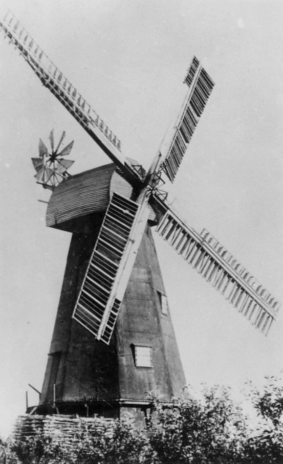


.jpg)


